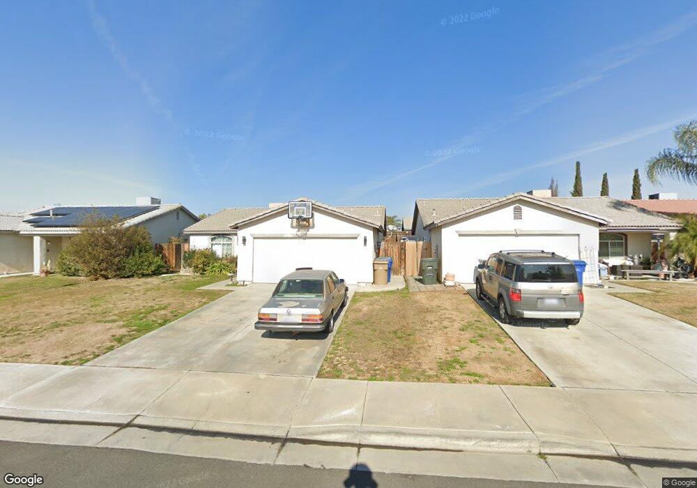
246 Misty Meadow Dr Bakersfield, CA 93308
Parkview Estates NeighborhoodEstimated Value: $347,010 - $373,000
4
Beds
2
Baths
1,357
Sq Ft
$264/Sq Ft
Est. Value
About This Home
This home is located at 246 Misty Meadow Dr, Bakersfield, CA 93308 and is currently estimated at $358,003, approximately $263 per square foot. 246 Misty Meadow Dr is a home located in Kern County with nearby schools including Highland Elementary School, Standard Middle School, and North High School.
Ownership History
Date
Name
Owned For
Owner Type
Purchase Details
Closed on
Dec 9, 2003
Sold by
Stuart Thomas Inc
Bought by
Kyle Danny L and Kyle Sandra D
Current Estimated Value
Home Financials for this Owner
Home Financials are based on the most recent Mortgage that was taken out on this home.
Original Mortgage
$129,608
Interest Rate
5.57%
Mortgage Type
FHA
Purchase Details
Closed on
Nov 20, 2003
Sold by
North Country Meadows Inc
Bought by
Stuart Thomas Inc and Lenox Homes
Home Financials for this Owner
Home Financials are based on the most recent Mortgage that was taken out on this home.
Original Mortgage
$129,608
Interest Rate
5.57%
Mortgage Type
FHA
Create a Home Valuation Report for This Property
The Home Valuation Report is an in-depth analysis detailing your home's value as well as a comparison with similar homes in the area
Home Values in the Area
Average Home Value in this Area
Purchase History
| Date | Buyer | Sale Price | Title Company |
|---|---|---|---|
| Kyle Danny L | $131,500 | Commonwealth Title | |
| Stuart Thomas Inc | $26,000 | Commonwealth Title |
Source: Public Records
Mortgage History
| Date | Status | Borrower | Loan Amount |
|---|---|---|---|
| Previous Owner | Kyle Danny L | $129,608 | |
| Previous Owner | Stuart Thomas Inc | $95,700 | |
| Closed | Kyle Danny L | $3,943 |
Source: Public Records
Tax History Compared to Growth
Tax History
| Year | Tax Paid | Tax Assessment Tax Assessment Total Assessment is a certain percentage of the fair market value that is determined by local assessors to be the total taxable value of land and additions on the property. | Land | Improvement |
|---|---|---|---|---|
| 2025 | $3,357 | $186,871 | $42,642 | $144,229 |
| 2024 | $3,247 | $183,207 | $41,806 | $141,401 |
| 2023 | $3,247 | $179,616 | $40,987 | $138,629 |
| 2022 | $3,152 | $176,095 | $40,184 | $135,911 |
| 2021 | $3,047 | $172,644 | $39,397 | $133,247 |
| 2020 | $2,944 | $170,875 | $38,994 | $131,881 |
| 2019 | $2,905 | $170,875 | $38,994 | $131,881 |
| 2018 | $2,807 | $164,242 | $37,481 | $126,761 |
| 2017 | $2,790 | $161,023 | $36,747 | $124,276 |
| 2016 | $2,533 | $157,867 | $36,027 | $121,840 |
| 2015 | $2,493 | $155,496 | $35,486 | $120,010 |
| 2014 | $2,440 | $152,451 | $34,791 | $117,660 |
Source: Public Records
Map
Nearby Homes
- 303 Fern Meadow Dr
- 325 W Pilot Ave
- 261 Winter Meadow Way
- 327 Fern Meadow Dr
- 202 Sunny Meadow Dr
- 408 Brite Meadow Ct
- 3724 Rock Meadow Ct
- 437 Rian Noelle Ct
- 337 Dani Rose Ln
- 444 Rian Noelle Ct
- 228 Redwood Meadow Dr
- 3727 Park Mountain Dr
- 349 Dani Rose Ln
- 400 Dry Meadow Ln
- 3505 Pacer St
- 3307 Pacer St
- 247 Deep Creek Dr
- 200 Electra Ave
- 288 Sherman Peak Dr
- 201 Day Ave
- 242 Misty Meadow Dr
- 250 Misty Meadow Dr
- 238 Misty Meadow Dr
- 254 Misty Meadow Dr
- 243 W Pilot Ave
- 239 W Pilot Ave
- 247 W Pilot Ave
- 251 W Pilot Ave
- 234 Misty Meadow Dr
- 258 Misty Meadow Dr
- 243 Misty Meadow Dr
- 247 Misty Meadow Dr
- 239 Misty Meadow Dr
- 231 W Pilot Ave
- 255 W Pilot Ave
- 251 Misty Meadow Dr
- 230 Misty Meadow Dr
- 235 Misty Meadow Dr
- 262 Misty Meadow Dr
- 255 Misty Meadow Dr