Estimated Value: $819,000 - $952,000
3
Beds
2
Baths
1,778
Sq Ft
$494/Sq Ft
Est. Value
About This Home
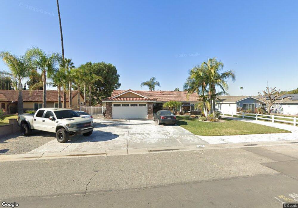
This home is located at 2460 Bronco Ln, Norco, CA 92860 and is currently estimated at $878,420, approximately $494 per square foot. 2460 Bronco Ln is a home located in Riverside County with nearby schools including Highland Elementary, Norco Intermediate School, and Norco High School.
Ownership History
Date
Name
Owned For
Owner Type
Purchase Details
Closed on
Jun 20, 2025
Sold by
Rogers Larry D and Rogers Drena
Bought by
Rogers Family Trust and Rogers
Current Estimated Value
Purchase Details
Closed on
May 20, 2002
Sold by
Rogers Drena
Bought by
Rogers Larry D and Rogers Drena
Home Financials for this Owner
Home Financials are based on the most recent Mortgage that was taken out on this home.
Original Mortgage
$216,750
Interest Rate
6.89%
Purchase Details
Closed on
Aug 12, 1999
Sold by
Rogers Larry
Bought by
Rogers Drena
Create a Home Valuation Report for This Property
The Home Valuation Report is an in-depth analysis detailing your home's value as well as a comparison with similar homes in the area
Home Values in the Area
Average Home Value in this Area
Purchase History
| Date | Buyer | Sale Price | Title Company |
|---|---|---|---|
| Rogers Family Trust | -- | None Listed On Document | |
| Rogers Larry D | -- | First American Title Ins Co | |
| Rogers Drena | -- | American Title Co |
Source: Public Records
Mortgage History
| Date | Status | Borrower | Loan Amount |
|---|---|---|---|
| Previous Owner | Rogers Larry D | $216,750 |
Source: Public Records
Tax History
| Year | Tax Paid | Tax Assessment Tax Assessment Total Assessment is a certain percentage of the fair market value that is determined by local assessors to be the total taxable value of land and additions on the property. | Land | Improvement |
|---|---|---|---|---|
| 2025 | $4,284 | $398,704 | $138,669 | $260,035 |
| 2023 | $4,284 | $383,224 | $133,285 | $249,939 |
| 2022 | $4,145 | $375,711 | $130,672 | $245,039 |
| 2021 | $4,061 | $368,345 | $128,110 | $240,235 |
| 2020 | $4,015 | $364,569 | $126,797 | $237,772 |
| 2019 | $3,920 | $357,421 | $124,311 | $233,110 |
| 2018 | $3,829 | $350,414 | $121,874 | $228,540 |
| 2017 | $3,732 | $343,544 | $119,485 | $224,059 |
| 2016 | $3,694 | $336,809 | $117,143 | $219,666 |
| 2015 | $3,611 | $331,752 | $115,385 | $216,367 |
| 2014 | $3,476 | $325,256 | $113,126 | $212,130 |
Source: Public Records
Map
Nearby Homes
- 3577 Belgian Dr
- 2843 Broken Arrow St
- 3090 Bronco Ln
- 2821 Riding Ring Rd
- 2386 Hialeah Cir
- 2384 Corydon Ave
- 2730 Vine Ave
- 2354 Corydon Ave
- 4058 Sundance Ln
- 2904 2nd St
- 1233 Dale Cir
- 2145 Cloverleaf Cir
- 3090 Norco Dr
- 1841 Providence Way
- 0 6th & Valleyview St Unit SW25164144
- 2910 Shadow Canyon Cir
- 1044 Meadowview Ct
- 2655 Hamner Ave
- 1642 4th St
- 1051 Nottingham Dr
Your Personal Tour Guide
Ask me questions while you tour the home.