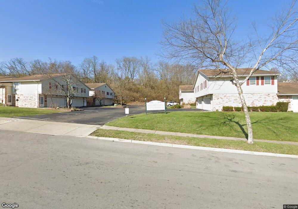
2460 Mustang Dr Unit 31 Cincinnati, OH 45211
Westwood NeighborhoodEstimated Value: $80,000 - $114,999
2
Beds
1
Bath
700
Sq Ft
$135/Sq Ft
Est. Value
About This Home
This home is located at 2460 Mustang Dr Unit 31, Cincinnati, OH 45211 and is currently estimated at $94,250, approximately $134 per square foot. 2460 Mustang Dr Unit 31 is a home located in Hamilton County with nearby schools including Western Hills High School, Gilbert A. Dater High School, and Robert A. Taft Information Technology High School.
Ownership History
Date
Name
Owned For
Owner Type
Purchase Details
Closed on
Feb 14, 2017
Sold by
Otchere Baffour A and Otchere Tonette
Bought by
Pro-Visions Enterprises Llc
Current Estimated Value
Purchase Details
Closed on
Sep 8, 2004
Sold by
Thompson Frost Maxine Y and Frost Henry D
Bought by
Otchere Baffour A and Otchere Tonette
Home Financials for this Owner
Home Financials are based on the most recent Mortgage that was taken out on this home.
Original Mortgage
$28,800
Interest Rate
5.5%
Mortgage Type
Purchase Money Mortgage
Create a Home Valuation Report for This Property
The Home Valuation Report is an in-depth analysis detailing your home's value as well as a comparison with similar homes in the area
Home Values in the Area
Average Home Value in this Area
Purchase History
| Date | Buyer | Sale Price | Title Company |
|---|---|---|---|
| Pro-Visions Enterprises Llc | -- | -- | |
| Otchere Baffour A | $36,000 | -- |
Source: Public Records
Mortgage History
| Date | Status | Borrower | Loan Amount |
|---|---|---|---|
| Previous Owner | Otchere Baffour A | $28,800 |
Source: Public Records
Tax History Compared to Growth
Tax History
| Year | Tax Paid | Tax Assessment Tax Assessment Total Assessment is a certain percentage of the fair market value that is determined by local assessors to be the total taxable value of land and additions on the property. | Land | Improvement |
|---|---|---|---|---|
| 2024 | $883 | $13,874 | $2,310 | $11,564 |
| 2023 | $884 | $13,874 | $2,310 | $11,564 |
| 2022 | $659 | $9,272 | $1,155 | $8,117 |
| 2021 | $646 | $9,272 | $1,155 | $8,117 |
| 2020 | $648 | $9,272 | $1,155 | $8,117 |
| 2019 | $892 | $11,638 | $1,155 | $10,483 |
| 2018 | $892 | $11,638 | $1,155 | $10,483 |
| 2017 | $859 | $11,638 | $1,155 | $10,483 |
| 2016 | $853 | $11,270 | $2,100 | $9,170 |
| 2015 | $763 | $11,270 | $2,100 | $9,170 |
| 2014 | $767 | $11,270 | $2,100 | $9,170 |
| 2013 | $780 | $11,270 | $2,100 | $9,170 |
Source: Public Records
Map
Nearby Homes
- 2454 Mustang Dr
- 2469 Montana Ave
- 2508 Mustang Dr
- 2562 Montana Ave
- 3401 Ferncroft Dr
- 2099 W Fork Rd
- 3418 Millrich Ave
- 2424 Westwood Northern Blvd
- 3162 Sunshine Ave
- 3116 Gobel Ave
- 3413 Fyffe Ave
- 3353 Saffer St
- 2822 Montana Ave
- 3072 Worthington Ave
- 3331 Felicity Dr
- 256 Nottingham Rd
- 3064 Mchenry Ave
- 2315 Iroll Ave
- 2352 Iroll Ave
- 3042 Percy Ave
- 2464 Mustang Dr Unit 30
- 2466 Mustang Dr
- 2462 Mustang Dr
- 2466 Mustang Dr Unit 29
- 2468 Mustang Dr
- 2442 Mustang Dr Unit 22
- 2446 Mustang Dr
- 2446 Mustang Dr Unit 19
- 2470 Mustang Dr
- 2474 Mustang Dr
- 2450 Mustang Dr Unit 18
- 2480 Mustang Dr
- 2476 Mustang Dr
- 2482 Mustang Dr
- 2444 Mustang Dr
- 2456 Mustang Dr Unit 13
- 2438 Mustang Dr Unit 23
- 2448 Mustang Dr
- 2452 Mustang Dr
- 2458 Mustang Dr