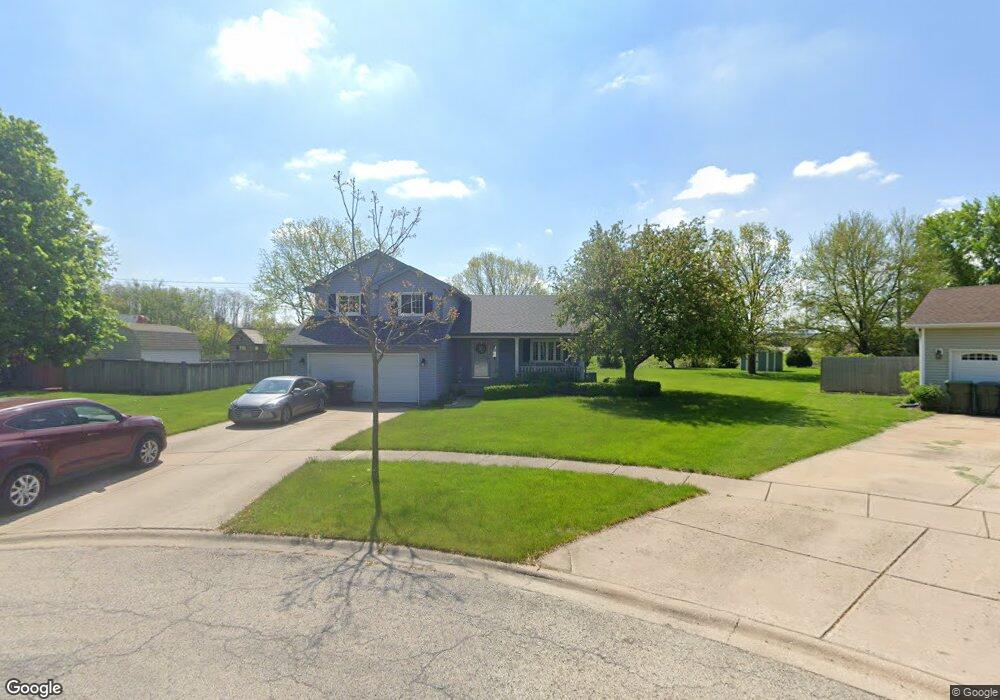
24631 S Alessio Ct Channahon, IL 60410
Estimated Value: $279,567 - $339,000
--
Bed
--
Bath
1,598
Sq Ft
$201/Sq Ft
Est. Value
About This Home
This home is located at 24631 S Alessio Ct, Channahon, IL 60410 and is currently estimated at $321,142, approximately $200 per square foot. 24631 S Alessio Ct is a home located in Will County with nearby schools including N B Galloway Elementary School, Pioneer Path School, and Three Rivers School.
Ownership History
Date
Name
Owned For
Owner Type
Purchase Details
Closed on
May 13, 2025
Sold by
Houston Donald S and Houston Robyn M
Bought by
Donald And Robyn Houston Family Trust and Houston
Current Estimated Value
Purchase Details
Closed on
Aug 29, 1997
Sold by
Smith Ronald L and Smith Terri L
Bought by
Houston Donald S and Houston Robyn M
Home Financials for this Owner
Home Financials are based on the most recent Mortgage that was taken out on this home.
Original Mortgage
$113,500
Interest Rate
7.28%
Purchase Details
Closed on
Jun 30, 1995
Sold by
Wadas Brian and Wadas Susan
Bought by
Smith Ronald L and Smith Terri L
Home Financials for this Owner
Home Financials are based on the most recent Mortgage that was taken out on this home.
Original Mortgage
$120,200
Interest Rate
7.88%
Create a Home Valuation Report for This Property
The Home Valuation Report is an in-depth analysis detailing your home's value as well as a comparison with similar homes in the area
Home Values in the Area
Average Home Value in this Area
Purchase History
| Date | Buyer | Sale Price | Title Company |
|---|---|---|---|
| Donald And Robyn Houston Family Trust | -- | None Listed On Document | |
| Houston Donald S | $142,000 | -- | |
| Smith Ronald L | $150,500 | -- |
Source: Public Records
Mortgage History
| Date | Status | Borrower | Loan Amount |
|---|---|---|---|
| Previous Owner | Houston Donald S | $113,500 | |
| Previous Owner | Smith Ronald L | $120,200 |
Source: Public Records
Tax History Compared to Growth
Tax History
| Year | Tax Paid | Tax Assessment Tax Assessment Total Assessment is a certain percentage of the fair market value that is determined by local assessors to be the total taxable value of land and additions on the property. | Land | Improvement |
|---|---|---|---|---|
| 2024 | $7,001 | $91,023 | $15,797 | $75,226 |
| 2023 | $7,001 | $80,374 | $13,949 | $66,425 |
| 2022 | $5,967 | $75,377 | $13,082 | $62,295 |
| 2021 | $5,576 | $71,245 | $12,365 | $58,880 |
| 2020 | $5,404 | $69,712 | $12,099 | $57,613 |
| 2019 | $5,139 | $66,550 | $11,550 | $55,000 |
| 2018 | $4,710 | $61,225 | $10,651 | $50,574 |
| 2017 | $4,591 | $58,701 | $10,212 | $48,489 |
| 2016 | $4,443 | $56,335 | $9,800 | $46,535 |
| 2015 | $3,798 | $52,050 | $8,800 | $43,250 |
| 2014 | $3,798 | $49,900 | $8,800 | $41,100 |
| 2013 | $3,798 | $49,900 | $8,800 | $41,100 |
Source: Public Records
Map
Nearby Homes
- 24519 S Edwin Dr
- 24241 W Hummingbird Dr
- 24415 W Quail Dr
- 25849 W Winding Hollow Dr
- 25930 W Winding Hollow Dr
- 25857 W Winding Hollow Dr
- 25865 W Winding Hollow Dr
- 25901 W Winding Hollow Dr
- 25905 W Winding Hollow Dr
- 25911 W Winding Hollow Dr
- 25200 S Westwind Dr
- 25156 S Westwind Dr
- 25203 S Westwind Dr
- 25127 S Westwind Dr
- Lot 123 W Cache Isle Cir
- Lot 120 W Cache Isle Cir
- Lot 122 W Cache Isle Cir
- 25123 S Westwind Dr
- 25137 S Westwind Dr
- 25133 S Westwind Dr
- 24625 S Alessio Ct
- 24136 W Bluff Rd
- 24619 S Alessio Ct
- 24629 S Alessio Ct
- 24620 S Alessio Ct
- 24617 S Alessio Ct
- 24608 S Alessio Ct
- 24150 W Bluff Rd
- 24603 S Edwin Dr
- 24609 S Alessio Ct
- 24609 S Edwin Dr
- 24563 S Edwin Dr
- 24602 S Alessio Ct
- 24613 S Edwin Dr
- 24557 S Edwin Dr
- 24621 S Edwin Dr
- 24555 S Edwin Dr
- 24627 S Edwin Dr
- 24603 S Alessio Ct
- 24637 S Edwin Dr