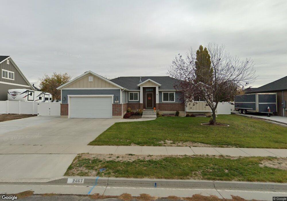
2467 S 1950 W Syracuse, UT 84075
Estimated Value: $518,000 - $579,000
3
Beds
2
Baths
1,458
Sq Ft
$373/Sq Ft
Est. Value
About This Home
This home is located at 2467 S 1950 W, Syracuse, UT 84075 and is currently estimated at $544,250, approximately $373 per square foot. 2467 S 1950 W is a home with nearby schools including Syracuse Elementary School, Syracuse Junior High School, and Syracuse High School.
Ownership History
Date
Name
Owned For
Owner Type
Purchase Details
Closed on
Jun 10, 2016
Sold by
Harper Ty J and Harper Kiera
Bought by
Madsen Cameron and Madsen Mikelle
Current Estimated Value
Purchase Details
Closed on
Dec 21, 2011
Sold by
Hark Associates Llc
Bought by
Harper Ty J and Harper Kiera
Home Financials for this Owner
Home Financials are based on the most recent Mortgage that was taken out on this home.
Original Mortgage
$184,416
Interest Rate
3.93%
Mortgage Type
Purchase Money Mortgage
Create a Home Valuation Report for This Property
The Home Valuation Report is an in-depth analysis detailing your home's value as well as a comparison with similar homes in the area
Home Values in the Area
Average Home Value in this Area
Purchase History
| Date | Buyer | Sale Price | Title Company |
|---|---|---|---|
| Madsen Cameron | -- | Us Title | |
| Harper Ty J | -- | Security Title Of Da |
Source: Public Records
Mortgage History
| Date | Status | Borrower | Loan Amount |
|---|---|---|---|
| Previous Owner | Harper Ty J | $184,416 |
Source: Public Records
Tax History
| Year | Tax Paid | Tax Assessment Tax Assessment Total Assessment is a certain percentage of the fair market value that is determined by local assessors to be the total taxable value of land and additions on the property. | Land | Improvement |
|---|---|---|---|---|
| 2025 | $2,862 | $276,100 | $125,213 | $150,887 |
| 2024 | $2,701 | $262,350 | $103,795 | $158,555 |
| 2023 | $2,526 | $447,000 | $144,612 | $302,388 |
| 2022 | $2,738 | $265,650 | $83,212 | $182,438 |
| 2021 | $2,530 | $380,000 | $122,996 | $257,004 |
| 2020 | $2,262 | $329,000 | $107,025 | $221,975 |
| 2019 | $2,229 | $320,000 | $104,756 | $215,244 |
| 2018 | $2,056 | $293,000 | $101,094 | $191,906 |
| 2016 | $1,872 | $139,920 | $38,797 | $101,123 |
| 2015 | $1,782 | $126,830 | $38,797 | $88,033 |
| 2014 | $1,902 | $137,931 | $38,797 | $99,134 |
| 2013 | -- | $121,000 | $32,232 | $88,768 |
Source: Public Records
Map
Nearby Homes
- 1876 W 2400 S
- 1826 W 2350 S
- 1686 W 2425 S
- 1653 W 2700 S Unit 218
- 1705 W 2770 S
- 1643 W 2700 S Unit 216
- 1667 W 2770 S Unit 206
- 2742 S Allison Way Unit 212
- 2721 S Allison Way
- 2968 Old Emigrant Rd
- 2188 S 2325 W
- 2138 Craig Ln
- 1996 S 1675 W
- 2653 S 2430 W Unit 115
- 1694 2975 S Unit D
- 2574 S 2430 W Unit 503
- 2594 S 2430 W Unit 501
- 1664 2975 S Unit B
- 2666 S 2430 W Unit 103
- 2013 S 1575 W
Your Personal Tour Guide
Ask me questions while you tour the home.