
Seller's Agent in 2025
David Hochwalt
Glasshouse Realty Group
(937) 241-4270
5 in this area
39 Total Sales
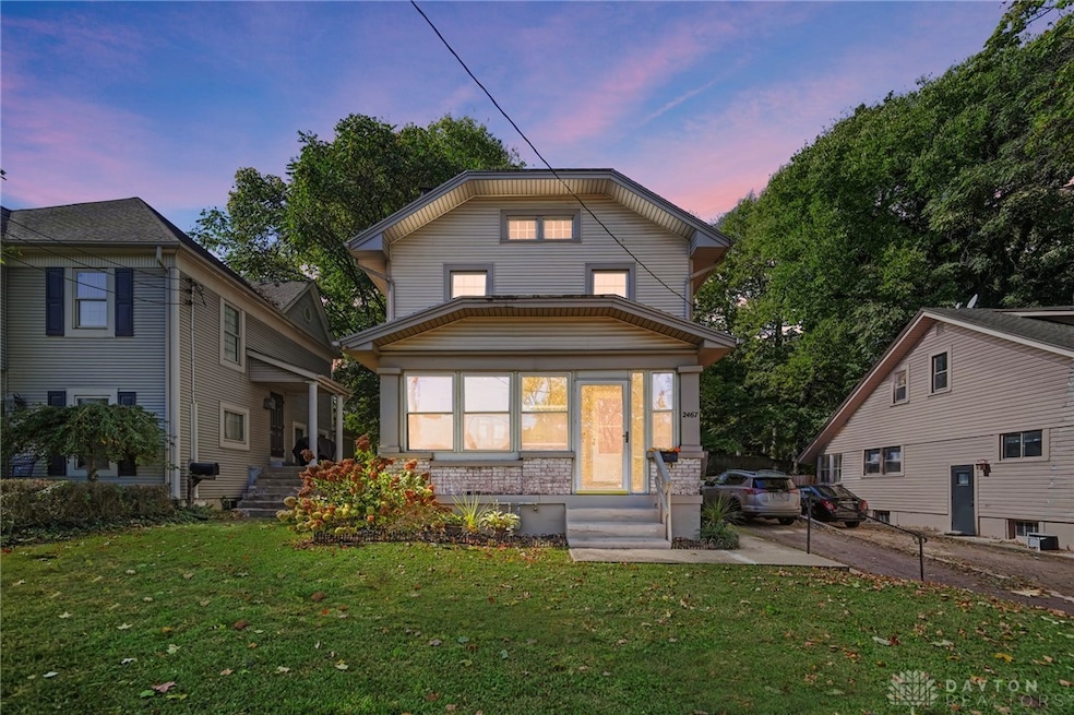
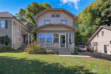
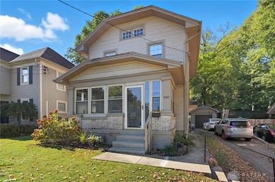
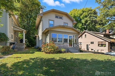
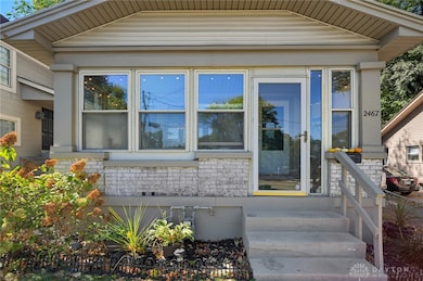
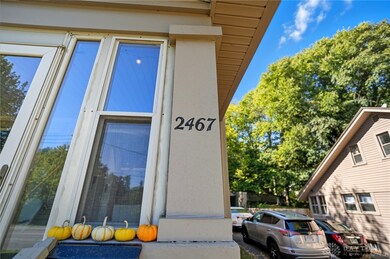
Charming Kettering Gem with Modern Upgrades and Classic Style!
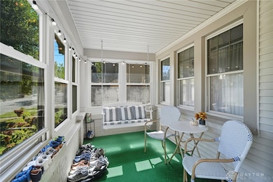
Step inside this beautiful 3-bedroom, 1.5-bath home and fall in love with the perfect mix of character and comfort. The sun-filled screened-in porch welcomes you to unwind with your morning coffee or enjoy quiet evenings with friends. Inside, you’ll find stunning original hardwood floors, an updated kitchen with granite countertops and stainless steel appliances, and fresh updates throughout that make this home truly move-in ready.
The spacious backyard offers plenty of room to play, garden, or host weekend get-togethers, complete with a handy storage shed for all your outdoor gear. Major updates include a new HVAC (2021), water heater (2023), updated electric, and half bath heater (2021) for added peace of mind.
Tucked in a friendly neighborhood within the Kettering school district and just minutes from downtown Dayton, this home offers the lifestyle you’ve been looking for — stylish, comfortable, and convenient.
Last Agent to Sell the Property
Glasshouse Realty Group Brokerage Phone: 9372414270 License #2023003124 Listed on: 10/23/2025
| Date | Type | Sale Price | Title Company |
|---|---|---|---|
| Warranty Deed | $207,000 | Landmark Title Agency South | |
| Warranty Deed | $145,000 | Triad Title Agency Inc | |
| Warranty Deed | $45,000 | First Ctrl Land Ttl Agcy Llc | |
| Quit Claim Deed | $86,900 | None Available |
| Date | Status | Loan Amount | Loan Type |
|---|---|---|---|
| Open | $207,000 | New Conventional | |
| Previous Owner | $140,650 | New Conventional | |
| Previous Owner | $77,250 | Unknown |
| Date | Event | Price | List to Sale | Price per Sq Ft |
|---|---|---|---|---|
| 12/19/2025 12/19/25 | Sold | $207,000 | -1.4% | $179 / Sq Ft |
| 11/04/2025 11/04/25 | Price Changed | $210,000 | -2.3% | $181 / Sq Ft |
| 10/23/2025 10/23/25 | For Sale | $215,000 | -- | $186 / Sq Ft |
| Year | Tax Paid | Tax Assessment Tax Assessment Total Assessment is a certain percentage of the fair market value that is determined by local assessors to be the total taxable value of land and additions on the property. | Land | Improvement |
|---|---|---|---|---|
| 2025 | $2,751 | $42,490 | $15,450 | $27,040 |
| 2024 | $2,674 | $42,490 | $15,450 | $27,040 |
| 2023 | $2,674 | $42,490 | $15,450 | $27,040 |
| 2022 | $2,419 | $30,320 | $11,030 | $19,290 |
| 2021 | $2,240 | $30,320 | $11,030 | $19,290 |
| 2020 | $2,247 | $30,320 | $11,030 | $19,290 |
| 2019 | $2,540 | $30,400 | $10,510 | $19,890 |
| 2018 | $1,834 | $30,400 | $10,510 | $19,890 |
| 2017 | $1,693 | $30,400 | $10,510 | $19,890 |
| 2016 | $1,769 | $30,040 | $10,510 | $19,530 |
| 2015 | $1,771 | $30,040 | $10,510 | $19,530 |
| 2014 | $1,771 | $30,040 | $10,510 | $19,530 |
| 2012 | -- | $36,900 | $10,330 | $26,570 |
Seller's Agent in 2025
David Hochwalt
Glasshouse Realty Group
(937) 241-4270
5 in this area
39 Total Sales
Buyer's Agent in 2025
Donald Brenneman
Irongate Inc.
(513) 200-9002
1 in this area
28 Total Sales
Source: Dayton REALTORS®
MLS Number: 945653
APN: N64-00306-0005
Disclaimer: Certain information contained herein is derived from information provided by parties other than Homes.com. All information provided is deemed reliable, but is not guaranteed to be accurate and should be independently verified.
![]() The information is being provided by Dayton Area Board of Realtors MLS. Information deemed reliable but not guaranteed. Information is provided for the consumer's personal, non-commercial use, and may not be used for any purpose other than the identification of potential properties for purchase. Copyright 2026 Dayton Area Board of Realtors MLS. All Rights Reserved.
The information is being provided by Dayton Area Board of Realtors MLS. Information deemed reliable but not guaranteed. Information is provided for the consumer's personal, non-commercial use, and may not be used for any purpose other than the identification of potential properties for purchase. Copyright 2026 Dayton Area Board of Realtors MLS. All Rights Reserved.
Ask me questions while you tour the home.