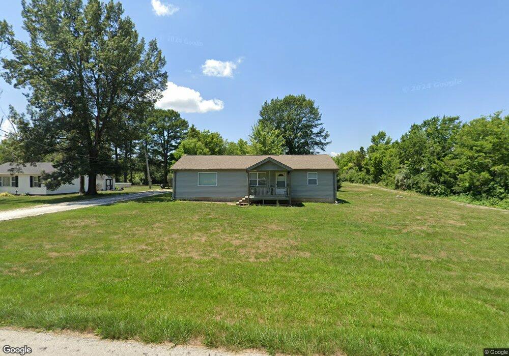
2469 Forst Dr O Fallon, MO 63368
Estimated Value: $292,000 - $372,000
3
Beds
2
Baths
1,670
Sq Ft
$204/Sq Ft
Est. Value
About This Home
This home is located at 2469 Forst Dr, O Fallon, MO 63368 and is currently estimated at $341,391, approximately $204 per square foot. 2469 Forst Dr is a home located in St. Charles County with nearby schools including Discovery Ridge Elementary School, Frontier Middle School, and Liberty High School.
Ownership History
Date
Name
Owned For
Owner Type
Purchase Details
Closed on
Mar 30, 2012
Sold by
Mitchell Cheryl M
Bought by
Wade Bradford W
Current Estimated Value
Home Financials for this Owner
Home Financials are based on the most recent Mortgage that was taken out on this home.
Original Mortgage
$89,600
Outstanding Balance
$62,063
Interest Rate
3.97%
Mortgage Type
New Conventional
Estimated Equity
$279,328
Purchase Details
Closed on
Aug 12, 2005
Sold by
Stoneking Ronald E and Stoneking Cynthia K
Bought by
Mitchell Chris A and Mitchell Cheryl M
Create a Home Valuation Report for This Property
The Home Valuation Report is an in-depth analysis detailing your home's value as well as a comparison with similar homes in the area
Home Values in the Area
Average Home Value in this Area
Purchase History
| Date | Buyer | Sale Price | Title Company |
|---|---|---|---|
| Wade Bradford W | $112,000 | None Available | |
| Mitchell Chris A | -- | Ust |
Source: Public Records
Mortgage History
| Date | Status | Borrower | Loan Amount |
|---|---|---|---|
| Open | Wade Bradford W | $89,600 |
Source: Public Records
Tax History
| Year | Tax Paid | Tax Assessment Tax Assessment Total Assessment is a certain percentage of the fair market value that is determined by local assessors to be the total taxable value of land and additions on the property. | Land | Improvement |
|---|---|---|---|---|
| 2025 | $2,508 | $41,683 | -- | -- |
| 2023 | $2,508 | $39,563 | $0 | $0 |
| 2022 | $2,039 | $30,022 | $0 | $0 |
| 2021 | $2,041 | $30,022 | $0 | $0 |
| 2020 | $1,983 | $27,972 | $0 | $0 |
| 2019 | $1,840 | $27,972 | $0 | $0 |
| 2018 | $1,888 | $27,352 | $0 | $0 |
| 2017 | $1,888 | $27,352 | $0 | $0 |
| 2016 | $1,909 | $26,502 | $0 | $0 |
| 2015 | $1,884 | $26,502 | $0 | $0 |
| 2014 | $1,660 | $25,052 | $0 | $0 |
Source: Public Records
Map
Nearby Homes
- 1 Rochester @ Creekside Sommers
- 1 Jackson @ Creekside at Sommers
- 1 Quincy @ Creekside at Sommers
- 1 Savannah @ Creekside Sommers
- 2340 Oak Dr
- 109 Sommers Creek Ct
- 1 Westbrook @ Creekside Sommers
- 1 Canterbury @ Creekside Sommers
- 1 Rockport @ Creekside Sommers
- 1 Princeton @ Creekside Sommers
- 1 Barkley @ Creekside Sommers
- 210 Randlin Dr
- 202 Randlin Dr
- 9045 Highway Dd
- 201 Randlin Dr
- 230 Randlin Dr
- 236 Randlin Dr
- 249 Randlin Dr
- 244 Randlin Dr
- 251 Randlin Dr
Your Personal Tour Guide
Ask me questions while you tour the home.