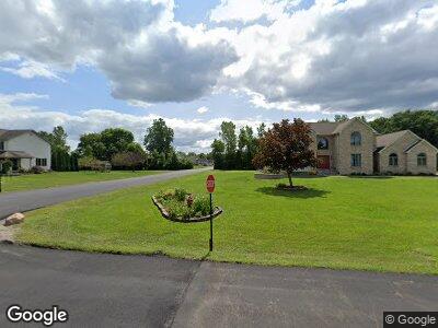
24690 Duff Rd Unit 18 New Boston, MI 48164
Estimated Value: $429,000 - $447,000
--
Bed
1
Bath
2,020
Sq Ft
$217/Sq Ft
Est. Value
About This Home
This home is located at 24690 Duff Rd Unit 18, New Boston, MI 48164 and is currently estimated at $437,867, approximately $216 per square foot. 24690 Duff Rd Unit 18 is a home located in Wayne County with nearby schools including Huron High School, St John's Lutheran School, and St. Stephen Elementary School.
Ownership History
Date
Name
Owned For
Owner Type
Purchase Details
Closed on
Sep 27, 2004
Sold by
Munroe Randall and Munroe Denise
Bought by
Martin Michael
Current Estimated Value
Home Financials for this Owner
Home Financials are based on the most recent Mortgage that was taken out on this home.
Original Mortgage
$219,200
Interest Rate
4.06%
Mortgage Type
Unknown
Create a Home Valuation Report for This Property
The Home Valuation Report is an in-depth analysis detailing your home's value as well as a comparison with similar homes in the area
Home Values in the Area
Average Home Value in this Area
Purchase History
| Date | Buyer | Sale Price | Title Company |
|---|---|---|---|
| Martin Michael | $274,000 | Multiple |
Source: Public Records
Mortgage History
| Date | Status | Borrower | Loan Amount |
|---|---|---|---|
| Open | Martin Michael | $280,000 | |
| Closed | Martin Christy R | $211,425 | |
| Closed | Martin Christy R | $247,000 | |
| Closed | Martin Christy R | $252,000 | |
| Closed | Martin Michael | $248,000 | |
| Previous Owner | Martin Michael D | $219,200 | |
| Previous Owner | Martin Michael | $27,400 |
Source: Public Records
Tax History Compared to Growth
Tax History
| Year | Tax Paid | Tax Assessment Tax Assessment Total Assessment is a certain percentage of the fair market value that is determined by local assessors to be the total taxable value of land and additions on the property. | Land | Improvement |
|---|---|---|---|---|
| 2024 | $2,754 | $200,500 | $0 | $0 |
| 2023 | $2,627 | $160,700 | $0 | $0 |
| 2022 | $4,573 | $166,000 | $0 | $0 |
| 2021 | $4,430 | $151,800 | $0 | $0 |
| 2020 | $4,378 | $142,800 | $0 | $0 |
| 2019 | $4,015 | $131,200 | $0 | $0 |
| 2018 | $2,201 | $127,600 | $0 | $0 |
| 2017 | $3,413 | $131,700 | $0 | $0 |
| 2016 | $3,823 | $131,700 | $0 | $0 |
| 2015 | $9,538 | $124,200 | $0 | $0 |
| 2013 | $9,240 | $92,400 | $0 | $0 |
| 2012 | -- | $92,400 | $27,800 | $64,600 |
Source: Public Records
Map
Nearby Homes
- 00 Huron River Dr
- 26239A Leontine Rd
- 26147 Frankfort Rd
- 23010 Waltz Rd
- 37684 Territorial Crossings Rd
- 22153 Waltz Rd
- 23755 Clark Rd
- 24817 Clark Rd
- 22128 Bell Rd
- 23178 Heron St
- 23154 Heron St
- 28203 Waltz Rd
- 28218 Mineral Springs Rd
- 23370 Blazer Ct
- 23086 N Evan Ct Unit 20
- 28503 Margaret Ln Unit 1
- 32461 West Rd
- 0 Oakville Waltz Rd Unit 20240044213
- 0 Oakville Waltz Rd Unit G50038710
- 24220 Fairview Dr
- 24690 Duff Rd Unit 18
- 24750 Duff Rd
- 24600 Duff Rd
- 36115 Felt Rd
- 24755 Austin Dr
- 24685 Duff Rd
- 24745 Duff Rd Unit 24
- 36700 Elizabeth Ln
- 24615 Duff Rd
- 36740 Elizabeth Ln Unit 15
- 24825 Duff Rd Unit 25
- 36145 Felt Rd
- 36780 Elizabeth Ln
- 36125 Felt Rd
- 24735 Austin Dr
- 36820 Elizabeth Ln Unit 13
- 24585 Duff Rd
- 24865 Duff Rd Unit 26
- 24730 Austin Dr
- 24525 Duff Rd
