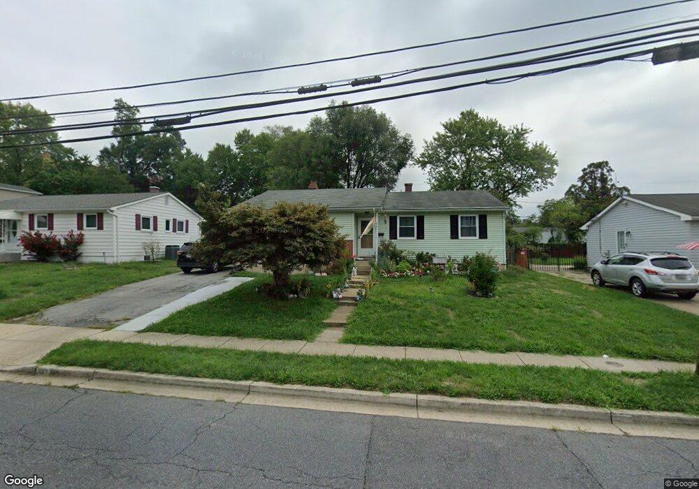
247 Brock Bridge Rd Laurel, MD 20724
Maryland City NeighborhoodEstimated Value: $387,000 - $444,000
3
Beds
3
Baths
1,262
Sq Ft
$334/Sq Ft
Est. Value
About This Home
This home is located at 247 Brock Bridge Rd, Laurel, MD 20724 and is currently estimated at $420,968, approximately $333 per square foot. 247 Brock Bridge Rd is a home located in Anne Arundel County with nearby schools including Maryland City Elementary School, Meade Middle School, and Meade High School.
Ownership History
Date
Name
Owned For
Owner Type
Purchase Details
Closed on
Oct 1, 2020
Sold by
Velazquez Roberto and Lemus Maura
Bought by
Velazquez Roberto
Current Estimated Value
Home Financials for this Owner
Home Financials are based on the most recent Mortgage that was taken out on this home.
Original Mortgage
$245,000
Outstanding Balance
$217,914
Interest Rate
2.9%
Mortgage Type
New Conventional
Estimated Equity
$203,054
Purchase Details
Closed on
Jan 8, 2010
Sold by
Rodean Barbara A
Bought by
Rodean Barbara A
Purchase Details
Closed on
Nov 14, 2007
Sold by
Rodean Frederick R
Bought by
Rodean Barbara A
Purchase Details
Closed on
Nov 8, 2007
Sold by
Rodean Frederick R
Bought by
Rodean Barbara A
Create a Home Valuation Report for This Property
The Home Valuation Report is an in-depth analysis detailing your home's value as well as a comparison with similar homes in the area
Home Values in the Area
Average Home Value in this Area
Purchase History
| Date | Buyer | Sale Price | Title Company |
|---|---|---|---|
| Velazquez Roberto | -- | None Available | |
| Rodean Barbara A | -- | -- | |
| Rodean Barbara A | -- | -- | |
| Rodean Barbara A | -- | -- |
Source: Public Records
Mortgage History
| Date | Status | Borrower | Loan Amount |
|---|---|---|---|
| Open | Velazquez Roberto | $245,000 |
Source: Public Records
Tax History
| Year | Tax Paid | Tax Assessment Tax Assessment Total Assessment is a certain percentage of the fair market value that is determined by local assessors to be the total taxable value of land and additions on the property. | Land | Improvement |
|---|---|---|---|---|
| 2025 | $3,985 | $337,500 | $198,800 | $138,700 |
| 2024 | $3,985 | $318,033 | $0 | $0 |
| 2023 | $3,734 | $298,567 | $0 | $0 |
| 2022 | $3,347 | $279,100 | $151,800 | $127,300 |
| 2020 | $3,167 | $265,767 | $0 | $0 |
| 2019 | $3,100 | $259,100 | $146,800 | $112,300 |
| 2018 | $2,553 | $251,733 | $0 | $0 |
| 2017 | $2,873 | $244,367 | $0 | $0 |
| 2016 | -- | $237,000 | $0 | $0 |
| 2015 | -- | $229,367 | $0 | $0 |
| 2014 | -- | $221,733 | $0 | $0 |
Source: Public Records
Map
Nearby Homes
- 322 Old Line Ave
- 11 S Carol St
- 328 Vale Summit S
- 3321 Yellow Flower Rd
- 3338 Old Line Ave
- 3339 Crumpton S
- 3500 Old Annapolis Rd
- 3372 Sudlersville S
- 342 Dameron S
- 9964B Count Fleet Crescent
- 9956A Count Fleet Crescent
- 9990 Justify Run Unit A
- 9990 Justify Run Unit B
- 341 Dameron S
- 3352 Sudlersville S
- 10009B American Pharoah Ln
- 10006 American Pharoah Ln Unit A
- 10012 -A American Pharoah Ln
- 3341 Valley Lee S
- 10026 American Pharoah Ln Unit A
- 249 Brock Bridge Rd
- 245 Brock Bridge Rd
- 237 Brock Bridge Rd
- 246 Sharptown S
- 251 Brock Bridge Rd
- 244 Sharptown S
- 243 Brock Bridge Rd
- 248 Sharptown S
- 250 Sharptown S
- 241 Brock Bridge Rd
- 253 Brock Bridge Rd
- 252 Brock Bridge Rd
- 254 Brock Bridge Rd
- 256 Brock Bridge Rd
- 250 Brock Bridge Rd
- 258 Brock Bridge Rd
- 252 Sharptown S
- 260 Brock Bridge Rd
- 255 Brock Bridge Rd
- 262 Brock Bridge Rd
Your Personal Tour Guide
Ask me questions while you tour the home.