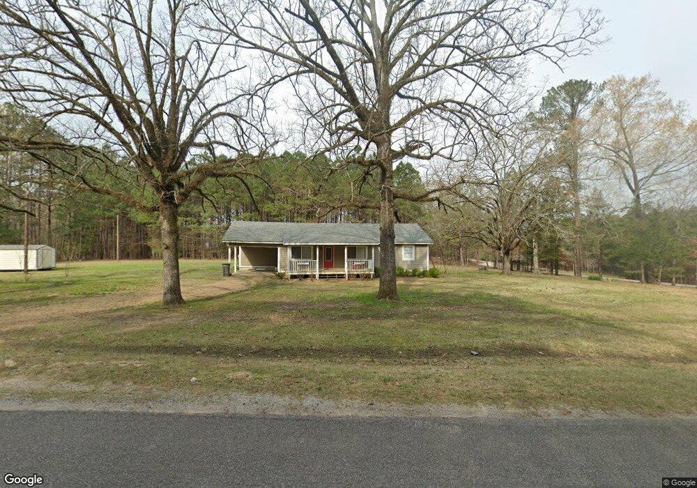
247 John High Rd Starkville, MS 39759
Estimated Value: $121,716 - $213,000
--
Bed
--
Bath
1,591
Sq Ft
$118/Sq Ft
Est. Value
About This Home
This home is located at 247 John High Rd, Starkville, MS 39759 and is currently estimated at $187,179, approximately $117 per square foot. 247 John High Rd is a home with nearby schools including Sudduth Elementary School, Henderson/Ward-Stewart Elementary School, and Overstreet Elementary School.
Ownership History
Date
Name
Owned For
Owner Type
Purchase Details
Closed on
Aug 31, 2023
Sold by
Littleton Kendall W and Littleton Tracy
Bought by
Turner Mark S and Turner Vickie L
Current Estimated Value
Home Financials for this Owner
Home Financials are based on the most recent Mortgage that was taken out on this home.
Original Mortgage
$143,200
Outstanding Balance
$131,079
Interest Rate
6.43%
Mortgage Type
Construction
Estimated Equity
$56,100
Purchase Details
Closed on
Aug 14, 2020
Bought by
Wade Littleton Kendall and Littleton Tracy
Purchase Details
Closed on
Jun 23, 2007
Bought by
Carl Tolbert
Create a Home Valuation Report for This Property
The Home Valuation Report is an in-depth analysis detailing your home's value as well as a comparison with similar homes in the area
Home Values in the Area
Average Home Value in this Area
Purchase History
| Date | Buyer | Sale Price | Title Company |
|---|---|---|---|
| Turner Mark S | $179,000 | Attorney Only | |
| Wade Littleton Kendall | $135,500 | -- | |
| Carl Tolbert | $115,000 | -- |
Source: Public Records
Mortgage History
| Date | Status | Borrower | Loan Amount |
|---|---|---|---|
| Open | Turner Mark S | $143,200 |
Source: Public Records
Tax History Compared to Growth
Tax History
| Year | Tax Paid | Tax Assessment Tax Assessment Total Assessment is a certain percentage of the fair market value that is determined by local assessors to be the total taxable value of land and additions on the property. | Land | Improvement |
|---|---|---|---|---|
| 2024 | $548 | $6,517 | $0 | $0 |
| 2023 | $1,098 | $8,813 | $0 | $0 |
| 2022 | $1,098 | $8,813 | $0 | $0 |
| 2021 | $1,014 | $8,135 | $0 | $0 |
| 2020 | $448 | $5,423 | $0 | $0 |
| 2019 | $448 | $5,423 | $0 | $0 |
| 2018 | $448 | $5,423 | $0 | $0 |
| 2017 | $420 | $5,178 | $0 | $0 |
| 2016 | $420 | $5,178 | $0 | $0 |
| 2015 | $406 | $5,178 | $0 | $0 |
| 2014 | $409 | $5,178 | $0 | $0 |
| 2013 | -- | $4,426 | $0 | $0 |
Source: Public Records
Map
Nearby Homes
- 363 Lakeview Dr
- 0 Old Hwy 12 Unit 25-1575
- 11 W Union Rd
- 123 Densbrook Ln
- 301 Maguire Rd
- 0 Maguire Rd
- 289 Maguire Rd
- 668 John White Rd
- 52 Alpine Dr
- 72 Ashwood Dr
- 92 Ashwood Dr
- 158 Cow Creek Rd
- 313 Prisock Rd
- 1501 Horseshoe Cir
- 0 Old Highway 12
- 1410 Pinecrest Rd
- 7863 Self Creek Rd
- 0 Longview Rd Unit 25-623
- 0 Longview Rd
- 1170 Meadowlark Dr
- 209 John High Rd
- 352 John High Rd
- 393 John High Rd
- 129 John High Rd
- 44 Sykes Rd
- 429 John High Rd
- 8955 New Light Rd
- 137 Sykes Rd
- 8919 New Light Rd
- 360 Sykes Rd
- 771 New Hope Church Rd
- 797 New Hope Church Rd
- 2 Lakeview Dr
- 8779 New Light Rd
- 59 Sykes Rd
- 109 Anne Ln
- 176 Seale Rd
- 52 Anne Ln
- 8868 New Light Rd
- 72 Lakeview Dr