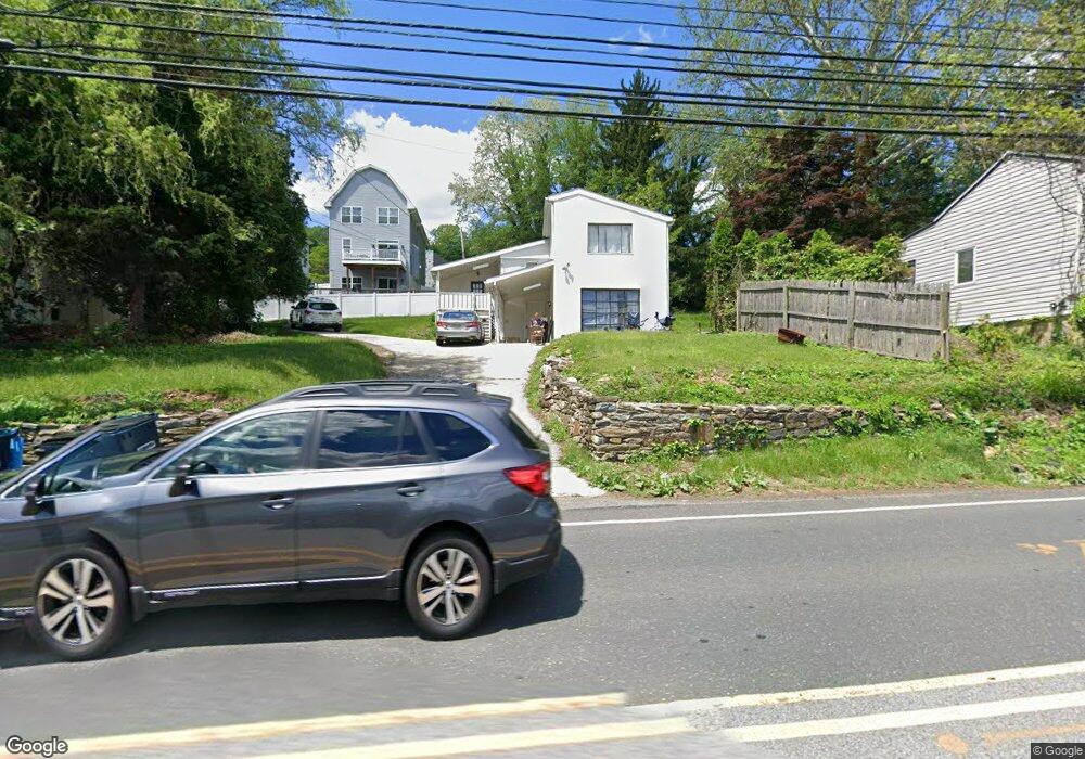
247 Matsonford Rd Conshohocken, PA 19428
Estimated Value: $434,587 - $601,000
3
Beds
1
Bath
2,196
Sq Ft
$246/Sq Ft
Est. Value
About This Home
This home is located at 247 Matsonford Rd, Conshohocken, PA 19428 and is currently estimated at $540,647, approximately $246 per square foot. 247 Matsonford Rd is a home located in Montgomery County with nearby schools including Roberts Elementary School, Upper Merion Middle School, and Upper Merion High School.
Ownership History
Date
Name
Owned For
Owner Type
Purchase Details
Closed on
Mar 22, 2023
Sold by
Sparango Benedict
Bought by
247 Matsonford Lawyers Llc
Current Estimated Value
Purchase Details
Closed on
Sep 10, 2008
Sold by
Sparango Benedict and Blake Samuel
Bought by
Sparango Benedict
Purchase Details
Closed on
Nov 18, 2005
Sold by
Mcneal Phyllis
Bought by
Sparango Benedict and Blake Samuel
Purchase Details
Closed on
Apr 29, 2005
Sold by
Not Provided
Bought by
Not Provided
Purchase Details
Closed on
Jun 10, 1999
Sold by
Miller Dexter G and Miller Avis Y
Bought by
Miller Dexter G
Create a Home Valuation Report for This Property
The Home Valuation Report is an in-depth analysis detailing your home's value as well as a comparison with similar homes in the area
Home Values in the Area
Average Home Value in this Area
Purchase History
| Date | Buyer | Sale Price | Title Company |
|---|---|---|---|
| 247 Matsonford Lawyers Llc | -- | World Wide Land Transfer | |
| Sparango Benedict | -- | None Available | |
| Sparango Benedict | $205,000 | None Available | |
| Not Provided | -- | -- | |
| Miller Dexter G | -- | -- |
Source: Public Records
Tax History Compared to Growth
Tax History
| Year | Tax Paid | Tax Assessment Tax Assessment Total Assessment is a certain percentage of the fair market value that is determined by local assessors to be the total taxable value of land and additions on the property. | Land | Improvement |
|---|---|---|---|---|
| 2025 | $3,440 | $111,620 | $29,810 | $81,810 |
| 2024 | $3,440 | $111,620 | $29,810 | $81,810 |
| 2023 | $3,318 | $111,620 | $29,810 | $81,810 |
| 2022 | $3,176 | $111,620 | $29,810 | $81,810 |
| 2021 | $3,078 | $111,620 | $29,810 | $81,810 |
| 2020 | $2,941 | $111,620 | $29,810 | $81,810 |
| 2019 | $2,891 | $111,620 | $29,810 | $81,810 |
| 2018 | $2,891 | $111,620 | $29,810 | $81,810 |
| 2017 | $2,787 | $111,620 | $29,810 | $81,810 |
| 2016 | $2,743 | $111,620 | $29,810 | $81,810 |
| 2015 | $2,642 | $111,620 | $29,810 | $81,810 |
| 2014 | $2,642 | $111,620 | $29,810 | $81,810 |
Source: Public Records
Map
Nearby Homes
- 281 E Matsonford Rd
- 1212 Rebel Hill Rd
- 223 Rebel Hill Rd
- 1196 Rebel Hill Rd
- 235 Valley Forge Lookout Place
- 1212 Lemonton Ct
- 258 Tennessee Ave
- 105 Timothy Cir
- 97 Timothy Cir
- 0 Matsonford Rd
- 117 Arden Rd
- 2 Arden Rd
- 4 Arden Rd
- Lot 1 Arden Rd
- Lot 3 Arden Rd
- 188 Arden Rd
- 1750 Cedar Ln
- 1626 Mount Pleasant Rd
- 161 Lantern Ln
- 628 Ford St
- 251 Matsonford Rd
- 239 Matsonford Rd
- 213 Gulph Ln
- 255 E Matsonford Rd
- 211 Gulph Ln
- 235 Matsonford Rd
- 257 Matsonford Rd
- 235 E Matsonford Rd
- 209 Gulph Ln
- 207 Gulph Ln
- 205 Gulph Ln
- 203 Gulph Ln
- 201 Matsonford Rd
- 259 Matsonford Rd Unit 8
- 212 Gulph Ln Unit 17
- 295 E Matsonford Rd
- 299 E Matsonford Rd
- 210 Gulph Ln
- 217 Gulph Ln
- 208 Gulph Ln Unit 2