Estimated Value: $79,000 - $102,000
Studio
--
Bath
864
Sq Ft
$103/Sq Ft
Est. Value
About This Home
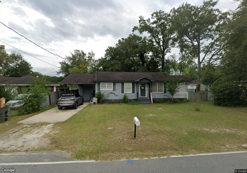
This home is located at 247 S 11th St, Jesup, GA 31545 and is currently estimated at $89,355, approximately $103 per square foot. 247 S 11th St is a home with nearby schools including Bacon Elementary School, Martha Puckett Middle School, and Wayne County High School.
Ownership History
Date
Name
Owned For
Owner Type
Purchase Details
Closed on
Jun 7, 2022
Sold by
Harris Betty J
Bought by
Daniels Dalton Gauge
Current Estimated Value
Home Financials for this Owner
Home Financials are based on the most recent Mortgage that was taken out on this home.
Original Mortgage
$63,822
Outstanding Balance
$60,213
Interest Rate
4.99%
Mortgage Type
FHA
Estimated Equity
$29,142
Purchase Details
Closed on
Sep 6, 2016
Sold by
Colon David
Bought by
Harris Betty
Purchase Details
Closed on
Jun 13, 2012
Sold by
Mcgregor Gail Hires
Bought by
Harper Colon D
Purchase Details
Closed on
Oct 1, 1982
Bought by
Hires Willene M
Purchase Details
Closed on
Jan 1, 1956
Create a Home Valuation Report for This Property
The Home Valuation Report is an in-depth analysis detailing your home's value as well as a comparison with similar homes in the area
Purchase History
| Date | Buyer | Sale Price | Title Company |
|---|---|---|---|
| Daniels Dalton Gauge | $65,000 | -- | |
| Daniels Dalton Gauge | -- | -- | |
| Harris Betty | $35,000 | -- | |
| Harper Colon D | -- | -- | |
| Hires Willene M | $1,000 | -- | |
| -- | -- | -- |
Source: Public Records
Mortgage History
| Date | Status | Borrower | Loan Amount |
|---|---|---|---|
| Open | Daniels Dalton Gauge | $63,822 |
Source: Public Records
Tax History
| Year | Tax Paid | Tax Assessment Tax Assessment Total Assessment is a certain percentage of the fair market value that is determined by local assessors to be the total taxable value of land and additions on the property. | Land | Improvement |
|---|---|---|---|---|
| 2025 | $923 | $29,244 | $2,190 | $27,054 |
| 2024 | $866 | $28,326 | $2,190 | $26,136 |
| 2023 | $522 | $14,759 | $2,135 | $12,624 |
| 2022 | $465 | $14,759 | $2,135 | $12,624 |
| 2021 | $498 | $14,759 | $2,135 | $12,624 |
| 2020 | $515 | $14,759 | $2,135 | $12,624 |
| 2019 | $530 | $14,759 | $2,135 | $12,624 |
| 2018 | $530 | $14,759 | $2,135 | $12,624 |
| 2017 | $433 | $14,759 | $2,135 | $12,624 |
| 2016 | $116 | $14,759 | $2,135 | $12,624 |
| 2014 | $116 | $14,759 | $2,135 | $12,624 |
| 2013 | -- | $14,758 | $2,135 | $12,623 |
Source: Public Records
Map
Nearby Homes
- 000 Hamburg St
- 370 S 6th St
- 10235 Lanes Bridge Rd
- 198 Greenwood St
- 548 S 5th St
- 100 Morgan Dr
- 545 S 5th St
- 535 S 4th St
- 695 Lanes Bridge Rd
- 686 S 4th St
- 344 N Fourth St
- 594 S 3rd St
- 757 Old Screven Rd
- 2324 Old Screven Rd
- 356 N Fourth St
- 1 Spring Grove Rd
- 356 N 4th St
- na Georgia 169
- 387 S 2nd St
- 761 S 4th St
- 267 Dreamland St
- 281 S 11th St
- 263 Dreamland St
- 1256 W Orange St
- 248 S 11th St
- 280 S 11th St
- 0 Dreamland St Unit 28023
- 0 Dreamland St Unit 24378
- 305 Dreamland St
- 1246 W Orange St
- 259 Dreamland St
- 1310 W Orange St
- 191 S 11th St
- 266 Dreamland St
- 1236 W Orange St
- 190 S 11th St
- 317 Dreamland St
- 255 Dreamland St
- 262 Dreamland St
- 1295 W Orange St
Your Personal Tour Guide
Ask me questions while you tour the home.