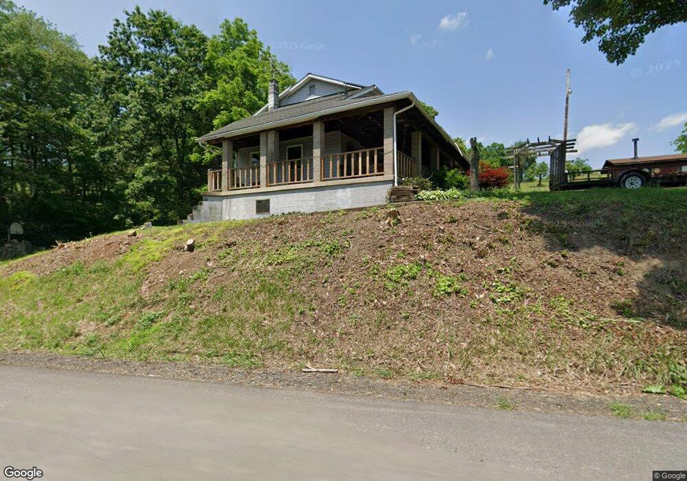
247 State Route 2021 Kittanning, PA 16201
Kittanning Township NeighborhoodEstimated Value: $96,665 - $349,000
3
Beds
1
Bath
1,848
Sq Ft
$108/Sq Ft
Est. Value
About This Home
This home is located at 247 State Route 2021, Kittanning, PA 16201 and is currently estimated at $199,416, approximately $107 per square foot. 247 State Route 2021 is a home with nearby schools including Lenape Elementary School.
Ownership History
Date
Name
Owned For
Owner Type
Purchase Details
Closed on
Aug 7, 2023
Sold by
Schall Tillie Ann
Bought by
Schall Luke D
Current Estimated Value
Purchase Details
Closed on
Aug 4, 2023
Sold by
Schall Tillie Ann
Bought by
Schall Luke D
Purchase Details
Closed on
Jul 20, 2022
Sold by
David Schall Wesley
Bought by
Schall Tillie Ann
Purchase Details
Closed on
Jan 10, 2007
Sold by
Wright Mary Ann
Bought by
Schall Tillie Ann
Purchase Details
Closed on
Feb 26, 1996
Bought by
Schall Tillie Ann and Wesley David
Create a Home Valuation Report for This Property
The Home Valuation Report is an in-depth analysis detailing your home's value as well as a comparison with similar homes in the area
Home Values in the Area
Average Home Value in this Area
Purchase History
| Date | Buyer | Sale Price | Title Company |
|---|---|---|---|
| Schall Luke D | -- | None Listed On Document | |
| Schall Luke D | -- | None Listed On Document | |
| Schall Tillie Ann | -- | None Listed On Document | |
| Schall Tillie Ann | -- | None Available | |
| Schall Tillie Ann | -- | -- |
Source: Public Records
Tax History Compared to Growth
Tax History
| Year | Tax Paid | Tax Assessment Tax Assessment Total Assessment is a certain percentage of the fair market value that is determined by local assessors to be the total taxable value of land and additions on the property. | Land | Improvement |
|---|---|---|---|---|
| 2025 | $1,683 | $19,930 | $11,950 | $7,980 |
| 2024 | $2,102 | $19,930 | $11,950 | $7,980 |
| 2023 | $1,357 | $19,930 | $11,950 | $7,980 |
| 2022 | $1,357 | $19,930 | $11,950 | $7,980 |
| 2021 | $1,357 | $19,930 | $11,950 | $7,980 |
| 2020 | $1,357 | $19,930 | $11,950 | $7,980 |
| 2019 | $1,357 | $19,930 | $11,950 | $7,980 |
| 2018 | $1,355 | $17,075 | $5,680 | $11,395 |
| 2017 | $1,345 | $19,930 | $11,950 | $7,980 |
| 2016 | $1,345 | $19,930 | $11,950 | $7,980 |
| 2015 | $896 | $19,930 | $11,950 | $7,980 |
| 2014 | $896 | $19,930 | $11,950 | $7,980 |
Source: Public Records
Map
Nearby Homes
- 354 Township Shed Rd
- 331 Township Shed Rd
- 360 State Route 2007
- 1017 1st St
- 2280 Garretts Run Rd
- 550 Silvis Hollow Rd
- 104 Heilman St
- 275 Claypoole Hill Rd Extension
- 4017 Fairway St
- 421 Red Mill Rd
- 124 Crooked Creek Dam Rd
- 176 Wray Plan Rd
- 2210 Ramer Rd
- 374 Garretts Run Rd
- 345 Gastown Rd
- 117 Red Mill Rd
- 2204 Maple Dr
- 11637 State Route 85
- 604 Neale Ave
- 611 11th St
- 211 State Route 2021
- 280 State Route 2021
- 209 State Route 2021
- 129 Wright Rd
- 354 State Route 2020
- 163 State Route 2021
- 514 State Route 2020
- 348 State Route 2020
- 348 State Route 2020
- 343 State Route 2020
- 190 Skunk Foot Rd
- 1123 Blaney Rd
- 200 Skunk Foot Rd
- 216 Skunk Foot Rd
- 524 State Route 2020
- 205 Moore Ln
- 222 Skunk Foot Rd
- 487 State Route 2020
- 234 Skunk Foot Rd
- 290 State Route 2020