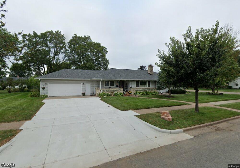
247 W Macarthur Ave Eau Claire, WI 54701
Putnam Heights NeighborhoodEstimated Value: $298,000 - $357,000
4
Beds
3
Baths
3,230
Sq Ft
$103/Sq Ft
Est. Value
About This Home
This home is located at 247 W Macarthur Ave, Eau Claire, WI 54701 and is currently estimated at $333,203, approximately $103 per square foot. 247 W Macarthur Ave is a home located in Eau Claire County with nearby schools including Putnam Heights Elementary School, Delong Middle School, and Memorial High School.
Ownership History
Date
Name
Owned For
Owner Type
Purchase Details
Closed on
May 5, 2008
Sold by
Hartfield D Anderw
Bought by
Olson Michelle K
Current Estimated Value
Home Financials for this Owner
Home Financials are based on the most recent Mortgage that was taken out on this home.
Original Mortgage
$135,000
Outstanding Balance
$85,495
Interest Rate
5.88%
Mortgage Type
New Conventional
Estimated Equity
$247,708
Create a Home Valuation Report for This Property
The Home Valuation Report is an in-depth analysis detailing your home's value as well as a comparison with similar homes in the area
Home Values in the Area
Average Home Value in this Area
Purchase History
| Date | Buyer | Sale Price | Title Company |
|---|---|---|---|
| Olson Michelle K | $86,600 | None Available |
Source: Public Records
Mortgage History
| Date | Status | Borrower | Loan Amount |
|---|---|---|---|
| Open | Olson Michelle K | $135,000 |
Source: Public Records
Tax History Compared to Growth
Tax History
| Year | Tax Paid | Tax Assessment Tax Assessment Total Assessment is a certain percentage of the fair market value that is determined by local assessors to be the total taxable value of land and additions on the property. | Land | Improvement |
|---|---|---|---|---|
| 2024 | $4,661 | $246,100 | $40,700 | $205,400 |
| 2023 | $4,243 | $246,100 | $40,700 | $205,400 |
| 2022 | $4,153 | $246,100 | $40,700 | $205,400 |
| 2021 | $4,063 | $246,100 | $40,700 | $205,400 |
| 2020 | $3,921 | $205,100 | $42,000 | $163,100 |
| 2019 | $3,907 | $205,100 | $42,000 | $163,100 |
| 2018 | $3,845 | $205,100 | $42,000 | $163,100 |
| 2017 | $3,544 | $162,500 | $36,100 | $126,400 |
| 2016 | $3,556 | $162,500 | $36,100 | $126,400 |
| 2014 | -- | $162,500 | $36,100 | $126,400 |
| 2013 | -- | $162,500 | $36,100 | $126,400 |
Source: Public Records
Map
Nearby Homes
- 328 W Grant Ave
- 202 E Hamilton Ave
- 2703 Patton St
- 3346 (Lot 7) Forest Glen
- 3374 State St
- 478 Westover Rd
- 621 E Polk Ave
- 3371 Westhaven Ct
- 1711 State St
- 914 E Tyler Ave
- 346 Mckinley Ave
- 1722 Rust St
- 3434 Gerrard Ave
- 3243 May St
- 1628 Rust St
- 3735 Halsey St
- 960 Grover Rd
- 3215 Craig Rd
- 3155 Craig Rd
- 1408 E Lexington Blvd
- 2909 S Lexington Blvd
- 241 W Macarthur Ave
- 2110 S Lexington Blvd
- 248 W Macarthur Ave
- 242 W Macarthur Ave
- 235 W Macarthur Ave
- 248 W Grant Ave
- 257 W Lexington Blvd
- 242 W Grant Ave
- 303 W Macarthur Ave
- 2908 S Lexington Blvd
- 236 W Grant Ave
- 2914 S Lexington Blvd
- 229 W Macarthur Ave
- 236 W Macarthur Ave
- 304 W Grant Ave
- 245 W Lexington Blvd
- 234 W Truman Ave
- 151 W Macarthur Ave
- 315 W Macarthur Ave