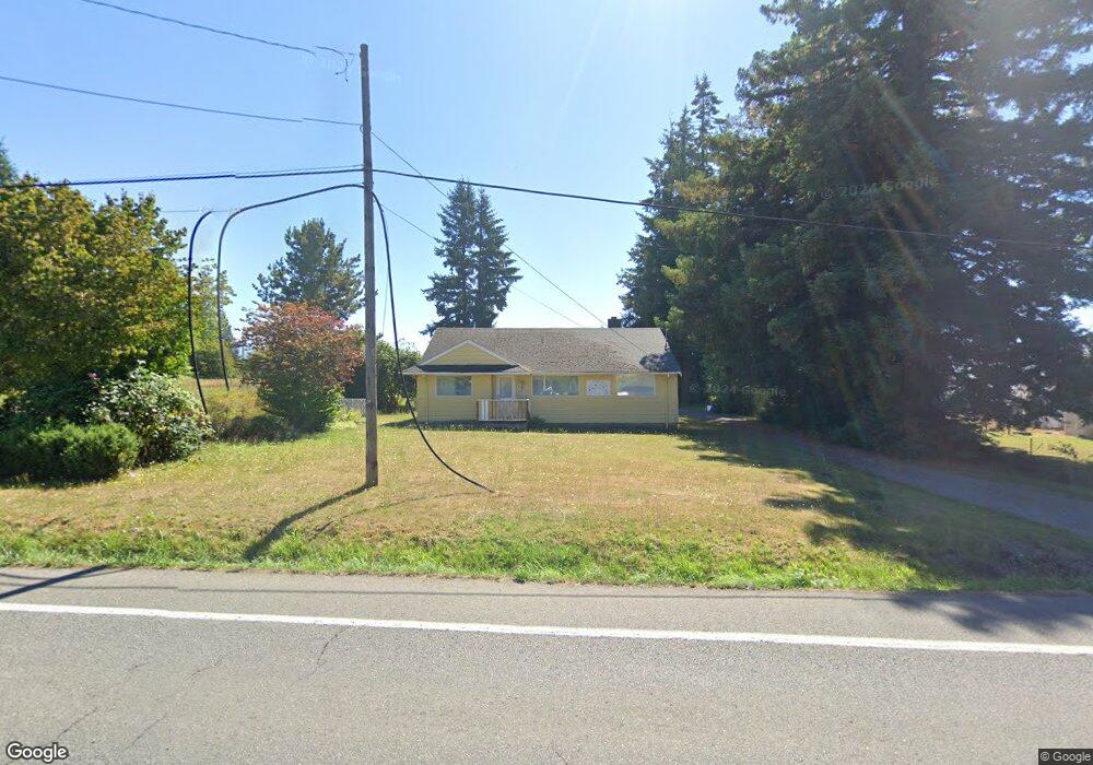
24711 SE 440th St Enumclaw, WA 98022
Estimated Value: $514,000 - $680,000
2
Beds
1
Bath
1,200
Sq Ft
$511/Sq Ft
Est. Value
About This Home
This home is located at 24711 SE 440th St, Enumclaw, WA 98022 and is currently estimated at $613,218, approximately $511 per square foot. 24711 SE 440th St is a home located in King County with nearby schools including Sunrise Elementary School, Enumclaw Middle School, and Enumclaw Senior High School.
Ownership History
Date
Name
Owned For
Owner Type
Purchase Details
Closed on
Jun 8, 1999
Sold by
Willette Richard A and Willette Ann G
Bought by
Trinity Lutheran Church
Current Estimated Value
Purchase Details
Closed on
Jun 2, 1998
Sold by
Berilla Anna C
Bought by
Willette Richard A and Willette Ann G
Home Financials for this Owner
Home Financials are based on the most recent Mortgage that was taken out on this home.
Original Mortgage
$192,000
Interest Rate
7.1%
Create a Home Valuation Report for This Property
The Home Valuation Report is an in-depth analysis detailing your home's value as well as a comparison with similar homes in the area
Home Values in the Area
Average Home Value in this Area
Purchase History
| Date | Buyer | Sale Price | Title Company |
|---|---|---|---|
| Trinity Lutheran Church | $259,000 | -- | |
| Willette Richard A | $240,000 | Transnation Title Insurance |
Source: Public Records
Mortgage History
| Date | Status | Borrower | Loan Amount |
|---|---|---|---|
| Previous Owner | Willette Richard A | $192,000 |
Source: Public Records
Tax History Compared to Growth
Tax History
| Year | Tax Paid | Tax Assessment Tax Assessment Total Assessment is a certain percentage of the fair market value that is determined by local assessors to be the total taxable value of land and additions on the property. | Land | Improvement |
|---|---|---|---|---|
| 2024 | -- | $540,000 | $297,000 | $243,000 |
| 2023 | $0 | $463,000 | $255,000 | $208,000 |
| 2022 | $7 | $529,000 | $292,000 | $237,000 |
| 2021 | $0 | $429,000 | $252,000 | $177,000 |
| 2020 | $672 | $0 | $0 | $0 |
| 2018 | $4 | $0 | $0 | $0 |
| 2017 | $0 | $291,000 | $184,000 | $107,000 |
| 2016 | $0 | $266,000 | $169,000 | $97,000 |
| 2015 | $4 | $250,000 | $160,000 | $90,000 |
| 2014 | -- | $240,000 | $163,000 | $77,000 |
| 2013 | -- | $185,000 | $131,000 | $54,000 |
Source: Public Records
Map
Nearby Homes
- 2942 Sun Mountain Dr
- 3005 Edel Ave
- 3552 Edith Ave
- 1903 Clovercrest St
- 1919 Clovercrest St
- 3035 Carbon Ridge St
- 2632 Cascade Ave
- 3195 Roosevelt Ave
- 3189 Roosevelt Ave
- 1720 Garfield St Unit 4
- 1722 Harding St
- 1165 Harding St
- 535 Blanchat Ct
- 1776 Lafromboise St
- 537 Burger Place
- 1486 Division St
- 23420 SE 448th St
- 837 Myrtine St
- 2054 Roosevelt Ave
- 1854 Hillcrest Ave
- 24631 SE 440th St
- 3255 Griffin Ave
- 3211 Griffin Ave
- 3270 Lois Ln
- 3250 Lois Ln
- 1770 Highpoint St
- 1790 Lois Ln
- 3249 Lois Ln
- 1820 Lois Ln
- 1822 Highpoint St
- 1863 Lois Ln
- 24515 SE 440th St
- 24729 SE 440th St
- 3285 Fisk Ave Unit 4-2
- 3311 Fisk Ave Unit 3-2
- 1870 Lois Ln
- 3257 Fisk Ave Unit 5-2
- 3339 Fisk Ave Unit 2-2
- 1872 Highpoint St