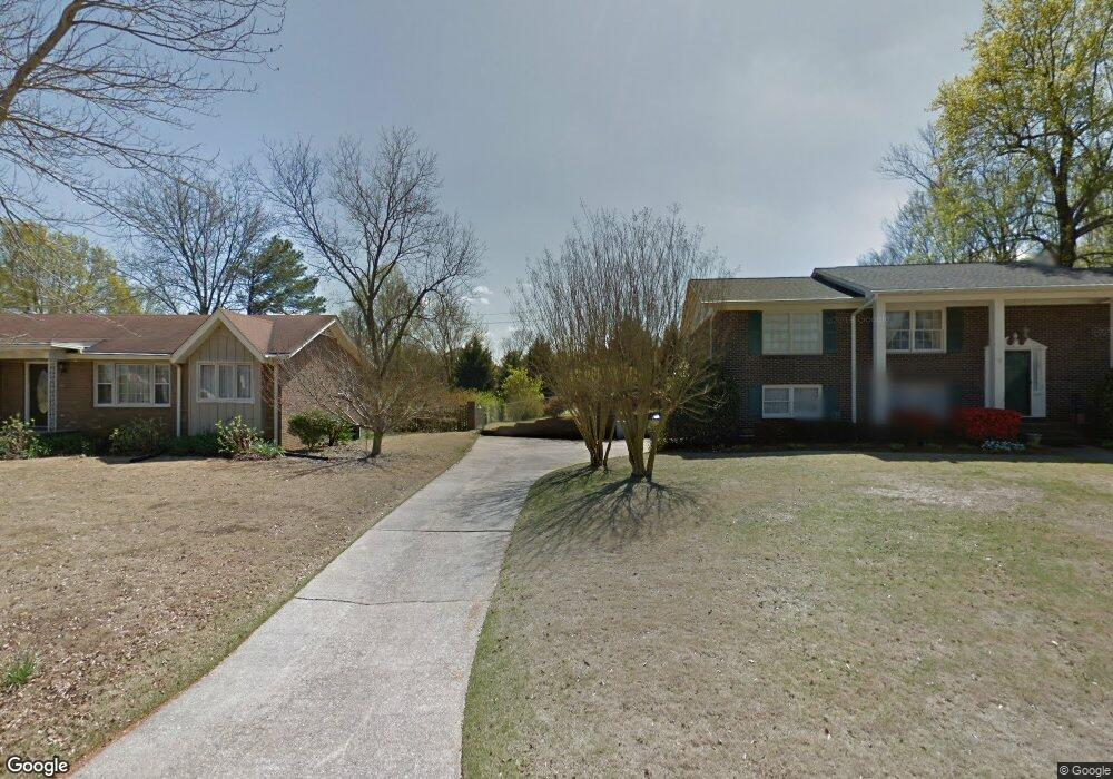
2472 Glascott Point Unit 18 Hoover, AL 35226
Ross Bridge NeighborhoodEstimated Value: $1,179,677 - $1,507,000
5
Beds
5
Baths
4,521
Sq Ft
$300/Sq Ft
Est. Value
About This Home
This home is located at 2472 Glascott Point Unit 18, Hoover, AL 35226 and is currently estimated at $1,355,892, approximately $299 per square foot. 2472 Glascott Point Unit 18 is a home located in Jefferson County with nearby schools including Deer Valley Elementary School, Robert F. Bumpus Middle School, and Hoover High School.
Ownership History
Date
Name
Owned For
Owner Type
Purchase Details
Closed on
Jan 7, 2011
Sold by
Cross Construction Llc
Bought by
Ashouri Amer I and Ashouri Linda S
Current Estimated Value
Home Financials for this Owner
Home Financials are based on the most recent Mortgage that was taken out on this home.
Original Mortgage
$535,400
Outstanding Balance
$16,210
Interest Rate
4.48%
Mortgage Type
New Conventional
Estimated Equity
$1,339,682
Create a Home Valuation Report for This Property
The Home Valuation Report is an in-depth analysis detailing your home's value as well as a comparison with similar homes in the area
Home Values in the Area
Average Home Value in this Area
Purchase History
| Date | Buyer | Sale Price | Title Company |
|---|---|---|---|
| Ashouri Amer I | $621,621 | None Available |
Source: Public Records
Mortgage History
| Date | Status | Borrower | Loan Amount |
|---|---|---|---|
| Open | Ashouri Amer I | $535,400 |
Source: Public Records
Tax History Compared to Growth
Tax History
| Year | Tax Paid | Tax Assessment Tax Assessment Total Assessment is a certain percentage of the fair market value that is determined by local assessors to be the total taxable value of land and additions on the property. | Land | Improvement |
|---|---|---|---|---|
| 2024 | $7,309 | $104,480 | -- | -- |
| 2022 | $6,398 | $88,850 | $20,900 | $67,950 |
| 2021 | $5,791 | $80,500 | $20,900 | $59,600 |
| 2020 | $5,672 | $78,720 | $20,900 | $57,820 |
| 2019 | $5,791 | $80,500 | $0 | $0 |
| 2018 | $5,431 | $75,540 | $0 | $0 |
| 2017 | $5,282 | $73,480 | $0 | $0 |
| 2016 | $5,094 | $70,900 | $0 | $0 |
| 2015 | $5,094 | $70,900 | $0 | $0 |
| 2014 | $5,078 | $72,460 | $0 | $0 |
| 2013 | $5,078 | $72,460 | $0 | $0 |
Source: Public Records
Map
Nearby Homes
- 2245 Southampton Dr
- 4250 Glasscott Crossing
- 1815 Williamette Trace Unit 1815
- 2438 Northampton Dr
- 1801 Williamette Trace Unit 101
- 1801 Williamette Trace Unit 102
- 1801 Williamette Trace Unit 113
- 4027 Adrian St
- 1811 Williamette Trace Unit 1811
- 4038 Adrian St
- 4371 Abbotts Way
- 1936 Heartpine Dr
- 4508 Amaton Way Unit 4508
- 4075 Adrian St
- 1935 Wilton Trace
- 2572 Montauk Rd
- 4650 Oakdell Rd
- 2369 Village Center St
- 1861 Williamette Trace Unit 97
- 1856 Williamette Trace
- 2472 Glascott Point
- 2494 Glasscott Crossing
- 2468 Glascott Point
- 2468 Glascott Point Unit 17
- 4208 Glascott Crossing Unit I 20
- 4208 Glascott Crossing
- 2479 Glascott Point
- 2479 Glascott Point Unit 20
- 4261 Glasscott Point
- 2480 Glascott Point
- 2480 Glascott Point Unit 19
- 2480 Glasscott Point Unit 19
- 2475 Glascott Point
- 2475 Glascott Point Unit 21
- 2471 Glascott Point
- 2471 Glascott Point Unit 22
- 2467 Glascott Point
- 2467 Glascott Point Unit 23
- 2491 Glasscott Crossing
- 4205 Glasscott Crossing