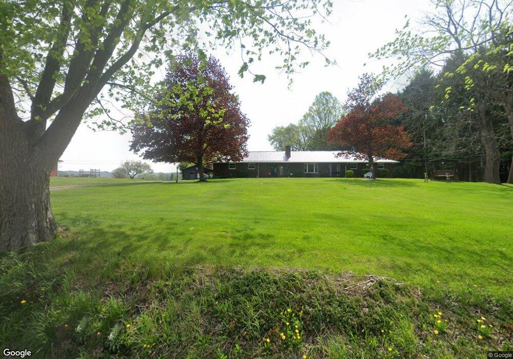
24732 State Route 621 Coshocton, OH 43812
Estimated Value: $240,000 - $284,000
3
Beds
2
Baths
1,824
Sq Ft
$146/Sq Ft
Est. Value
About This Home
This home is located at 24732 State Route 621, Coshocton, OH 43812 and is currently estimated at $265,425, approximately $145 per square foot. 24732 State Route 621 is a home located in Coshocton County with nearby schools including River View High School, Coshocton Christian School, and Sacred Heart School.
Ownership History
Date
Name
Owned For
Owner Type
Purchase Details
Closed on
Apr 30, 2019
Sold by
Finton Kevin L and Finton Kent K
Bought by
Schonauer Paul M and Schonauer Lorene L
Current Estimated Value
Purchase Details
Closed on
May 27, 1998
Sold by
Finton Kurt W and Finton Kevin L
Bought by
Finton C Kenneth, Trustee
Purchase Details
Closed on
Aug 23, 1996
Sold by
Finton C Kenneth
Bought by
Finton Kurt W and Finton Kevin L
Create a Home Valuation Report for This Property
The Home Valuation Report is an in-depth analysis detailing your home's value as well as a comparison with similar homes in the area
Home Values in the Area
Average Home Value in this Area
Purchase History
| Date | Buyer | Sale Price | Title Company |
|---|---|---|---|
| Schonauer Paul M | $120,000 | None Available | |
| Finton C Kenneth, Trustee | -- | -- | |
| Finton Kurt W | -- | -- |
Source: Public Records
Tax History Compared to Growth
Tax History
| Year | Tax Paid | Tax Assessment Tax Assessment Total Assessment is a certain percentage of the fair market value that is determined by local assessors to be the total taxable value of land and additions on the property. | Land | Improvement |
|---|---|---|---|---|
| 2024 | $2,172 | $63,670 | $10,130 | $53,540 |
| 2023 | $2,172 | $51,391 | $6,773 | $44,618 |
| 2022 | $1,935 | $51,391 | $6,773 | $44,618 |
| 2021 | $1,894 | $51,391 | $6,773 | $44,618 |
| 2020 | $2,094 | $56,424 | $6,787 | $49,637 |
| 2019 | $1,813 | $56,424 | $6,787 | $49,637 |
| 2018 | $1,670 | $56,424 | $6,787 | $49,637 |
| 2017 | $1,596 | $51,142 | $6,048 | $45,094 |
| 2016 | $1,508 | $51,142 | $6,048 | $45,094 |
| 2015 | $754 | $51,142 | $6,048 | $45,094 |
| 2014 | $1,598 | $53,543 | $5,376 | $48,167 |
Source: Public Records
Map
Nearby Homes
- 217 E Liberty St
- 230 Rivercrest Dr
- 23900 Airport Rd
- 23749 County Road 621
- 527 N 15th St
- 1636 Trade Ave
- 216 N 15th St
- 821 Grandview Ave
- 1421 Chestnut St
- 1945 Hall Dr
- 353 N 11th St
- 349 N 11th St
- 133 N 12th St
- 1706 Adams St
- 1822 Adams St
- 624 Cemetery St
- 0 Adams St
- 1518 Walnut St
- 631 Locust St
- 1027 Orchard St
- 24734 State Route 621
- 24766 State Route 621
- 24800 State Route 621
- 24817 State Route 621
- 24834 State Route 621
- 24831 State Route 621
- 24866 State Route 621
- 24863 State Route 621
- 24898 State Route 621
- 24712 County Road 193
- 24907 State Route 621
- 24790 County Road 193
- 24741 County Road 193
- 24940 State Route 621
- 24968 Ohio 621
- 24968 State Route 621
- 24904 Walnut Hill Dr
- 24779 County Road 193
- 24924 Walnut Hill Dr
- 24993 State Route 621