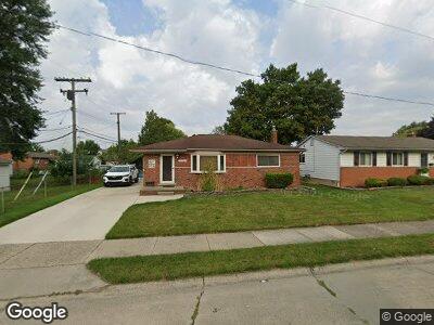
24737 Cushing Ave Eastpointe, MI 48021
Estimated Value: $187,000 - $220,000
--
Bed
3
Baths
1,062
Sq Ft
$189/Sq Ft
Est. Value
About This Home
This home is located at 24737 Cushing Ave, Eastpointe, MI 48021 and is currently estimated at $201,084, approximately $189 per square foot. 24737 Cushing Ave is a home located in Macomb County with nearby schools including Forest Park Elementary School, Eastpointe Middle School, and Reach Charter Academy.
Ownership History
Date
Name
Owned For
Owner Type
Purchase Details
Closed on
Oct 15, 1999
Sold by
Smith Laurence M
Bought by
Klix Howard L
Current Estimated Value
Home Financials for this Owner
Home Financials are based on the most recent Mortgage that was taken out on this home.
Original Mortgage
$124,000
Interest Rate
8.16%
Create a Home Valuation Report for This Property
The Home Valuation Report is an in-depth analysis detailing your home's value as well as a comparison with similar homes in the area
Home Values in the Area
Average Home Value in this Area
Purchase History
| Date | Buyer | Sale Price | Title Company |
|---|---|---|---|
| Klix Howard L | $125,500 | -- |
Source: Public Records
Mortgage History
| Date | Status | Borrower | Loan Amount |
|---|---|---|---|
| Open | Klix Howard L | $30,000 | |
| Open | Klix Howard L | $99,745 | |
| Closed | Klix Howard Leroy | $100,347 | |
| Closed | Klix Howard L | $106,575 | |
| Closed | Klix Howard L | $138,000 | |
| Previous Owner | Klix Howard L | $124,000 |
Source: Public Records
Tax History Compared to Growth
Tax History
| Year | Tax Paid | Tax Assessment Tax Assessment Total Assessment is a certain percentage of the fair market value that is determined by local assessors to be the total taxable value of land and additions on the property. | Land | Improvement |
|---|---|---|---|---|
| 2024 | $2,437 | $88,300 | $0 | $0 |
| 2023 | $2,360 | $76,500 | $0 | $0 |
| 2022 | $2,439 | $65,700 | $0 | $0 |
| 2021 | $2,402 | $58,500 | $0 | $0 |
| 2020 | $2,294 | $54,400 | $0 | $0 |
| 2019 | $2,445 | $46,800 | $0 | $0 |
| 2018 | $2,358 | $39,810 | $0 | $0 |
| 2017 | $2,168 | $37,210 | $4,490 | $32,720 |
| 2016 | $2,149 | $37,210 | $0 | $0 |
| 2015 | $1,575 | $33,430 | $0 | $0 |
| 2013 | $1,790 | $33,190 | $0 | $0 |
Source: Public Records
Map
Nearby Homes
- 17085 Bell St
- 24917 Saxony Ave
- 16655 Roberts St
- 16500 Roberts St
- 24450 Gratiot Ave
- 16207 Chesterfield Ave
- 24607 Tuscany Ave
- 24300 Melrose Ave
- 16147 Chesterfield Ave
- 24228 Melrose Ave
- 24511 Brittany Ave
- 24584 Brittany Ave
- 25137 Packard St
- 23830 Shakespeare Ave
- 16084 Hauss Ave
- 24310 Brittany Ave
- 17717 Oakdale St
- 25135 Buick St
- 25110 Cole St
- 25271 Ford St
- 24737 Cushing Ave
- 24747 Cushing Ave
- 16943 Hauss Ave
- 16892 Chesterfield Ave
- 16933 Hauss Ave
- 16923 Hauss Ave
- 16953 Hauss Ave
- 16882 Chesterfield Ave
- 16913 Hauss Ave Unit Bldg-Unit
- 16913 Hauss Ave
- 24803 Cushing Ave
- 16913 Hauss Ave
- 16872 Chesterfield Ave
- 24738 Cushing Ave
- 16903 Hauss Ave
- 16895 Chesterfield Ave
- 24728 Cushing Ave
- 24720 Cushing Ave
- 24819 Cushing Ave
- 24748 Cushing Ave