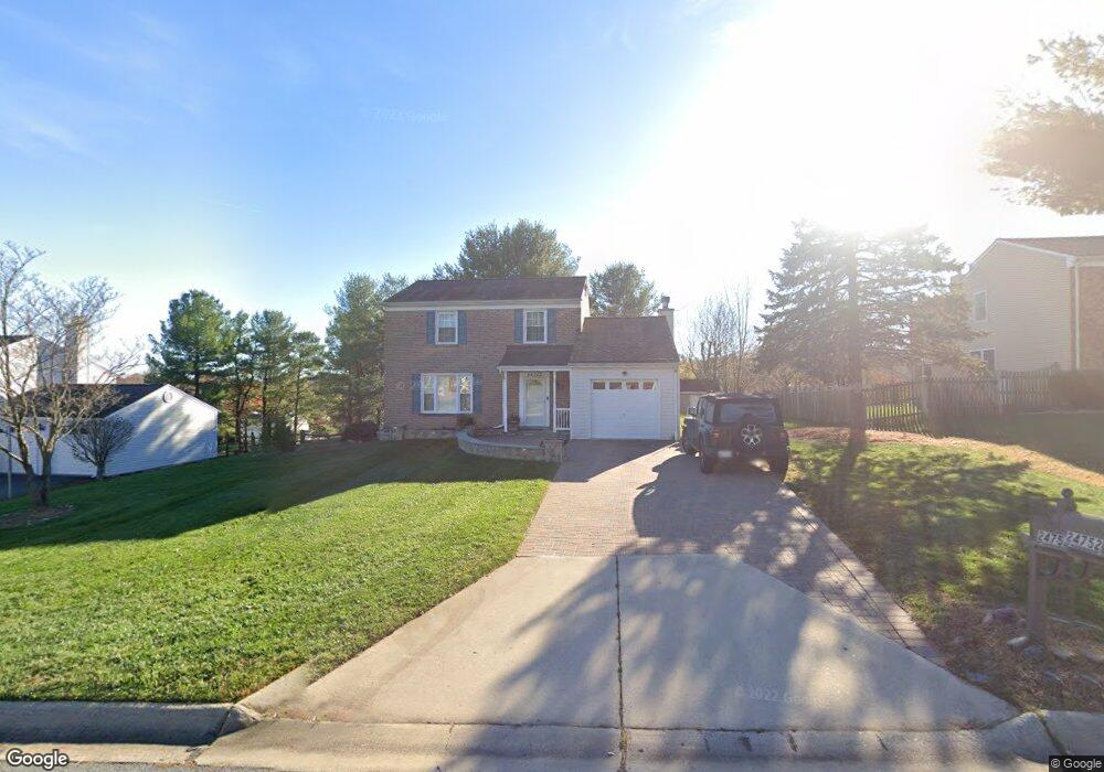
24752 Cutsail Dr Damascus, MD 20872
Estimated Value: $521,000 - $607,000
Studio
3
Baths
1,544
Sq Ft
$360/Sq Ft
Est. Value
About This Home
This home is located at 24752 Cutsail Dr, Damascus, MD 20872 and is currently estimated at $555,076, approximately $359 per square foot. 24752 Cutsail Dr is a home located in Montgomery County with nearby schools including Lois P. Rockwell Elementary School, John T. Baker Middle School, and Damascus High.
Ownership History
Date
Name
Owned For
Owner Type
Purchase Details
Closed on
Apr 8, 2009
Sold by
Bell Frank E
Bought by
Bell Frank E and Bell Claudia
Current Estimated Value
Home Financials for this Owner
Home Financials are based on the most recent Mortgage that was taken out on this home.
Original Mortgage
$345,950
Outstanding Balance
$222,311
Interest Rate
5.25%
Mortgage Type
FHA
Estimated Equity
$332,765
Purchase Details
Closed on
Feb 13, 2004
Sold by
Bell Frank E
Bought by
Bell Frank E and Bell Claudia Symons
Purchase Details
Closed on
Mar 1, 2001
Sold by
Toman Andrew B
Bought by
Bell Frank E
Purchase Details
Closed on
Nov 14, 1996
Sold by
Lewis Lewis V and Lewis Killpack L
Bought by
Toman Andrew B
Purchase Details
Closed on
Mar 31, 1995
Sold by
Burns Francis X
Bought by
Killpack V L
Home Financials for this Owner
Home Financials are based on the most recent Mortgage that was taken out on this home.
Original Mortgage
$135,000
Interest Rate
8.8%
Create a Home Valuation Report for This Property
The Home Valuation Report is an in-depth analysis detailing your home's value as well as a comparison with similar homes in the area
Home Values in the Area
Average Home Value in this Area
Purchase History
| Date | Buyer | Sale Price | Title Company |
|---|---|---|---|
| Bell Frank E | -- | -- | |
| Bell Frank E | -- | -- | |
| Bell Frank E | -- | -- | |
| Bell Frank E | $212,000 | -- | |
| Toman Andrew B | $161,000 | -- | |
| Killpack V L | $168,000 | -- |
Source: Public Records
Mortgage History
| Date | Status | Borrower | Loan Amount |
|---|---|---|---|
| Open | Bell Frank E | $345,950 | |
| Previous Owner | Killpack V L | $135,000 |
Source: Public Records
Tax History
| Year | Tax Paid | Tax Assessment Tax Assessment Total Assessment is a certain percentage of the fair market value that is determined by local assessors to be the total taxable value of land and additions on the property. | Land | Improvement |
|---|---|---|---|---|
| 2025 | $5,459 | $450,667 | -- | -- |
| 2024 | $5,459 | $435,300 | $184,200 | $251,100 |
| 2023 | $5,810 | $407,833 | $0 | $0 |
| 2022 | $3,913 | $380,367 | $0 | $0 |
| 2021 | $3,458 | $352,900 | $184,200 | $168,700 |
| 2020 | $3,458 | $346,200 | $0 | $0 |
| 2019 | $3,369 | $339,500 | $0 | $0 |
| 2018 | $3,294 | $332,800 | $184,200 | $148,600 |
| 2017 | $3,205 | $318,900 | $0 | $0 |
| 2016 | -- | $305,000 | $0 | $0 |
| 2015 | $3,384 | $291,100 | $0 | $0 |
| 2014 | $3,384 | $291,100 | $0 | $0 |
Source: Public Records
Map
Nearby Homes
- 10417 Sweepstakes Rd
- 10432 Sweepstakes Rd
- 24737 Nickelby Dr
- 10603 Hunters Chase Ln
- 10715 Hunters Chase Ln
- 24200 Newbury Rd
- 10840 Sir Barton Cir
- 25304 Clearwater Dr
- 24357 Flamingo Terrace
- 24052 Sugar Cane Ln
- 24004 Desert Wine Ct
- 9805 Hawkins Creamery Rd
- 23623 Cornerstone Ln
- 25508 Coltrane Dr
- 25527 Coltrane Dr
- 23601 Founders Place
- 10008 Founders Way
- 24013 Bush Hill Rd
- 9709 Noble Ridge Terrace
- 3 Valley Park Ct
- 24748 Cutsail Dr
- 24756 Cutsail Dr
- 10425 Carlyn Ridge Rd
- 10429 Carlyn Ridge Rd
- 10421 Carlyn Ridge Rd
- 24744 Cutsail Dr
- 24800 Cutsail Dr
- 24757 Cutsail Dr
- 24753 Cutsail Dr
- 10433 Carlyn Ridge Rd
- 10417 Carlyn Ridge Rd
- 24749 Cutsail Dr
- 24801 Cutsail Dr
- 24810 Cutsail Dr
- 24740 Cutsail Dr
- 24803 Cutsail Dr
- 24805 Cutsail Dr
- 24745 Cutsail Dr
- 10437 Carlyn Ridge Rd
- 10411 Carlyn Ridge Rd
Your Personal Tour Guide
Ask me questions while you tour the home.