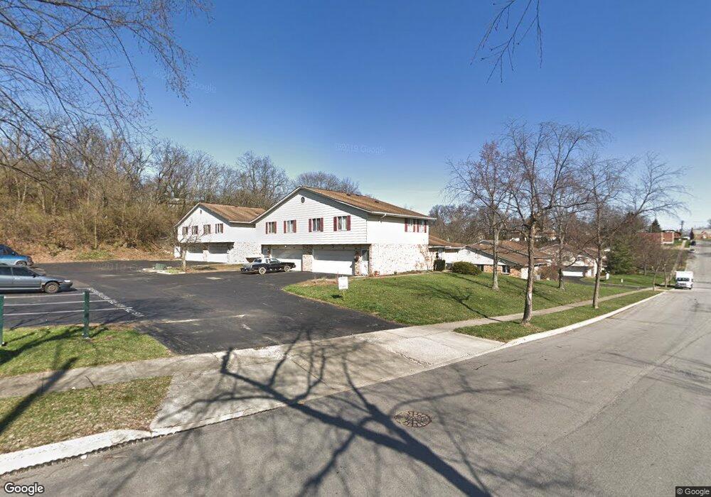
2476 Mustang Dr Cincinnati, OH 45211
Westwood NeighborhoodEstimated Value: $74,000 - $96,000
2
Beds
1
Bath
700
Sq Ft
$125/Sq Ft
Est. Value
About This Home
This home is located at 2476 Mustang Dr, Cincinnati, OH 45211 and is currently estimated at $87,180, approximately $124 per square foot. 2476 Mustang Dr is a home located in Hamilton County with nearby schools including Western Hills High School, Gilbert A. Dater High School, and Robert A. Taft Information Technology High School.
Ownership History
Date
Name
Owned For
Owner Type
Purchase Details
Closed on
Jul 23, 1999
Sold by
Katenkamp Elizabeth B and Badger Elizabeth
Bought by
Dixon Barbara Ann
Current Estimated Value
Home Financials for this Owner
Home Financials are based on the most recent Mortgage that was taken out on this home.
Original Mortgage
$37,000
Outstanding Balance
$9,561
Interest Rate
7.54%
Mortgage Type
FHA
Estimated Equity
$77,619
Purchase Details
Closed on
Aug 5, 1996
Sold by
Basquette Virgil P
Bought by
Katenkamp Elizabeth Badger
Home Financials for this Owner
Home Financials are based on the most recent Mortgage that was taken out on this home.
Original Mortgage
$24,600
Interest Rate
8.18%
Create a Home Valuation Report for This Property
The Home Valuation Report is an in-depth analysis detailing your home's value as well as a comparison with similar homes in the area
Home Values in the Area
Average Home Value in this Area
Purchase History
| Date | Buyer | Sale Price | Title Company |
|---|---|---|---|
| Dixon Barbara Ann | $37,500 | -- | |
| Katenkamp Elizabeth Badger | $30,800 | -- |
Source: Public Records
Mortgage History
| Date | Status | Borrower | Loan Amount |
|---|---|---|---|
| Open | Dixon Barbara Ann | $37,000 | |
| Previous Owner | Katenkamp Elizabeth Badger | $24,600 |
Source: Public Records
Tax History
| Year | Tax Paid | Tax Assessment Tax Assessment Total Assessment is a certain percentage of the fair market value that is determined by local assessors to be the total taxable value of land and additions on the property. | Land | Improvement |
|---|---|---|---|---|
| 2025 | $862 | $13,874 | $2,310 | $11,564 |
| 2023 | $856 | $13,874 | $2,310 | $11,564 |
| 2022 | $641 | $9,272 | $1,155 | $8,117 |
| 2021 | $619 | $9,272 | $1,155 | $8,117 |
| 2020 | $633 | $9,272 | $1,155 | $8,117 |
| 2019 | $866 | $11,638 | $1,155 | $10,483 |
| 2018 | $867 | $11,638 | $1,155 | $10,483 |
| 2017 | $826 | $11,638 | $1,155 | $10,483 |
| 2016 | $812 | $11,270 | $2,100 | $9,170 |
| 2015 | $731 | $11,270 | $2,100 | $9,170 |
| 2014 | $736 | $11,270 | $2,100 | $9,170 |
| 2013 | $749 | $11,270 | $2,100 | $9,170 |
Source: Public Records
Map
Nearby Homes
- 2508 Mustang Dr
- 2454 Mustang Dr
- 2456 Mustang Dr Unit 13
- 2458 Mustang Dr
- 3427 Bighorn Ct
- 2406 Montana Ave
- 3328 Brodbeck Place
- 2525 Millennium Place
- 3412 Millrich Ave
- 3404 Millrich Ave
- 3162 Sunshine Ave
- 2424 Westwood Northern Blvd
- 3116 Gobel Ave
- 3519 Mchenry Ave
- 3312 Mchenry Ave
- 3521 Mchenry Ave
- 3359 Felicity Dr
- 2824 Montana Ave
- 2838 Montana Ave
- 1915 W Fork Rd
- 2482 Mustang Dr
- 2480 Mustang Dr
- 2478 Mustang Dr
- 2486 Mustang Dr
- 2490 Mustang Dr Unit 34
- 2484 Mustang Dr
- 2488 Mustang Dr
- 2494 Mustang Dr
- 2502 Mustang Dr Unit 44
- 2496 Mustang Dr Unit 46
- 2498 Mustang Dr Unit 45
- 2510 Mustang Dr
- 2506 Mustang Dr
- 2504 Mustang Dr Unit 42
- 2500 Mustang Dr Unit 43
- 2492 Mustang Dr
- 2460 Mustang Dr Unit 31
- 2468 Mustang Dr
- 2464 Mustang Dr Unit 30
- 2466 Mustang Dr
Your Personal Tour Guide
Ask me questions while you tour the home.