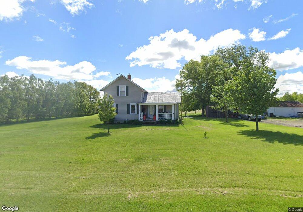
2480 State Route 99 Monroeville, OH 44847
Estimated Value: $135,000 - $265,000
2
Beds
1
Bath
1,215
Sq Ft
$145/Sq Ft
Est. Value
About This Home
This home is located at 2480 State Route 99, Monroeville, OH 44847 and is currently estimated at $176,499, approximately $145 per square foot. 2480 State Route 99 is a home located in Huron County with nearby schools including Monroeville Elementary School, Monroeville High School, and St Joseph Catholic School.
Ownership History
Date
Name
Owned For
Owner Type
Purchase Details
Closed on
Aug 25, 2011
Bought by
Kenneth L Gerber
Current Estimated Value
Purchase Details
Closed on
Feb 28, 2011
Bought by
John H Kousma
Purchase Details
Closed on
Jul 29, 2010
Bought by
Federal Home Loan Mortgage Corporation
Purchase Details
Closed on
Mar 13, 1992
Bought by
Gessling Bryon D and Gessling Stacia S
Create a Home Valuation Report for This Property
The Home Valuation Report is an in-depth analysis detailing your home's value as well as a comparison with similar homes in the area
Home Values in the Area
Average Home Value in this Area
Purchase History
| Date | Buyer | Sale Price | Title Company |
|---|---|---|---|
| Kenneth L Gerber | $87,000 | -- | |
| John H Kousma | $40,200 | -- | |
| Federal Home Loan Mortgage Corporation | $59,300 | -- | |
| Gessling Bryon D | $43,300 | -- |
Source: Public Records
Tax History Compared to Growth
Tax History
| Year | Tax Paid | Tax Assessment Tax Assessment Total Assessment is a certain percentage of the fair market value that is determined by local assessors to be the total taxable value of land and additions on the property. | Land | Improvement |
|---|---|---|---|---|
| 2024 | $1,442 | $36,490 | $8,690 | $27,800 |
| 2023 | $1,442 | $31,770 | $7,280 | $24,490 |
| 2022 | $1,346 | $31,770 | $7,280 | $24,490 |
| 2021 | $1,315 | $31,770 | $7,280 | $24,490 |
| 2020 | $1,328 | $30,720 | $7,280 | $23,440 |
| 2019 | $1,320 | $30,720 | $7,280 | $23,440 |
| 2018 | $1,294 | $30,720 | $7,280 | $23,440 |
| 2017 | $1,102 | $26,730 | $7,280 | $19,450 |
| 2016 | $1,081 | $26,730 | $7,280 | $19,450 |
| 2015 | $1,105 | $26,730 | $7,280 | $19,450 |
| 2014 | $922 | $24,680 | $6,200 | $18,480 |
| 2013 | $986 | $24,680 | $6,200 | $18,480 |
Source: Public Records
Map
Nearby Homes
- 40 Monroe St
- 9 Herrick Aly
- 17 Hollister St
- 117 North St
- 113 North St
- 2 Eagle View Dr
- 196 Ridge St N
- 29 Horseshoe Dr
- 144 Sycamore Dr
- 280 W Main St
- 2961 Ridge Rd
- 157 W Main St
- 2711 Arrowhead Ln
- 9 N Pleasant St
- 102 N Pleasant St
- 40 Briarcrest Village
- 15 Minard Place
- 12 Minard Place
- 35 State St
- 50 Norwood Ave
- 2480 Ohio 99
- 2428 State Route 99
- 2455 Hettle Rd
- 2636 Ohio 99
- 2636 State Route 99
- 2523 Hettle Rd
- 2666 State Route 99
- 2481 Hettle Rd
- 2365 Hettle Rd
- 2688 State Route 99
- 2433 Hettle Rd
- 2417 Hettle Rd
- 2202 State Route 99
- 2393 Hettle Rd
- 2710 State Route 99
- 2187 State Route 99
- 2612 Hettle Rd
- 2681 Hettle Rd
- 2756 State Route 99
- 2291 Hettle Rd