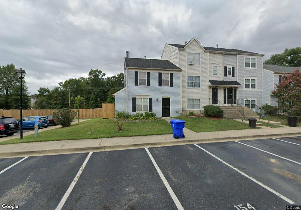
2483 Homestead Ct Waldorf, MD 20601
Estimated Value: $297,000 - $334,988
--
Bed
2
Baths
1,220
Sq Ft
$260/Sq Ft
Est. Value
About This Home
This home is located at 2483 Homestead Ct, Waldorf, MD 20601 and is currently estimated at $316,997, approximately $259 per square foot. 2483 Homestead Ct is a home located in Charles County with nearby schools including C. Paul Barnhart Elementary School, Mattawoman Middle School, and Thomas Stone High School.
Ownership History
Date
Name
Owned For
Owner Type
Purchase Details
Closed on
May 29, 2003
Sold by
Jordan John P and Jordan William J
Bought by
Lewis James S
Current Estimated Value
Purchase Details
Closed on
Oct 23, 2001
Sold by
Jordan Donna L
Bought by
Jordan John P and Jordan William J
Purchase Details
Closed on
Oct 5, 1999
Sold by
Secretary Of Veterans Affairs
Bought by
Jordan Donna L
Purchase Details
Closed on
May 14, 1998
Sold by
Brooks Larry A and Ingle Dorinda B
Bought by
Secretary Of Veterans Affairs
Create a Home Valuation Report for This Property
The Home Valuation Report is an in-depth analysis detailing your home's value as well as a comparison with similar homes in the area
Home Values in the Area
Average Home Value in this Area
Purchase History
| Date | Buyer | Sale Price | Title Company |
|---|---|---|---|
| Lewis James S | $128,900 | -- | |
| Jordan John P | -- | -- | |
| Jordan Donna L | $86,000 | -- | |
| Secretary Of Veterans Affairs | $83,866 | -- |
Source: Public Records
Mortgage History
| Date | Status | Borrower | Loan Amount |
|---|---|---|---|
| Closed | Jordan Donna L | -- |
Source: Public Records
Tax History Compared to Growth
Tax History
| Year | Tax Paid | Tax Assessment Tax Assessment Total Assessment is a certain percentage of the fair market value that is determined by local assessors to be the total taxable value of land and additions on the property. | Land | Improvement |
|---|---|---|---|---|
| 2025 | $8,253 | $259,400 | -- | -- |
| 2024 | $3,534 | $243,900 | $90,000 | $153,900 |
| 2023 | $3,132 | $219,200 | $0 | $0 |
| 2022 | $2,829 | $194,500 | $0 | $0 |
| 2021 | $2,350 | $169,800 | $80,000 | $89,800 |
| 2020 | $2,350 | $161,700 | $0 | $0 |
| 2019 | $2,227 | $153,600 | $0 | $0 |
| 2018 | $2,081 | $145,500 | $75,000 | $70,500 |
| 2017 | $2,074 | $145,500 | $0 | $0 |
| 2016 | -- | $145,500 | $0 | $0 |
| 2015 | $2,147 | $146,800 | $0 | $0 |
| 2014 | $2,147 | $146,800 | $0 | $0 |
Source: Public Records
Map
Nearby Homes
- 2545 Enterprise Place
- 2031 Tanglewood Dr
- HAYDEN Plan at Acton Park
- 2522 Regal Place
- 2073 Tanglewood Dr
- 12113 Farrar Place
- 231 Westdale Dr
- 11565 Timberbrook Dr
- 11748 Torcello Ct
- 11519 Shearwater Dr
- 11616 Kipling Dr
- 2712 Tred Avon Ct
- 2704 Tred Avon Ct
- 11613 Gallinule Ct
- 11824 Murre Ct
- 12061 Pierce Rd
- 11507 Timberbrook Dr
- 11540 Leland Place
- 2204 Holly Oak Ct
- 11800 Railroad Place
- 2485 Homestead Ct
- 2487 Homestead Ct
- 2489 Homestead Ct
- 2491 Homestead Ct
- 11949 Homestead Place
- 11947 Homestead Place
- 2497 Homestead Ct
- 11945 Homestead Place
- 11943 Homestead Place
- 2498 Homestead Ct
- 11941 Homestead Place
- 2496 Homestead Ct
- 11939 Homestead Place
- 2494 Homestead Ct
- 2484 Homestead Ct
- 2482 Homestead Ct
- 2486 Homestead Ct
- 11937 Homestead Place
- 2488 Homestead Ct
- 2492 Homestead Ct