Estimated Value: $216,000 - $263,000
4
Beds
2
Baths
1,998
Sq Ft
$119/Sq Ft
Est. Value
About This Home
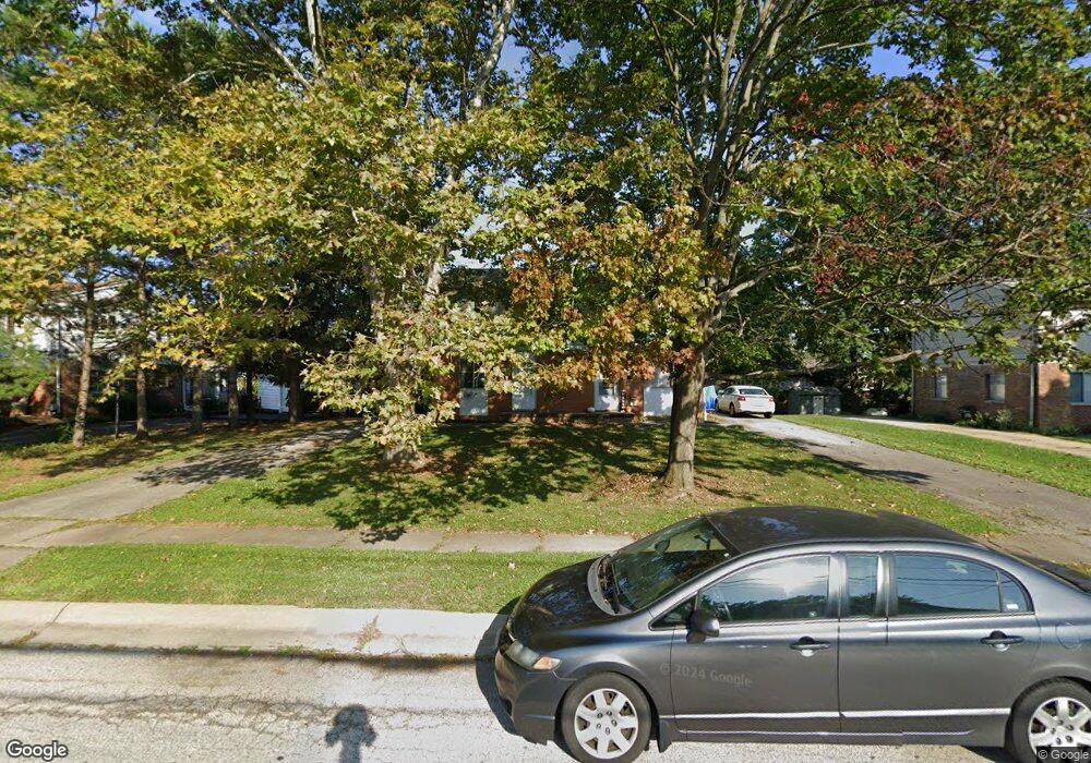
This home is located at 2483 Maplehurst Dr Unit 2487, Stow, OH 44224 and is currently estimated at $238,697, approximately $119 per square foot. 2483 Maplehurst Dr Unit 2487 is a home located in Summit County with nearby schools including Stow-Munroe Falls High School, Holy Family Elementary School, and Walsh Jesuit High School.
Ownership History
Date
Name
Owned For
Owner Type
Purchase Details
Closed on
Sep 24, 2002
Sold by
Cymanski Mark T and Cymansky Kelly K
Bought by
Zelina Karen M
Current Estimated Value
Home Financials for this Owner
Home Financials are based on the most recent Mortgage that was taken out on this home.
Original Mortgage
$105,600
Outstanding Balance
$44,370
Interest Rate
6.32%
Mortgage Type
Purchase Money Mortgage
Estimated Equity
$194,327
Purchase Details
Closed on
Aug 30, 1996
Sold by
Dray Laura A
Bought by
Cymanski Mark T and Cymanski Kelly
Home Financials for this Owner
Home Financials are based on the most recent Mortgage that was taken out on this home.
Original Mortgage
$87,900
Interest Rate
8.3%
Mortgage Type
New Conventional
Create a Home Valuation Report for This Property
The Home Valuation Report is an in-depth analysis detailing your home's value as well as a comparison with similar homes in the area
Home Values in the Area
Average Home Value in this Area
Purchase History
| Date | Buyer | Sale Price | Title Company |
|---|---|---|---|
| Zelina Karen M | $132,000 | Multiple | |
| Cymanski Mark T | $109,900 | -- |
Source: Public Records
Mortgage History
| Date | Status | Borrower | Loan Amount |
|---|---|---|---|
| Open | Zelina Karen M | $105,600 | |
| Previous Owner | Cymanski Mark T | $87,900 |
Source: Public Records
Tax History
| Year | Tax Paid | Tax Assessment Tax Assessment Total Assessment is a certain percentage of the fair market value that is determined by local assessors to be the total taxable value of land and additions on the property. | Land | Improvement |
|---|---|---|---|---|
| 2024 | $3,289 | $56,123 | $13,458 | $42,665 |
| 2023 | $3,289 | $56,123 | $13,458 | $42,665 |
| 2022 | $2,816 | $42,288 | $10,119 | $32,169 |
| 2021 | $2,573 | $42,288 | $10,119 | $32,169 |
| 2020 | $2,492 | $42,290 | $10,120 | $32,170 |
| 2019 | $2,631 | $41,840 | $10,120 | $31,720 |
| 2018 | $2,590 | $41,840 | $10,120 | $31,720 |
| 2017 | $3,664 | $41,840 | $10,120 | $31,720 |
| 2016 | $3,062 | $38,940 | $10,120 | $28,820 |
| 2015 | $3,664 | $38,940 | $10,120 | $28,820 |
| 2014 | $3,510 | $38,940 | $10,120 | $28,820 |
| 2013 | $4,015 | $45,610 | $10,120 | $35,490 |
Source: Public Records
Map
Nearby Homes
- 4556 Fishcreek Rd
- 4155 Burton Dr
- 2260 E Gilwood Dr
- 4638 Dresher Trail
- 4078 Pardee Rd
- 4916 Friar Rd Unit B
- 4932 Friar Rd Unit A
- 2066 King Dr
- 4424 Timberdale Dr Unit 4428
- 2054 Maplewood Rd
- 3961 Klein Ave
- 2055-2059 Bryn Mawr Dr
- 4462 Timberdale Dr
- 0 Vira Rd
- 3901 Moreland Ave
- 2908 Wexford Blvd
- 3861 Klein Ave
- 3828 Osage St Unit 3832
- 1933 Arndale Rd
- 4846 Garnet Cir
- 2495 Maplehurst Dr
- 2491 Maplehurst Dr Unit 2495
- 2473 Maplehurst Dr Unit 2477
- 2491 Maplehurst Dr
- 4391 Maplepark Rd
- 4399 Maplepark Rd
- 4429 N Norman Dr Unit 4433
- 2503 Maplehurst Dr Unit 2507
- 4433 N Norman Dr
- 4385 Maplepark Rd
- 2482 Maplehurst Dr Unit 2486
- 4407 Maplepark Rd Unit 4411
- 2507 Maplehurst Dr
- 2490 Maplehurst Dr Unit 2494
- 4419 N Norman Dr Unit 4423
- 4377 Maplepark Rd
- 2511 Maplehurst Dr Unit 2515
- 4415 Maplepark Rd Unit 4419
- 4363 Maplepark Rd
- 4388 Elmhurst Dr Unit 4392