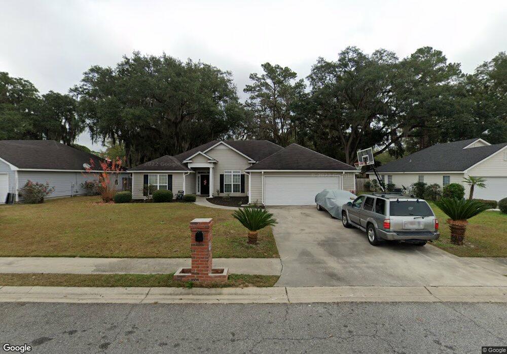
2483 Muscogee Dr Valdosta, GA 31602
Estimated Value: $250,000 - $276,000
4
Beds
2
Baths
1,929
Sq Ft
$136/Sq Ft
Est. Value
About This Home
This home is located at 2483 Muscogee Dr, Valdosta, GA 31602 and is currently estimated at $261,733, approximately $135 per square foot. 2483 Muscogee Dr is a home located in Lowndes County with nearby schools including Sallas Mahone Elementary School, Valdosta Middle School, and Valdosta High School.
Ownership History
Date
Name
Owned For
Owner Type
Purchase Details
Closed on
Mar 22, 2013
Sold by
Cnota Randall J
Bought by
Swader Susan S
Current Estimated Value
Purchase Details
Closed on
Feb 25, 2005
Sold by
The Lamon Co Llc
Bought by
Cnota Randall J and Kinsman Dawna M
Home Financials for this Owner
Home Financials are based on the most recent Mortgage that was taken out on this home.
Original Mortgage
$119,920
Interest Rate
5.13%
Mortgage Type
New Conventional
Purchase Details
Closed on
Aug 10, 2004
Sold by
Brown T C Construction Inc
Bought by
Lamon Company Llc The
Purchase Details
Closed on
Jul 19, 2004
Sold by
Cumberland Plantation Partners
Bought by
Brown T C Construction Inc
Purchase Details
Closed on
Dec 15, 2003
Bought by
Cumberland Plantation Partners Llc
Create a Home Valuation Report for This Property
The Home Valuation Report is an in-depth analysis detailing your home's value as well as a comparison with similar homes in the area
Home Values in the Area
Average Home Value in this Area
Purchase History
| Date | Buyer | Sale Price | Title Company |
|---|---|---|---|
| Swader Susan S | $143,000 | -- | |
| Cnota Randall J | $149,900 | -- | |
| Lamon Company Llc The | $25,300 | -- | |
| Brown T C Construction Inc | $25,000 | -- | |
| Cumberland Plantation Partners Llc | -- | -- |
Source: Public Records
Mortgage History
| Date | Status | Borrower | Loan Amount |
|---|---|---|---|
| Previous Owner | Cnota Randall J | $119,920 | |
| Previous Owner | Cnota Randall J | $22,485 |
Source: Public Records
Tax History Compared to Growth
Tax History
| Year | Tax Paid | Tax Assessment Tax Assessment Total Assessment is a certain percentage of the fair market value that is determined by local assessors to be the total taxable value of land and additions on the property. | Land | Improvement |
|---|---|---|---|---|
| 2024 | $2,577 | $98,268 | $11,200 | $87,068 |
| 2023 | $2,577 | $84,337 | $11,200 | $73,137 |
| 2022 | $1,827 | $60,068 | $11,200 | $48,868 |
| 2021 | $1,880 | $60,068 | $11,200 | $48,868 |
| 2020 | $1,920 | $60,068 | $11,200 | $48,868 |
| 2019 | $1,919 | $60,068 | $11,200 | $48,868 |
| 2018 | $1,944 | $60,068 | $11,200 | $48,868 |
| 2017 | $1,958 | $60,068 | $11,200 | $48,868 |
| 2016 | $1,955 | $60,068 | $11,200 | $48,868 |
| 2015 | -- | $60,068 | $11,200 | $48,868 |
| 2014 | $1,722 | $60,068 | $11,200 | $48,868 |
Source: Public Records
Map
Nearby Homes
- 2414 Deborah Dr
- 2435 Muscogee Dr
- 1 Pomona Cir
- 2517 Deborah Dr
- 1647 Fresno St
- 2320 Barack Obama Blvd
- 904 Habersham Rd
- 0 Northside Dr Unit 145194
- 2310 Barack Obama Blvd
- 9 Oconee Place
- 1703 Largo Cir
- 1507 Leone Ave
- 2713 Pineview Dr Unit A&B
- 2400 Lowndes Dr
- 2311 Lowndes Dr
- 957 McAfina Trail
- 2712 Clayton Dr
- 1642 Lexington Cir
- 1724 Eli Place
- 1739 Eli Place
- 2479 Muscogee Dr
- 2487 Muscogee Dr
- 2412 Deborah Dr
- 2491 Muscogee Dr
- 2475 Muscogee Dr
- 2416 Deborah Dr
- 2484 Muscogee Dr
- 2488 Muscogee Dr
- 2480 Muscogee Dr
- 2410 Deborah Dr
- 2418 Deborah Dr
- 2495 Muscogee Dr
- 2492 Muscogee Dr
- 2474 Muscogee Dr
- 2471 Muscogee Dr
- 2408 Deborah Dr
- 2420 Deborah Dr
- 2496 Muscogee Dr
- 2462 Muscogee Dr
- 2495 Melrose Dr