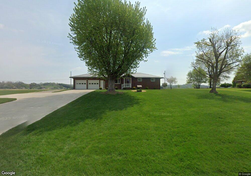
24834 State Route 621 Coshocton, OH 43812
Estimated Value: $239,000 - $332,000
3
Beds
4
Baths
1,826
Sq Ft
$155/Sq Ft
Est. Value
About This Home
This home is located at 24834 State Route 621, Coshocton, OH 43812 and is currently estimated at $283,823, approximately $155 per square foot. 24834 State Route 621 is a home located in Coshocton County with nearby schools including River View High School, Coshocton Christian School, and Sacred Heart School.
Ownership History
Date
Name
Owned For
Owner Type
Purchase Details
Closed on
Oct 10, 2018
Sold by
Wills Barbara L
Bought by
Leindecker Larry L and Leindecker Sally R
Current Estimated Value
Purchase Details
Closed on
Jun 30, 2014
Sold by
Leindecker Larry L and Leindecker Sally
Bought by
Wills Harold M and Wills Barbara L
Home Financials for this Owner
Home Financials are based on the most recent Mortgage that was taken out on this home.
Original Mortgage
$110,000
Interest Rate
4.2%
Mortgage Type
New Conventional
Purchase Details
Closed on
Apr 19, 2007
Sold by
Leindecker Larry L and Leindecker Sally
Bought by
Leindecker Larry L and Leindecker Sally
Create a Home Valuation Report for This Property
The Home Valuation Report is an in-depth analysis detailing your home's value as well as a comparison with similar homes in the area
Home Values in the Area
Average Home Value in this Area
Purchase History
| Date | Buyer | Sale Price | Title Company |
|---|---|---|---|
| Leindecker Larry L | $175,000 | Owl Creek Title Agency | |
| Wills Harold M | $120,000 | None Available | |
| Leindecker Larry L | -- | None Available |
Source: Public Records
Mortgage History
| Date | Status | Borrower | Loan Amount |
|---|---|---|---|
| Previous Owner | Wills Harold M | $110,000 |
Source: Public Records
Tax History Compared to Growth
Tax History
| Year | Tax Paid | Tax Assessment Tax Assessment Total Assessment is a certain percentage of the fair market value that is determined by local assessors to be the total taxable value of land and additions on the property. | Land | Improvement |
|---|---|---|---|---|
| 2024 | $1,936 | $66,590 | $15,380 | $51,210 |
| 2023 | $1,936 | $52,956 | $10,287 | $42,669 |
| 2022 | $1,629 | $52,956 | $10,287 | $42,669 |
| 2021 | $1,629 | $52,956 | $10,287 | $42,669 |
| 2020 | $1,799 | $57,211 | $10,304 | $46,907 |
| 2019 | $1,432 | $46,407 | $10,304 | $36,103 |
| 2018 | $1,499 | $41,885 | $10,304 | $31,581 |
| 2017 | $1,459 | $39,008 | $9,184 | $29,824 |
| 2016 | $1,381 | $39,008 | $9,184 | $29,824 |
| 2015 | $690 | $39,008 | $9,184 | $29,824 |
| 2014 | $1,127 | $40,370 | $8,166 | $32,204 |
Source: Public Records
Map
Nearby Homes
- 217 E Liberty St
- 230 Rivercrest Dr
- 23900 Airport Rd
- 23749 County Road 621
- 527 N 15th St
- 1636 Trade Ave
- 216 N 15th St
- 821 Grandview Ave
- 1421 Chestnut St
- 1945 Hall Dr
- 353 N 11th St
- 349 N 11th St
- 1124 Chestnut St
- 133 N 12th St
- 1706 Adams St
- 1822 Adams St
- 624 Cemetery St
- 0 Adams St
- 1518 Walnut St
- 631 Locust St
- 24866 State Route 621
- 24800 State Route 621
- 24863 State Route 621
- 24831 State Route 621
- 24898 State Route 621
- 24817 State Route 621
- 24766 State Route 621
- 24940 State Route 621
- 24907 State Route 621
- 24732 State Route 621
- 24734 State Route 621
- 24968 State Route 621
- 24968 Ohio 621
- 24993 State Route 621
- 24904 Walnut Hill Dr
- 24924 Walnut Hill Dr
- 24790 County Road 193
- 24947 Walnut Hill Dr
- 24741 County Road 193
- 24859 Walnut Hill Dr