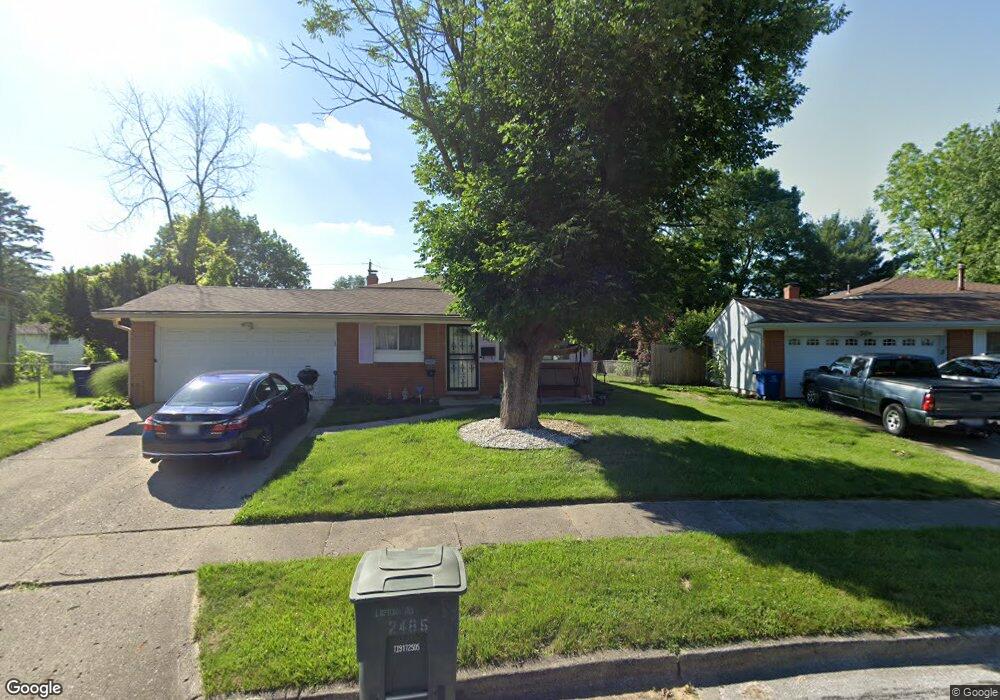
2485 Lipton Rd Columbus, OH 43232
Walnut Heights NeighborhoodEstimated Value: $190,482 - $239,000
3
Beds
2
Baths
960
Sq Ft
$217/Sq Ft
Est. Value
About This Home
This home is located at 2485 Lipton Rd, Columbus, OH 43232 and is currently estimated at $207,871, approximately $216 per square foot. 2485 Lipton Rd is a home located in Franklin County with nearby schools including Liberty Elementary School, Yorktown Middle School, and Independence High School.
Ownership History
Date
Name
Owned For
Owner Type
Purchase Details
Closed on
Aug 21, 2019
Sold by
Estate Of Melvin E Ross
Bought by
Ross Lois K
Current Estimated Value
Purchase Details
Closed on
Dec 13, 2002
Sold by
Cherubim Llc
Bought by
Ross Melvin E
Home Financials for this Owner
Home Financials are based on the most recent Mortgage that was taken out on this home.
Original Mortgage
$97,962
Interest Rate
6.01%
Mortgage Type
FHA
Purchase Details
Closed on
Aug 15, 2002
Sold by
Jackson James A and Equicredit Corp Of America
Bought by
Cheribum Properties Llc
Purchase Details
Closed on
Aug 5, 1993
Bought by
Jackson James A
Purchase Details
Closed on
Aug 4, 1987
Purchase Details
Closed on
Sep 1, 1978
Create a Home Valuation Report for This Property
The Home Valuation Report is an in-depth analysis detailing your home's value as well as a comparison with similar homes in the area
Home Values in the Area
Average Home Value in this Area
Purchase History
| Date | Buyer | Sale Price | Title Company |
|---|---|---|---|
| Ross Lois K | -- | None Available | |
| Ross Melvin E | $99,500 | Amerititle East | |
| Cheribum Properties Llc | $62,100 | -- | |
| Jackson James A | $66,000 | -- | |
| -- | $54,300 | -- | |
| -- | $41,500 | -- |
Source: Public Records
Mortgage History
| Date | Status | Borrower | Loan Amount |
|---|---|---|---|
| Previous Owner | Ross Melvin E | $97,962 |
Source: Public Records
Tax History
| Year | Tax Paid | Tax Assessment Tax Assessment Total Assessment is a certain percentage of the fair market value that is determined by local assessors to be the total taxable value of land and additions on the property. | Land | Improvement |
|---|---|---|---|---|
| 2025 | $3,109 | $69,270 | $18,970 | $50,300 |
| 2024 | $3,109 | $69,270 | $18,970 | $50,300 |
| 2023 | $3,069 | $69,265 | $18,970 | $50,295 |
| 2022 | $2,071 | $39,940 | $7,110 | $32,830 |
| 2021 | $2,313 | $39,940 | $7,110 | $32,830 |
| 2020 | $2,154 | $39,940 | $7,110 | $32,830 |
| 2019 | $2,035 | $33,540 | $5,920 | $27,620 |
| 2018 | $1,769 | $33,540 | $5,920 | $27,620 |
| 2017 | $2,033 | $33,540 | $5,920 | $27,620 |
| 2016 | $1,660 | $25,060 | $4,900 | $20,160 |
| 2015 | $1,507 | $25,060 | $4,900 | $20,160 |
| 2014 | $1,511 | $25,060 | $4,900 | $20,160 |
| 2013 | $827 | $27,825 | $5,425 | $22,400 |
Source: Public Records
Map
Nearby Homes
- 2336 Noe Bixby Rd
- 2348 Noe Bixby Rd
- 2342 Noe Bixby Rd
- 2360 Noe Bixby Rd
- 2354 Noe Bixby Rd
- 0 Noe Bixby Rd
- 2615 Carbondale Place
- 2706 Maywood Rd
- 5114 Carbondale Dr
- 5123 Jameson Dr
- 2746 Noe Bixby Rd
- 5084 Refugee Rd
- 5137 Holbrook Dr
- 2608 Hubbell Rd
- 4942 Talbert Dr
- 2651 Brownfield Rd
- 2949 Fleet Rd
- 5278 Glenbriar Ct
- 1945 Riverdale Rd
- 5290 Quincy Dr