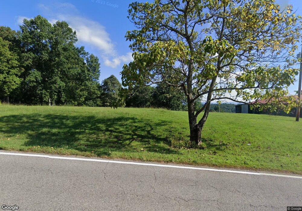
2487 Demory Rd La Follette, TN 37766
Estimated Value: $208,000 - $639,980
--
Bed
1
Bath
916
Sq Ft
$463/Sq Ft
Est. Value
About This Home
This home is located at 2487 Demory Rd, La Follette, TN 37766 and is currently estimated at $423,990, approximately $462 per square foot. 2487 Demory Rd is a home located in Campbell County.
Ownership History
Date
Name
Owned For
Owner Type
Purchase Details
Closed on
May 26, 1992
Current Estimated Value
Purchase Details
Closed on
Aug 21, 1985
Bought by
Thompson Paul H and Thompson Sandra E
Purchase Details
Closed on
Dec 20, 1983
Purchase Details
Closed on
Jul 25, 1980
Purchase Details
Closed on
Jan 1, 1980
Purchase Details
Closed on
May 1, 1978
Purchase Details
Closed on
Jan 3, 1900
Purchase Details
Closed on
Jan 2, 1900
Create a Home Valuation Report for This Property
The Home Valuation Report is an in-depth analysis detailing your home's value as well as a comparison with similar homes in the area
Home Values in the Area
Average Home Value in this Area
Purchase History
| Date | Buyer | Sale Price | Title Company |
|---|---|---|---|
| -- | -- | -- | |
| Thompson Paul H | -- | -- | |
| -- | -- | -- | |
| -- | -- | -- | |
| -- | $50,000 | -- | |
| -- | -- | -- | |
| -- | -- | -- | |
| -- | -- | -- |
Source: Public Records
Tax History Compared to Growth
Tax History
| Year | Tax Paid | Tax Assessment Tax Assessment Total Assessment is a certain percentage of the fair market value that is determined by local assessors to be the total taxable value of land and additions on the property. | Land | Improvement |
|---|---|---|---|---|
| 2025 | $1,330 | $109,450 | $0 | $0 |
| 2024 | $1,330 | $109,450 | $20,950 | $88,500 |
| 2023 | $1,258 | $60,900 | $15,650 | $45,250 |
| 2022 | $1,258 | $60,900 | $15,650 | $45,250 |
| 2021 | $1,258 | $60,900 | $15,650 | $45,250 |
| 2020 | $1,233 | $60,900 | $15,650 | $45,250 |
| 2019 | $1,258 | $60,900 | $15,650 | $45,250 |
| 2018 | $1,375 | $61,125 | $16,050 | $45,075 |
| 2017 | $1,375 | $61,125 | $16,050 | $45,075 |
| 2016 | $1,375 | $61,125 | $16,050 | $45,075 |
| 2015 | $1,216 | $61,125 | $16,050 | $45,075 |
| 2014 | -- | $61,125 | $16,050 | $45,075 |
| 2013 | -- | $61,125 | $16,050 | $45,075 |
Source: Public Records
Map
Nearby Homes
- 0 Low Gap Rd Unit 18767562
- 0 Low Gap Rd Unit 11277254
- 519 Whitman Hollow Rd
- 1971 Demory Rd
- 2473 Long Hollow Rd
- 0 Whitman Hollow Rd Unit 1271817
- 268 Cross View Ln
- 258 Marina Ln
- 0 Cross View Ln Unit 1312951
- 309 Marina Ln
- 286 Lewis White Ln
- 0 W High Knob Rd
- 1123 Pleasant Ridge Rd
- 647 Coolidge Rd
- 0 Dr
- 689 Ivey Hollow Rd
- 4160 Demory Rd
- 00 Chestnut Stump Rd
- 0 Carp Ln Unit 1258153
- 0 Grantsboro Rd
- 2553 Demory Rd
- 2423 Demory Rd
- 221 Low Gap Rd
- 251 Young Rd
- 266 Young Rd
- 302 Young Rd
- 152 Lois Ln
- 269 Young Rd
- 269 Young Rd
- 114 Housley Ln
- 261 Low Gap Rd
- 148 Durkee Hollow Ln
- 2353 Demory Rd
- 2681 Demory Rd
- 280 Low Gap Rd
- 127 Lark Ln
- 2732 Demory Rd
- 250 Low Gap Rd
- 248 Durkee Hollow Ln
- 250 Durkee Hollow Ln
