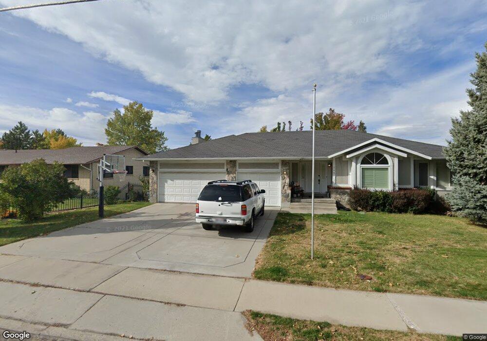
2487 N 1200 E Provo, UT 84604
Rock Canyon NeighborhoodEstimated Value: $710,273 - $965,000
5
Beds
3
Baths
3,370
Sq Ft
$249/Sq Ft
Est. Value
About This Home
This home is located at 2487 N 1200 E, Provo, UT 84604 and is currently estimated at $839,068, approximately $248 per square foot. 2487 N 1200 E is a home located in Utah County with nearby schools including Rock Canyon Elementary School, Centennial Middle School, and Timpview High School.
Ownership History
Date
Name
Owned For
Owner Type
Purchase Details
Closed on
Sep 24, 2021
Sold by
2487 N 1200 E Llc
Bought by
Shields Scott and Shields Dorene
Current Estimated Value
Home Financials for this Owner
Home Financials are based on the most recent Mortgage that was taken out on this home.
Original Mortgage
$550,800
Outstanding Balance
$501,187
Interest Rate
2.8%
Mortgage Type
New Conventional
Estimated Equity
$337,881
Purchase Details
Closed on
Feb 23, 2016
Sold by
Willder Mark E and Willder Erin
Bought by
2487 N 1200 E Llc
Create a Home Valuation Report for This Property
The Home Valuation Report is an in-depth analysis detailing your home's value as well as a comparison with similar homes in the area
Home Values in the Area
Average Home Value in this Area
Purchase History
| Date | Buyer | Sale Price | Title Company |
|---|---|---|---|
| Shields Scott | -- | Backman Title Services | |
| 2487 N 1200 E Llc | -- | None Available |
Source: Public Records
Mortgage History
| Date | Status | Borrower | Loan Amount |
|---|---|---|---|
| Open | Shields Scott | $550,800 |
Source: Public Records
Tax History
| Year | Tax Paid | Tax Assessment Tax Assessment Total Assessment is a certain percentage of the fair market value that is determined by local assessors to be the total taxable value of land and additions on the property. | Land | Improvement |
|---|---|---|---|---|
| 2025 | $3,256 | $349,580 | -- | -- |
| 2024 | $3,256 | $320,485 | $0 | $0 |
| 2023 | $3,056 | $296,560 | $0 | $0 |
| 2022 | $3,184 | $311,575 | $0 | $0 |
| 2021 | $2,547 | $434,700 | $178,400 | $256,300 |
| 2020 | $2,540 | $406,400 | $155,100 | $251,300 |
| 2019 | $2,266 | $377,000 | $155,100 | $221,900 |
| 2018 | $2,066 | $348,700 | $141,000 | $207,700 |
| 2017 | $2,004 | $185,845 | $0 | $0 |
| 2016 | $1,971 | $170,335 | $0 | $0 |
| 2015 | $1,743 | $152,240 | $0 | $0 |
| 2014 | $1,587 | $144,485 | $0 | $0 |
Source: Public Records
Map
Nearby Homes
- 788 E 2680 N
- 2025 Oak Ln
- 2848 Foothill Dr
- 758 E 3030 N
- 3043 Bannock Dr
- 3129 Cherokee Ln
- 3250 Mohawk Ln
- 1801 N 650 E
- 2774 N 370 E
- 240 E 2230 N Unit 7
- 186 E 2100 N
- 1411 N Locust Ln
- 182 E 2090 N
- 360 Sumac Ln
- 3025 N 250 E
- 2735 N Country Club Dr
- 1960 N Canyon Rd
- 990 Cedar Ave
- 5600 N Canyon Rd
- 3702 N 920 E
- 2487 Iroquois Dr
- 2457 Iroquois Dr
- 2517 Iroquois Dr
- 2502 N 1150 E
- 1146 E 2500 N
- 2527 Iroquois Dr
- 2527 N 1200 E
- 2526 N 1150 E
- 1132 E 2500 N
- 2549 Iroquois Dr
- 2431 Iroquois Dr
- 2548 N 1150 E
- 1131 E 2500 N
- 1114 E 2500 N
- 2569 Iroquois Dr
- 1225 Cambridge Ct
- 2552 N 1150 E
- 1134 E 2570 N
- 2415 Iroquois Dr
- 1113 E 2500 N
Your Personal Tour Guide
Ask me questions while you tour the home.