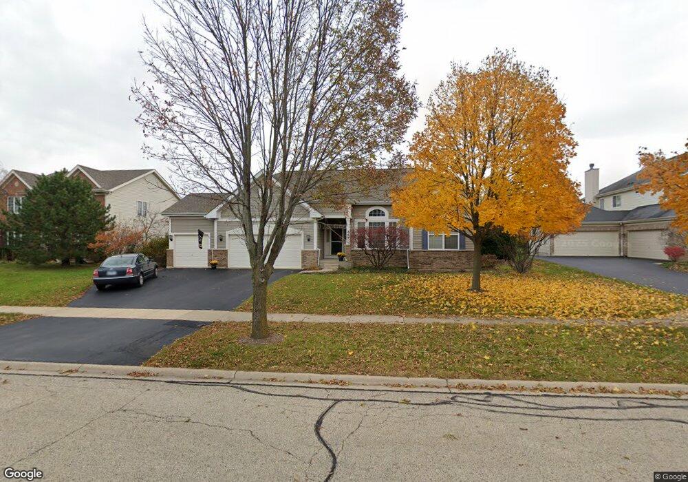
249 Barnside Cir Unit 2 Geneva, IL 60134
Heartland NeighborhoodEstimated Value: $603,618 - $722,000
3
Beds
2
Baths
2,454
Sq Ft
$269/Sq Ft
Est. Value
About This Home
This home is located at 249 Barnside Cir Unit 2, Geneva, IL 60134 and is currently estimated at $660,655, approximately $269 per square foot. 249 Barnside Cir Unit 2 is a home located in Kane County with nearby schools including Heartland Elementary School, Geneva Community High School, and Kensington School - Geneva.
Ownership History
Date
Name
Owned For
Owner Type
Purchase Details
Closed on
Jan 17, 2002
Sold by
Drh Cambridge Homes Inc
Bought by
Reith Thomas R and Reith Christine M
Current Estimated Value
Home Financials for this Owner
Home Financials are based on the most recent Mortgage that was taken out on this home.
Original Mortgage
$180,000
Outstanding Balance
$74,184
Interest Rate
7.16%
Estimated Equity
$586,471
Create a Home Valuation Report for This Property
The Home Valuation Report is an in-depth analysis detailing your home's value as well as a comparison with similar homes in the area
Home Values in the Area
Average Home Value in this Area
Purchase History
| Date | Buyer | Sale Price | Title Company |
|---|---|---|---|
| Reith Thomas R | $372,500 | Ticor Title Insurance |
Source: Public Records
Mortgage History
| Date | Status | Borrower | Loan Amount |
|---|---|---|---|
| Open | Reith Thomas R | $180,000 |
Source: Public Records
Tax History Compared to Growth
Tax History
| Year | Tax Paid | Tax Assessment Tax Assessment Total Assessment is a certain percentage of the fair market value that is determined by local assessors to be the total taxable value of land and additions on the property. | Land | Improvement |
|---|---|---|---|---|
| 2024 | $11,384 | $154,689 | $41,369 | $113,320 |
| 2023 | $11,095 | $140,626 | $37,608 | $103,018 |
| 2022 | $10,611 | $130,669 | $34,945 | $95,724 |
| 2021 | $10,297 | $125,812 | $33,646 | $92,166 |
| 2020 | $10,181 | $123,891 | $33,132 | $90,759 |
| 2019 | $10,155 | $121,546 | $32,505 | $89,041 |
| 2018 | $10,409 | $124,547 | $32,505 | $92,042 |
| 2017 | $10,299 | $121,225 | $31,638 | $89,587 |
| 2016 | $10,356 | $119,586 | $31,210 | $88,376 |
| 2015 | -- | $113,697 | $29,673 | $84,024 |
| 2014 | -- | $107,525 | $29,673 | $77,852 |
| 2013 | -- | $107,525 | $29,673 | $77,852 |
Source: Public Records
Map
Nearby Homes
- 2731 Stone Cir
- 2771 Stone Cir
- 2767 Stone Cir
- 2692 Stone Cir Unit 203
- 2671 Stone Cir Unit 208
- 231 N Cambridge Dr
- 560 Renee Ct
- 2528 Heritage Ct Unit 1
- 528 Horizon Dr W
- 3024 Langston Cir
- 3497 Winding Meadow Ln
- 2147 Fargo Blvd
- 38W533 Berquist Dr
- Unit 6A Prairie Grove Dr
- Unit 5B Prairie Grove Dr
- Unit 4A Prairie Grove Dr
- Unit 5A Prairie Grove Dr
- Unit 7A Prairie Grove Dr
- Unit 6C Prairie Grove Dr
- Unit 5C Prairie Grove Dr
- 261 Barnside Cir Unit 2
- 227 Barnside Cir
- 283 Barnside Cir Unit 2
- 136 Planters Row
- 205 Barnside Cir Unit 2
- 254 Barnside Cir Unit 2
- 118 Planters Row
- 232 Barnside Cir
- 150 Planters Row
- 269 Prairieview Dr Unit 2
- 295 Barnside Cir
- 210 Barnside Cir Unit 2
- 172 Planters Row
- 190 Fairview Ct
- 180 Fairview Ct
- 247 Prairieview Dr Unit 2
- 227 Willowbrook Way Unit 2
- 323 Prairieview Dr
- 249 Willowbrook Way
- 109 Planters Row