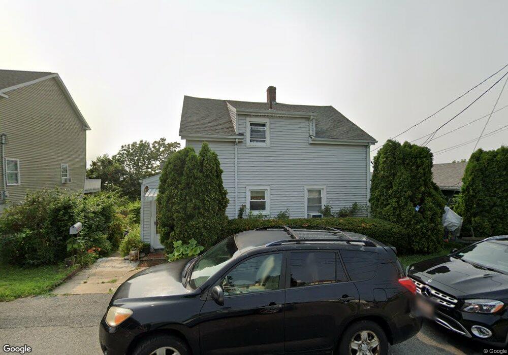
249 Bayview St Fall River, MA 02724
Sandy Beach NeighborhoodEstimated Value: $526,620 - $579,000
Studio
1
Bath
--
Sq Ft
6,665
Sq Ft Lot
About This Home
This home is located at 249 Bayview St, Fall River, MA 02724 and is currently estimated at $549,655. 249 Bayview St is a home located in Bristol County with nearby schools including Carlton M. Viveiros Elementary School, Matthew J. Kuss Middle School, and B M C Durfee High School.
Ownership History
Date
Name
Owned For
Owner Type
Purchase Details
Closed on
Feb 5, 2025
Sold by
Oliveira Herculano B Est and Oliveira
Bought by
Oliveira Mario J and Oliveira Jose C
Current Estimated Value
Purchase Details
Closed on
Nov 2, 2004
Sold by
Rodrigues Irene C
Bought by
Rodrigues Richard B
Purchase Details
Closed on
Feb 5, 1979
Bought by
Oliveira Herculano B and Oliveira Ilda C
Create a Home Valuation Report for This Property
The Home Valuation Report is an in-depth analysis detailing your home's value as well as a comparison with similar homes in the area
Home Values in the Area
Average Home Value in this Area
Purchase History
| Date | Buyer | Sale Price | Title Company |
|---|---|---|---|
| Oliveira Mario J | -- | None Available | |
| Oliveira Mario J | -- | None Available | |
| Rodrigues Richard B | -- | -- | |
| Rodrigues Richard B | -- | -- | |
| Oliveira Herculano B | $29,000 | -- |
Source: Public Records
Tax History
| Year | Tax Paid | Tax Assessment Tax Assessment Total Assessment is a certain percentage of the fair market value that is determined by local assessors to be the total taxable value of land and additions on the property. | Land | Improvement |
|---|---|---|---|---|
| 2025 | $4,933 | $430,800 | $134,500 | $296,300 |
| 2024 | $4,648 | $404,500 | $131,900 | $272,600 |
| 2023 | $4,643 | $378,400 | $118,800 | $259,600 |
| 2022 | $4,078 | $323,100 | $112,100 | $211,000 |
| 2021 | $3,800 | $274,800 | $107,100 | $167,700 |
| 2020 | $3,771 | $261,000 | $102,200 | $158,800 |
| 2019 | $4,657 | $257,500 | $106,800 | $150,700 |
| 2018 | $3,874 | $242,700 | $107,600 | $135,100 |
| 2017 | $3,373 | $240,900 | $107,600 | $133,300 |
| 2016 | $3,223 | $236,500 | $110,900 | $125,600 |
| 2015 | $3,093 | $236,500 | $110,900 | $125,600 |
| 2014 | $2,975 | $236,500 | $110,900 | $125,600 |
Source: Public Records
Map
Nearby Homes
Your Personal Tour Guide
Ask me questions while you tour the home.