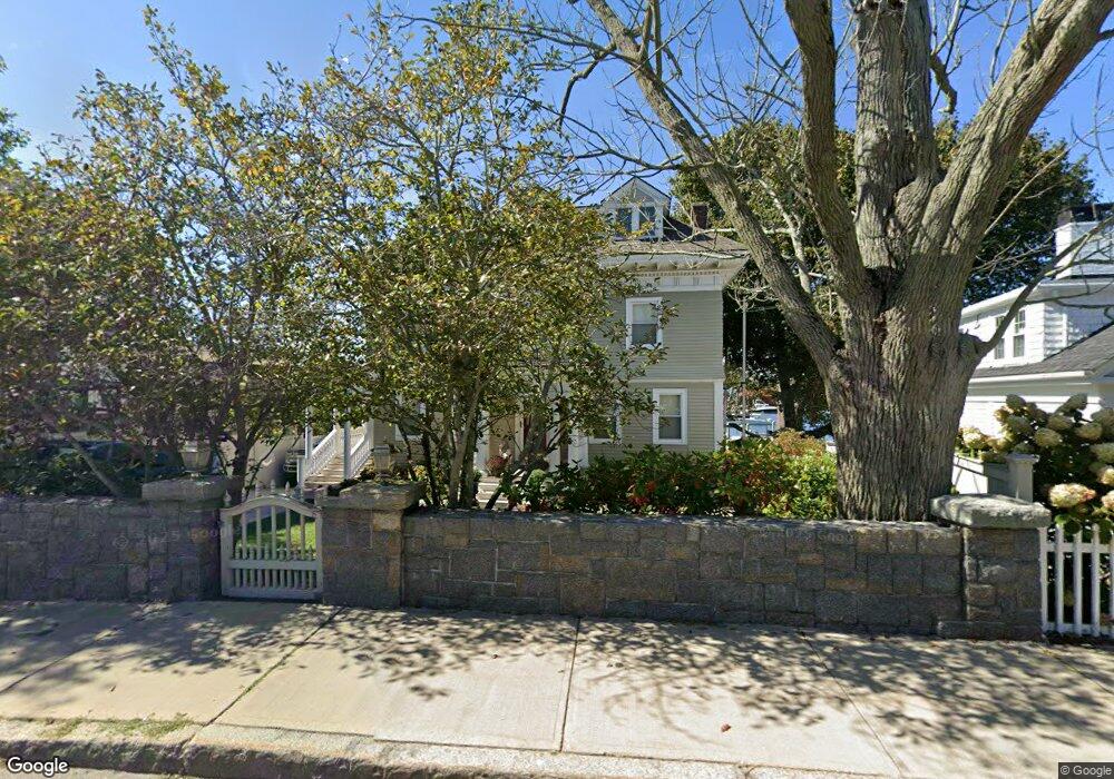
249 E Main St Unit 2 Gloucester, MA 01930
East Gloucester NeighborhoodEstimated Value: $1,175,000 - $2,039,000
1
Bed
1
Bath
720
Sq Ft
$2,354/Sq Ft
Est. Value
About This Home
This home is located at 249 E Main St Unit 2, Gloucester, MA 01930 and is currently estimated at $1,694,814, approximately $2,353 per square foot. 249 E Main St Unit 2 is a home located in Essex County with nearby schools including East Gloucester Elementary School, Ralph B O'maley Middle School, and Gloucester High School.
Ownership History
Date
Name
Owned For
Owner Type
Purchase Details
Closed on
May 4, 2016
Sold by
Montagnino James V
Bought by
Montagnino James and Montagnino Mary J
Current Estimated Value
Home Financials for this Owner
Home Financials are based on the most recent Mortgage that was taken out on this home.
Original Mortgage
$600,000
Outstanding Balance
$475,842
Interest Rate
3.71%
Mortgage Type
Stand Alone Refi Refinance Of Original Loan
Estimated Equity
$1,218,972
Purchase Details
Closed on
Apr 16, 2003
Sold by
Montagnino James V and Montagnino Marcia J
Bought by
Montagnino James
Purchase Details
Closed on
Apr 29, 1994
Sold by
Household Finance Corp
Bought by
Montagnino James
Create a Home Valuation Report for This Property
The Home Valuation Report is an in-depth analysis detailing your home's value as well as a comparison with similar homes in the area
Home Values in the Area
Average Home Value in this Area
Purchase History
| Date | Buyer | Sale Price | Title Company |
|---|---|---|---|
| Montagnino James | -- | -- | |
| Montagnino James | -- | -- | |
| Montagnino James | $250,000 | -- |
Source: Public Records
Mortgage History
| Date | Status | Borrower | Loan Amount |
|---|---|---|---|
| Open | Montagnino James | $600,000 | |
| Previous Owner | Montagnino James | $265,000 | |
| Previous Owner | Montagnino James | $320,000 |
Source: Public Records
Tax History
| Year | Tax Paid | Tax Assessment Tax Assessment Total Assessment is a certain percentage of the fair market value that is determined by local assessors to be the total taxable value of land and additions on the property. | Land | Improvement |
|---|---|---|---|---|
| 2025 | $17,763 | $1,827,500 | $1,172,800 | $654,700 |
| 2024 | $17,167 | $1,764,300 | $1,115,700 | $648,600 |
| 2023 | $16,730 | $1,579,800 | $952,600 | $627,200 |
| 2022 | $16,097 | $1,372,300 | $827,500 | $544,800 |
| 2021 | $15,551 | $1,250,100 | $752,800 | $497,300 |
| 2020 | $15,062 | $1,221,600 | $752,800 | $468,800 |
| 2019 | $14,294 | $1,126,400 | $717,800 | $408,600 |
| 2018 | $13,724 | $1,061,400 | $700,300 | $361,100 |
| 2017 | $13,227 | $1,002,800 | $667,000 | $335,800 |
| 2016 | $12,766 | $938,000 | $637,100 | $300,900 |
| 2015 | $12,117 | $887,700 | $622,700 | $265,000 |
Source: Public Records
Map
Nearby Homes
- 73 Rocky Neck Ave Unit 2
- 1 Wonson St
- 60 Rocky Neck Ave Unit 202
- 197 E Main St Unit 1
- 15 Raven Ln Unit 15
- 10 Seaview Rd
- 191 Main St Unit 3
- 191 Main St Unit 2A
- 11 Ocean View Dr
- 139A Prospect St
- 35 Middle St Unit 4
- 33 Middle St
- 15 Mount Vernon St
- 3 Mondello Square
- 36 Eastern Ave
- 113 Pleasant St
- 50 Warner St
- 33 Maplewood Ave Unit 310
- 5 Wise Place
- 20 Beacon St
Your Personal Tour Guide
Ask me questions while you tour the home.