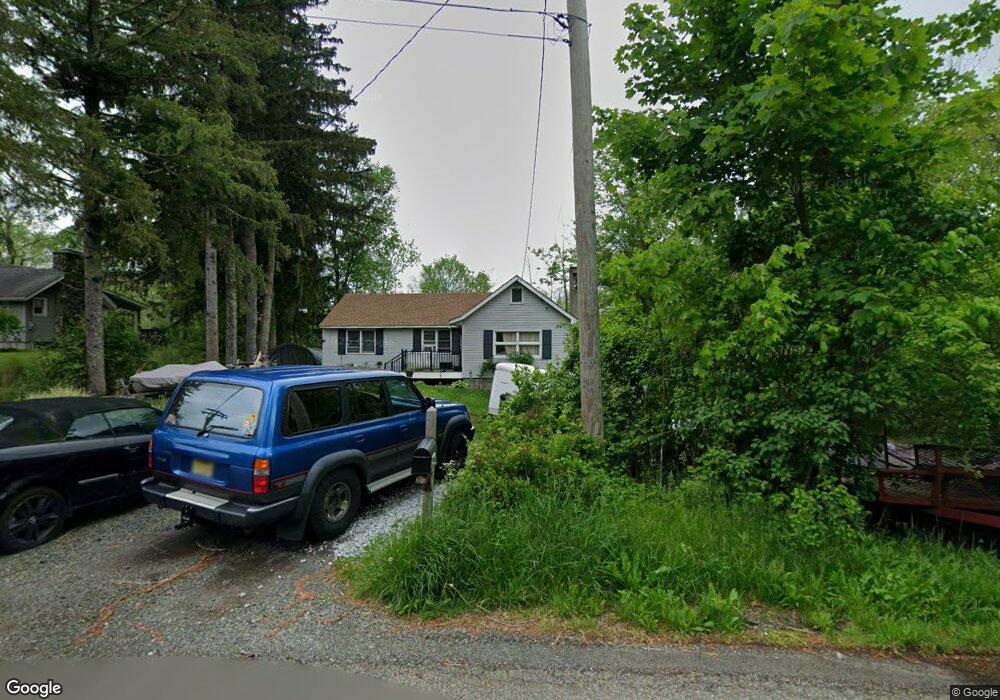
249 Us Highway 206 Byram Township, NJ 07821
Estimated Value: $253,044 - $323,000
--
Bed
--
Bath
1,138
Sq Ft
$253/Sq Ft
Est. Value
About This Home
This home is located at 249 Us Highway 206, Byram Township, NJ 07821 and is currently estimated at $288,011, approximately $253 per square foot. 249 Us Highway 206 is a home located in Sussex County with nearby schools including Byram Lakes Elementary School, Byram Township Intermediate School, and Lenape Val Regional High School.
Ownership History
Date
Name
Owned For
Owner Type
Purchase Details
Closed on
Oct 6, 2009
Sold by
Mukamal Barry E
Bought by
Gilliam Phillip A
Current Estimated Value
Home Financials for this Owner
Home Financials are based on the most recent Mortgage that was taken out on this home.
Original Mortgage
$80,000
Outstanding Balance
$27,129
Interest Rate
7.5%
Mortgage Type
Purchase Money Mortgage
Estimated Equity
$260,882
Purchase Details
Closed on
Dec 8, 2006
Sold by
Beers George D
Bought by
Beers Brenda J
Purchase Details
Closed on
Jul 26, 2006
Sold by
Beers George D
Bought by
Beers George D and Beers Brenda J
Create a Home Valuation Report for This Property
The Home Valuation Report is an in-depth analysis detailing your home's value as well as a comparison with similar homes in the area
Home Values in the Area
Average Home Value in this Area
Purchase History
| Date | Buyer | Sale Price | Title Company |
|---|---|---|---|
| Gilliam Phillip A | $80,000 | First American Title Ins Co | |
| Beers Brenda J | -- | First American Title Ins Co | |
| Beers Brenda J | -- | None Available | |
| Beers George D | -- | None Available |
Source: Public Records
Mortgage History
| Date | Status | Borrower | Loan Amount |
|---|---|---|---|
| Open | Gilliam Phillip A | $80,000 |
Source: Public Records
Tax History Compared to Growth
Tax History
| Year | Tax Paid | Tax Assessment Tax Assessment Total Assessment is a certain percentage of the fair market value that is determined by local assessors to be the total taxable value of land and additions on the property. | Land | Improvement |
|---|---|---|---|---|
| 2025 | $5,347 | $139,600 | $52,700 | $86,900 |
| 2024 | $5,252 | $139,600 | $52,700 | $86,900 |
| 2023 | $5,252 | $139,600 | $52,700 | $86,900 |
| 2022 | $5,109 | $139,600 | $52,700 | $86,900 |
| 2021 | $5,031 | $139,600 | $52,700 | $86,900 |
| 2020 | $4,989 | $139,600 | $52,700 | $86,900 |
| 2019 | $4,982 | $139,600 | $52,700 | $86,900 |
| 2018 | $4,949 | $139,600 | $52,700 | $86,900 |
| 2017 | $4,862 | $139,600 | $52,700 | $86,900 |
| 2016 | $4,781 | $139,600 | $52,700 | $86,900 |
| 2015 | $4,661 | $139,600 | $52,700 | $86,900 |
| 2014 | $4,636 | $139,600 | $52,700 | $86,900 |
Source: Public Records
Map
Nearby Homes
- 3 Roger Dr
- 3 Knute Dr
- 7 Lakeview Trail
- 34 Allamuchy Trail
- 00 Forest Lakes Dr
- 56A Sleepy Hollow Rd
- 4 Bank St
- 288 Decker Pond Rd
- 9 Richmond Rd
- 24 the Rotunda
- 7 U S Highway 206
- 14 Hillside Terrace
- 0 Decker Pond Airport Rd Unit 3945534
- 40 Brookwood Rd
- 11 Joan Dr
- 2 Robert St
- 30 Ross Rd
- 28 Acorn St
- 8 Brighton Ave
- 5 Railroad Ave