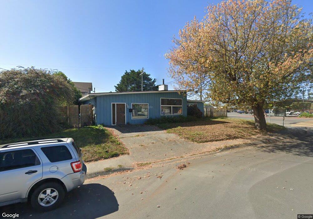
2490 Alliance Rd Arcata, CA 95521
Westwood-Vasside NeighborhoodEstimated Value: $391,000 - $457,000
3
Beds
2
Baths
1,500
Sq Ft
$284/Sq Ft
Est. Value
About This Home
This home is located at 2490 Alliance Rd, Arcata, CA 95521 and is currently estimated at $425,780, approximately $283 per square foot. 2490 Alliance Rd is a home located in Humboldt County with nearby schools including Arcata Elementary School, Sunny Brae Middle School, and Arcata High School.
Ownership History
Date
Name
Owned For
Owner Type
Purchase Details
Closed on
Sep 24, 2003
Sold by
Hicks Darlene A and Darlene A Hicks 1993 Trust
Bought by
Leal Francisco P and Leal Lenda M
Current Estimated Value
Home Financials for this Owner
Home Financials are based on the most recent Mortgage that was taken out on this home.
Original Mortgage
$171,900
Outstanding Balance
$79,909
Interest Rate
6.27%
Mortgage Type
Purchase Money Mortgage
Estimated Equity
$345,871
Create a Home Valuation Report for This Property
The Home Valuation Report is an in-depth analysis detailing your home's value as well as a comparison with similar homes in the area
Home Values in the Area
Average Home Value in this Area
Purchase History
| Date | Buyer | Sale Price | Title Company |
|---|---|---|---|
| Leal Francisco P | $215,000 | Fidelity National |
Source: Public Records
Mortgage History
| Date | Status | Borrower | Loan Amount |
|---|---|---|---|
| Open | Leal Francisco P | $171,900 |
Source: Public Records
Tax History Compared to Growth
Tax History
| Year | Tax Paid | Tax Assessment Tax Assessment Total Assessment is a certain percentage of the fair market value that is determined by local assessors to be the total taxable value of land and additions on the property. | Land | Improvement |
|---|---|---|---|---|
| 2025 | $3,556 | $305,524 | $149,281 | $156,243 |
| 2024 | $3,556 | $299,534 | $146,354 | $153,180 |
| 2023 | $3,483 | $293,662 | $143,485 | $150,177 |
| 2022 | $3,547 | $287,905 | $140,672 | $147,233 |
| 2021 | $3,381 | $282,261 | $137,914 | $144,347 |
| 2020 | $3,323 | $279,367 | $136,500 | $142,867 |
| 2019 | $3,217 | $273,890 | $133,824 | $140,066 |
| 2018 | $3,144 | $268,520 | $131,200 | $137,320 |
| 2017 | $3,082 | $263,256 | $128,628 | $134,628 |
| 2016 | $2,983 | $258,095 | $126,106 | $131,989 |
| 2015 | $2,951 | $254,219 | $124,212 | $130,007 |
| 2014 | $2,920 | $249,240 | $121,779 | $127,461 |
Source: Public Records
Map
Nearby Homes
- 2705 Alliance Rd
- 2141 Western Ave
- 3028 Alliance Rd
- 2700 Meadow Creek Way
- 2470 Eye St
- 2310 Eye St
- 2565 Todd Ct
- 3659 Spear Ave
- 2925 Evergreen Ave
- 429 Evergreen Ave
- 3000 Saint Louis Rd
- 1836 Iverson Ave
- 2910 Greenbriar Ln
- 402 Tanglewood Rd
- 119 Sylva St
- 113 Sylva St
- 3763 Coombs Ct
- 1977 11th St
- 1002 Diamond Dr
- 2033 Ernest Way
- 1571 Stromberg Ave
- 1555 Stromberg Ave
- 1590 Stromberg Ave
- 1560 Stromberg Ave
- 2505 Alliance Rd
- 2520 Alliance Rd
- 1541 Stromberg Ave
- 1640 Stromberg Ave
- 2535 Alliance Rd
- 2530 Alliance Rd
- 1525 Stromberg Ave
- 1530 Stromberg Ave
- 1650 Stromberg Ave
- 2531 Acheson Way
- 2547 Alliance Rd
- 160 Westwood Center
- 2520 Acheson Way
- 2540 Alliance Rd
- 1550 Stewart Ct
- 1574 Stewart Ct