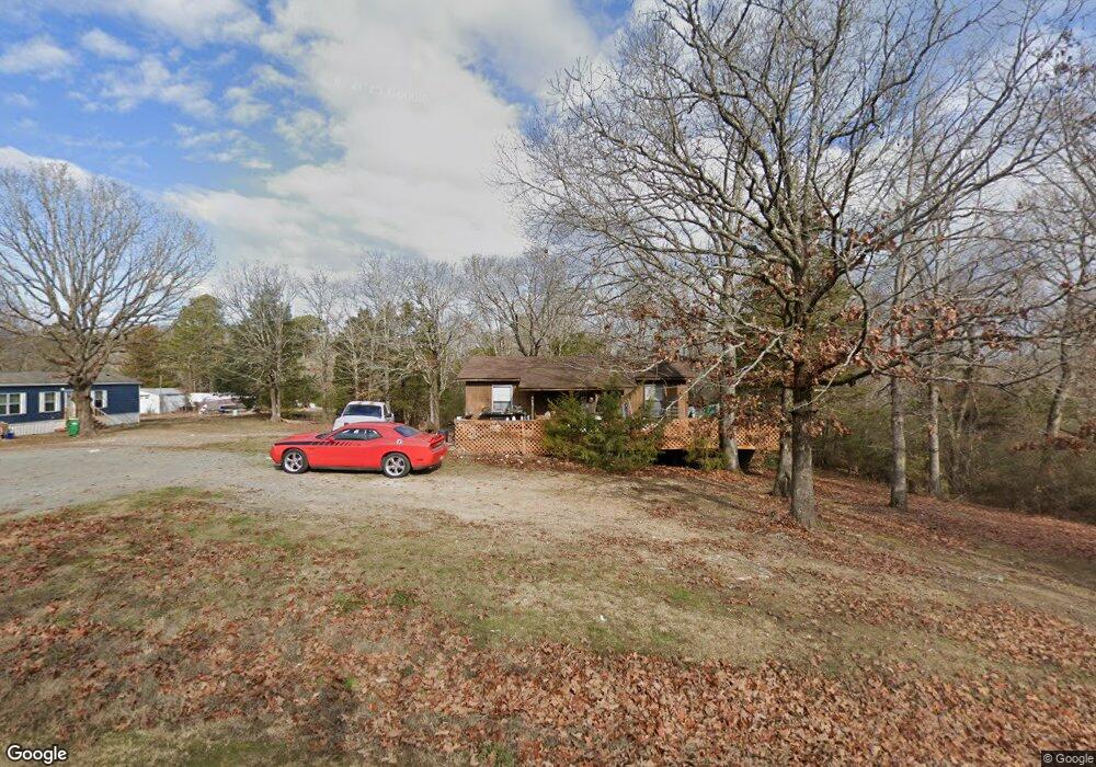
24922 Kent Ln Little Rock, AR 72223
Estimated Value: $164,295 - $629,000
--
Bed
2
Baths
1,074
Sq Ft
$295/Sq Ft
Est. Value
About This Home
This home is located at 24922 Kent Ln, Little Rock, AR 72223 and is currently estimated at $317,074, approximately $295 per square foot. 24922 Kent Ln is a home located in Pulaski County with nearby schools including Chenal Elementary School, Joe T. Robinson Middle School, and Joe T. Robinson High School.
Ownership History
Date
Name
Owned For
Owner Type
Purchase Details
Closed on
Aug 21, 2025
Sold by
Denley Daniel S
Bought by
Denley Zachary and Denley Brittain
Current Estimated Value
Purchase Details
Closed on
May 14, 2008
Sold by
Alexander David E
Bought by
Denley Daniel S
Home Financials for this Owner
Home Financials are based on the most recent Mortgage that was taken out on this home.
Original Mortgage
$87,966
Interest Rate
5.86%
Mortgage Type
Purchase Money Mortgage
Purchase Details
Closed on
Apr 26, 2005
Sold by
Alexander Margaret P
Bought by
Alexander Margaret P
Create a Home Valuation Report for This Property
The Home Valuation Report is an in-depth analysis detailing your home's value as well as a comparison with similar homes in the area
Home Values in the Area
Average Home Value in this Area
Purchase History
| Date | Buyer | Sale Price | Title Company |
|---|---|---|---|
| Denley Zachary | $100,000 | Pulaski County Title | |
| Denley Daniel S | $84,000 | Realty Title | |
| Alexander Margaret P | -- | -- |
Source: Public Records
Mortgage History
| Date | Status | Borrower | Loan Amount |
|---|---|---|---|
| Previous Owner | Denley Daniel S | $87,966 |
Source: Public Records
Tax History Compared to Growth
Tax History
| Year | Tax Paid | Tax Assessment Tax Assessment Total Assessment is a certain percentage of the fair market value that is determined by local assessors to be the total taxable value of land and additions on the property. | Land | Improvement |
|---|---|---|---|---|
| 2025 | $1,309 | $26,069 | $11,339 | $14,730 |
| 2024 | $1,200 | $26,069 | $11,339 | $14,730 |
| 2023 | $1,200 | $26,069 | $11,339 | $14,730 |
| 2022 | $1,196 | $26,069 | $11,339 | $14,730 |
| 2021 | $1,142 | $21,490 | $9,860 | $11,630 |
| 2020 | $767 | $21,490 | $9,860 | $11,630 |
| 2019 | $767 | $21,490 | $9,860 | $11,630 |
| 2018 | $792 | $21,490 | $9,860 | $11,630 |
| 2017 | $792 | $21,490 | $9,860 | $11,630 |
| 2016 | $1,070 | $21,070 | $12,320 | $8,750 |
| 2015 | $1,070 | $21,070 | $12,320 | $8,750 |
| 2014 | $1,070 | $21,070 | $12,320 | $8,750 |
Source: Public Records
Map
Nearby Homes
- 3110 Ferndale Cut Off Rd
- 25501 Kanis Rd
- 2003 Lambert Rd
- 32315 Kanis Rd
- 23 Witness Tree Ln
- 4109 Garrison Rd
- 4001 Ridgefield Ln
- 28721 Kanis Rd
- 23104 Denny Rd
- 0 Fox Ridge Rd Unit 25010505
- 0 Studer Rd
- 7107 Ferndale Cut Off Rd
- 000 Foxridge Rd
- 0 Serenity Dr
- 211 County Line Rd
- 5 Jabo Lake Rd
- 24923 Colonel Glenn Rd
- 20377 Congo Ferndale Rd
- 39 Golden Eagle Dr
- 17615 Burlingame Rd
- 24919 Kent Ln
- 24720 Alneta Loop
- 24600 Kent Ln
- 2409 Live Oaks Dr
- 2325 Live Oaks Dr
- 2417 Live Oaks Dr
- 24704 Kent Ln
- 2301 Live Oaks Dr
- 24810 Alneta Loop
- 24700 Kent Ln
- 2420 Live Oaks Dr
- 2302 Live Oaks Dr
- 24900 Alneta Loop
- 2323 Roberts Rd
- 24624 Kent Ln
- 2412 Live Oaks Dr
- 0 Simpsonville Ln
- 2400 Live Oaks Dr
- 24801 Simpsonville Ln
- 2211 Live Oaks Dr