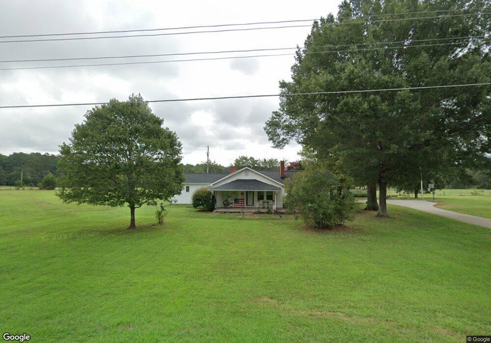
2495 Devine Rd Lincolnton, NC 28092
Estimated Value: $363,000 - $565,000
3
Beds
2
Baths
1,930
Sq Ft
$240/Sq Ft
Est. Value
About This Home
This home is located at 2495 Devine Rd, Lincolnton, NC 28092 and is currently estimated at $464,000, approximately $240 per square foot. 2495 Devine Rd is a home with nearby schools including Iron Station Elementary School, East Lincoln Middle School, and East Lincoln High School.
Ownership History
Date
Name
Owned For
Owner Type
Purchase Details
Closed on
Nov 12, 2024
Sold by
Devine Group Llc
Bought by
Cole Blythe Steven
Current Estimated Value
Purchase Details
Closed on
Aug 16, 2018
Sold by
Reel Rhyne E and Reel Frances H
Bought by
Cody Katie Reel
Purchase Details
Closed on
Nov 7, 2003
Bought by
Devine Daniel M and Devine Peggy
Purchase Details
Closed on
Oct 15, 1998
Bought by
Keever Leonard T and Keever Ann D
Purchase Details
Closed on
Mar 15, 1993
Bought by
Guffie Larry J and Guffie Toni K
Create a Home Valuation Report for This Property
The Home Valuation Report is an in-depth analysis detailing your home's value as well as a comparison with similar homes in the area
Purchase History
| Date | Buyer | Sale Price | Title Company |
|---|---|---|---|
| Cole Blythe Steven | $553,000 | None Listed On Document | |
| Blythe Steven Cole | $553,000 | None Listed On Document | |
| Cody Katie Reel | -- | None Available | |
| Devine Daniel M | $75,600 | -- | |
| Keever Leonard T | $69,800 | -- | |
| Guffie Larry J | $48,000 | -- |
Source: Public Records
Tax History
| Year | Tax Paid | Tax Assessment Tax Assessment Total Assessment is a certain percentage of the fair market value that is determined by local assessors to be the total taxable value of land and additions on the property. | Land | Improvement |
|---|---|---|---|---|
| 2025 | $1,790 | $266,588 | $51,004 | $215,584 |
| 2024 | $1,770 | $266,588 | $51,004 | $215,584 |
| 2023 | $1,729 | $266,588 | $51,004 | $215,584 |
| 2022 | $1,247 | $153,882 | $37,545 | $116,337 |
| 2021 | $1,145 | $140,041 | $37,545 | $102,496 |
| 2020 | $1,002 | $140,041 | $37,545 | $102,496 |
| 2019 | $1,002 | $140,041 | $37,545 | $102,496 |
| 2018 | $939 | $115,178 | $35,336 | $79,842 |
| 2017 | $838 | $115,178 | $35,336 | $79,842 |
| 2016 | $838 | $115,178 | $35,336 | $79,842 |
| 2015 | $907 | $115,178 | $35,336 | $79,842 |
| 2014 | $950 | $122,541 | $36,045 | $86,496 |
Source: Public Records
Map
Nearby Homes
- 821 Latrobe Dr
- 1987 & 1981 Magnolia Grove Rd
- 1481 Depot St
- 1371 Alexis High Shoals Rd
- 3132 Fox Den Cir
- 1466 Pressley Dr
- 4242 John Ritchie Rd
- 1279 Craig Dr
- 1259 Hardin Rd
- 4432 E Highway 27
- 325 Holly Ridge Rd
- 0 Hovis Rd
- 853 Spring Lake Dr
- 1222 Hardin Rd
- 1743 Autumn Banks Way Unit 73p
- 1747 Autumn Banks Way Unit 75p
- 1753 Autumn Banks Way Unit 76p
- 1755 Autumn Banks Way Unit 77p
- 2336 Salem Church Rd
- 1551 Autumn Banks Way Unit 23
- 2516 Devine Rd
- 2473 Devine Rd
- Lot 5 Bryce Ln
- Lot 3 Bryce Ln
- 2822 Greystone Ln
- Lot #6 Bryce Ln
- Lot 4 Bryce Ln
- 1.91 Acres Devine Rd
- 2453 Devine Rd
- 2549 Colewood Ln
- 2369 Devine Rd
- 2541 Devine Rd
- 2995 Bryce Ln
- 3046 Bryce Ln
- 00 Bryce Ln
- 3009 Bryce Ln
- 2561 Devine Rd
- 2721 Greystone Ln
- 2557 Devine Rd
- 3032 Bryce Ln
Your Personal Tour Guide
Ask me questions while you tour the home.