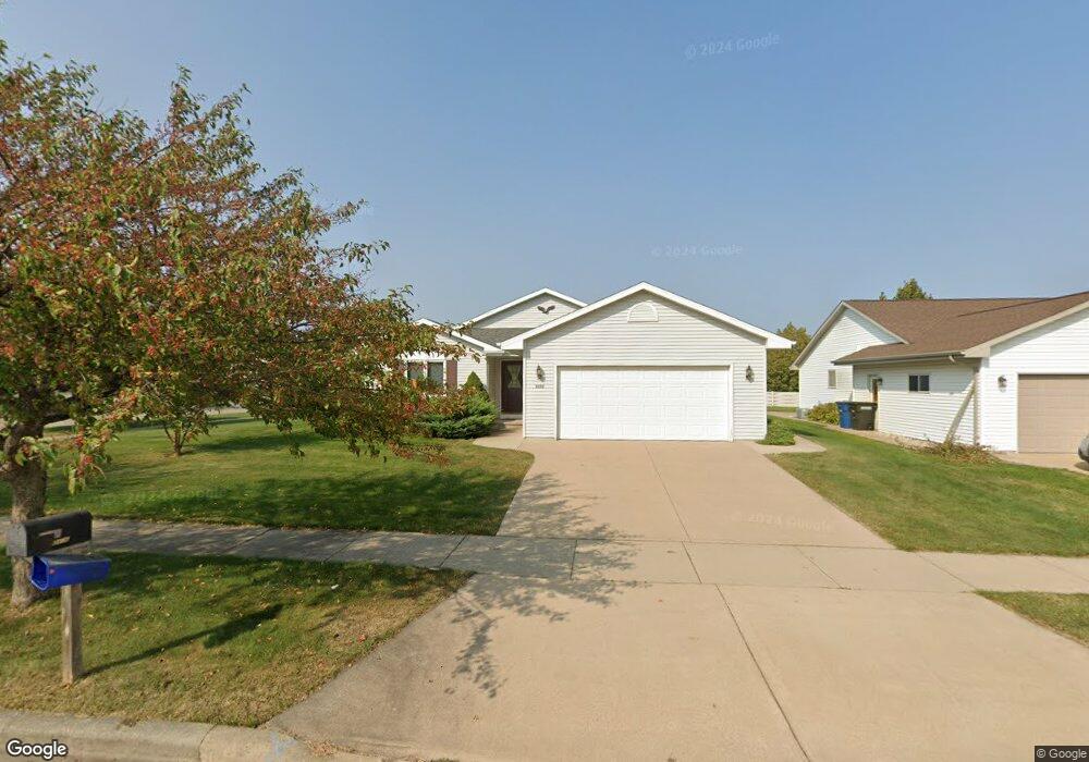
2496 Security Dr Oshkosh, WI 54904
Estimated Value: $328,000 - $364,000
3
Beds
2
Baths
1,582
Sq Ft
$216/Sq Ft
Est. Value
About This Home
This home is located at 2496 Security Dr, Oshkosh, WI 54904 and is currently estimated at $341,120, approximately $215 per square foot. 2496 Security Dr is a home located in Winnebago County with nearby schools including Franklin Elementary School, Tipler Middle School, and West High School.
Ownership History
Date
Name
Owned For
Owner Type
Purchase Details
Closed on
Mar 15, 2023
Sold by
Charley Linda S
Bought by
Charley Heather A and Charley-Johnson Donna M
Current Estimated Value
Purchase Details
Closed on
Jul 21, 2006
Sold by
Drake Michael J and Drake Rachel K
Bought by
Charley Phillip A and Charley Linda S
Create a Home Valuation Report for This Property
The Home Valuation Report is an in-depth analysis detailing your home's value as well as a comparison with similar homes in the area
Purchase History
| Date | Buyer | Sale Price | Title Company |
|---|---|---|---|
| Charley Heather A | -- | None Listed On Document | |
| Charley Phillip A | $1,700,000 | None Available |
Source: Public Records
Tax History
| Year | Tax Paid | Tax Assessment Tax Assessment Total Assessment is a certain percentage of the fair market value that is determined by local assessors to be the total taxable value of land and additions on the property. | Land | Improvement |
|---|---|---|---|---|
| 2024 | $5,042 | $280,700 | $36,900 | $243,800 |
| 2023 | $4,757 | $171,600 | $28,400 | $143,200 |
| 2022 | $4,743 | $171,600 | $28,400 | $143,200 |
| 2021 | $4,449 | $171,600 | $28,400 | $143,200 |
| 2020 | $4,274 | $171,600 | $28,400 | $143,200 |
| 2019 | $4,130 | $171,600 | $28,400 | $143,200 |
| 2018 | $4,067 | $171,600 | $28,400 | $143,200 |
| 2017 | $4,158 | $171,600 | $28,400 | $143,200 |
| 2016 | $4,107 | $166,600 | $28,400 | $138,200 |
| 2015 | $4,022 | $166,600 | $28,400 | $138,200 |
| 2014 | $4,050 | $166,600 | $28,400 | $138,200 |
| 2013 | $4,063 | $166,600 | $28,400 | $138,200 |
Source: Public Records
Map
Nearby Homes
- 363 Sunnybrook Dr
- 2457 Blake Ct
- 765 N Washburn St
- 1775 Lombard Ave
- 855 Greenfield Trail
- 3009 Omro Rd
- 1875 Rath Ln
- 1753 W 5th Ave
- 0 Quail Run Dr Unit 50290410
- 0 Quail Run Dr Unit 50290411
- 0 Quail Run Dr Unit 50290414
- 0 Quail Run Dr Unit 50290413
- 1051 S Oakwood Rd
- 1519 Adams Ave
- 3140 Bailey Ct
- 1422 W 2nd Ave
- 1416 W 2nd Ave
- 1325 S Westhaven Dr
- 4164 Star Ct
- 1928 Timberline Dr
- 2495 Security Dr
- 2490 Security Dr
- 2485 Security Dr
- 2480 Security Dr
- 450 N Westhaven Dr
- 2501 Havenwood Dr
- 460 N Westhaven Dr
- 2505 Havenwood Dr
- 2471 Security Dr
- 2460 Security Dr
- 2511 Havenwood Dr Unit 2511
- 386 N Westhaven Dr
- 2461 Security Dr
- 480 N Westhaven Dr
- 2450 Security Dr
- 2515 Havenwood Dr
- 467 Sunnybrook Dr
- 397 Sunnybrook Dr
- 2521 Havenwood Dr
- 382 N Westhaven Dr
Your Personal Tour Guide
Ask me questions while you tour the home.