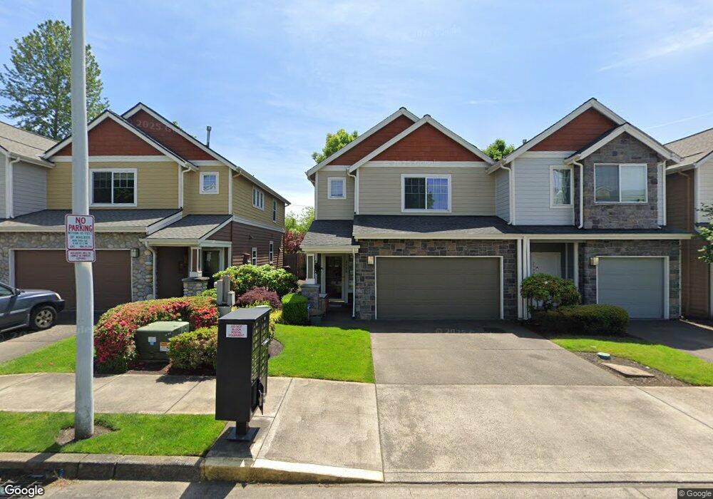
2498 NW 1st Dr Gresham, OR 97030
Northwest Gresham NeighborhoodEstimated Value: $356,000 - $400,000
3
Beds
3
Baths
1,603
Sq Ft
$232/Sq Ft
Est. Value
About This Home
This home is located at 2498 NW 1st Dr, Gresham, OR 97030 and is currently estimated at $372,108, approximately $232 per square foot. 2498 NW 1st Dr is a home located in Multnomah County with nearby schools including North Gresham Elementary School, Clear Creek Middle School, and Gresham High School.
Ownership History
Date
Name
Owned For
Owner Type
Purchase Details
Closed on
Nov 14, 2006
Sold by
Alltree Russell
Bought by
Phillips Randolph L and Phillips Encarnita F
Current Estimated Value
Purchase Details
Closed on
Oct 5, 2004
Sold by
Hutton James B
Bought by
Alltree Russell
Home Financials for this Owner
Home Financials are based on the most recent Mortgage that was taken out on this home.
Original Mortgage
$137,600
Interest Rate
5.77%
Mortgage Type
Credit Line Revolving
Purchase Details
Closed on
Sep 2, 2003
Sold by
Gsl Properties
Bought by
Hutton James B and Hutton Mildred L
Home Financials for this Owner
Home Financials are based on the most recent Mortgage that was taken out on this home.
Original Mortgage
$126,352
Interest Rate
5.87%
Mortgage Type
Purchase Money Mortgage
Create a Home Valuation Report for This Property
The Home Valuation Report is an in-depth analysis detailing your home's value as well as a comparison with similar homes in the area
Home Values in the Area
Average Home Value in this Area
Purchase History
| Date | Buyer | Sale Price | Title Company |
|---|---|---|---|
| Phillips Randolph L | $237,500 | Chicago Title Insurance Co | |
| Alltree Russell | $172,000 | Chicago Title Insurance Comp | |
| Hutton James B | $157,940 | First American |
Source: Public Records
Mortgage History
| Date | Status | Borrower | Loan Amount |
|---|---|---|---|
| Previous Owner | Alltree Russell | $137,600 | |
| Previous Owner | Hutton James B | $126,352 | |
| Closed | Hutton James B | $15,700 |
Source: Public Records
Tax History Compared to Growth
Tax History
| Year | Tax Paid | Tax Assessment Tax Assessment Total Assessment is a certain percentage of the fair market value that is determined by local assessors to be the total taxable value of land and additions on the property. | Land | Improvement |
|---|---|---|---|---|
| 2025 | $4,280 | $210,340 | -- | -- |
| 2024 | $4,097 | $204,220 | -- | -- |
| 2023 | $3,733 | $198,280 | $0 | $0 |
| 2022 | $3,629 | $192,510 | $0 | $0 |
| 2021 | $3,538 | $186,910 | $0 | $0 |
| 2020 | $3,329 | $181,470 | $0 | $0 |
| 2019 | $3,241 | $176,190 | $0 | $0 |
| 2018 | $3,091 | $171,060 | $0 | $0 |
| 2017 | $2,965 | $166,080 | $0 | $0 |
| 2016 | $2,615 | $161,250 | $0 | $0 |
Source: Public Records
Map
Nearby Homes
- 85 NW Mawrcrest Ave
- 63 NW Mawrcrest Ave
- 21 NW Mawrcrest Ave
- 181 NW Mawrcrest Ave
- 185 NW Mawrcrest Ave
- 2514 NW 3rd Terrace
- 256 NW Mawrcrest Ave
- 296 NW Mawrcrest Ave
- 284 NW Mawrcrest Ave
- 272 NW Mawrcrest Ave
- 2513 NW 3rd Terrace
- 249 NW Battaglia Ave
- 2360 NW 3rd St
- 815 NW Battaglia Ave
- 3412 NW 1st St
- 65 SW Pleasant View Ave
- 275 SW Towle Ave
- 317 SW Angeline Ave
- 2185 SW 9th Ct
- 748 SW Willowbrook Ave
- 2502 NW 1st Dr
- 2494 NW 1st Dr
- 2504 NW 1st Dr
- 2490 NW 1st Dr
- 2506 NW 1st Dr
- 2510 NW 1st Dr
- 2486 NW 1st Dr
- 2514 NW 1st Dr
- 2518 NW 1st Dr
- 106 NW Eleven Mile Ave
- 2505 NW 1st Dr
- 2522 NW 1st Dr
- 114 NW Eleven Mile Ave
- 2509 NW 1st Dr
- 2526 NW 1st Dr
- 122 NW Eleven Mile Ave
- 2513 NW 1st Dr
- 2530 NW 1st Dr
- 2517 NW 1st Dr
- 138 NW Eleven Mile Ave