Estimated Value: $751,249 - $770,000
3
Beds
2
Baths
1,738
Sq Ft
$439/Sq Ft
Est. Value
About This Home
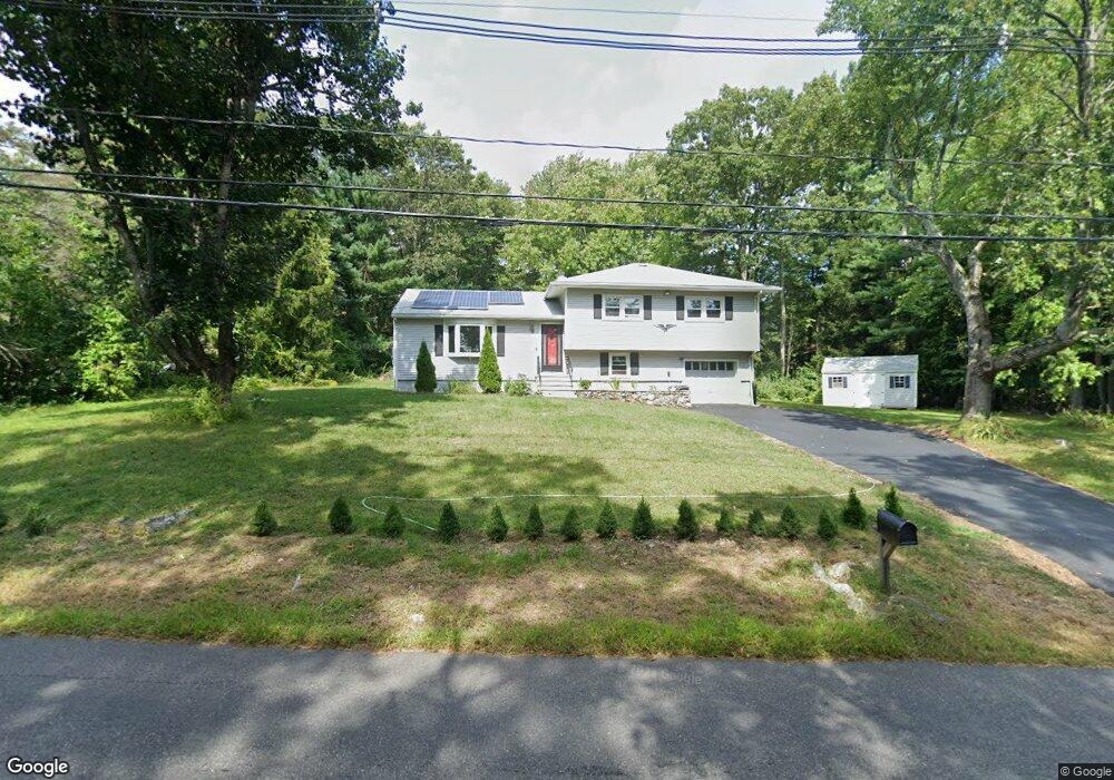
This home is located at 25 Adams St Unit 25, Acton, MA 01720 and is currently estimated at $763,062, approximately $439 per square foot. 25 Adams St Unit 25 is a home located in Middlesex County with nearby schools including Acton-Boxborough Regional High School, Maynard Knowledge Beginnings, and The Imago School.
Ownership History
Date
Name
Owned For
Owner Type
Purchase Details
Closed on
Jul 1, 2025
Sold by
Wang Jia
Bought by
Anderson Jillian L and Sullivan Paul J
Current Estimated Value
Home Financials for this Owner
Home Financials are based on the most recent Mortgage that was taken out on this home.
Original Mortgage
$684,000
Outstanding Balance
$681,652
Interest Rate
6.81%
Mortgage Type
New Conventional
Estimated Equity
$81,410
Purchase Details
Closed on
Aug 25, 2011
Sold by
Li Zhong and Liu Cuiyu
Bought by
Wang Jia
Create a Home Valuation Report for This Property
The Home Valuation Report is an in-depth analysis detailing your home's value as well as a comparison with similar homes in the area
Home Values in the Area
Average Home Value in this Area
Purchase History
| Date | Buyer | Sale Price | Title Company |
|---|---|---|---|
| Anderson Jillian L | $760,000 | -- | |
| Anderson Jillian L | $760,000 | -- | |
| Wang Jia | $345,000 | -- | |
| Wang Jia | $345,000 | -- | |
| Wang Jia | $345,000 | -- |
Source: Public Records
Mortgage History
| Date | Status | Borrower | Loan Amount |
|---|---|---|---|
| Open | Anderson Jillian L | $684,000 | |
| Closed | Anderson Jillian L | $684,000 | |
| Previous Owner | Wang Jia | $264,000 |
Source: Public Records
Tax History Compared to Growth
Tax History
| Year | Tax Paid | Tax Assessment Tax Assessment Total Assessment is a certain percentage of the fair market value that is determined by local assessors to be the total taxable value of land and additions on the property. | Land | Improvement |
|---|---|---|---|---|
| 2025 | $10,002 | $583,200 | $315,700 | $267,500 |
| 2024 | $10,042 | $602,400 | $315,700 | $286,700 |
| 2023 | $9,477 | $539,700 | $286,800 | $252,900 |
| 2022 | $8,788 | $451,800 | $249,700 | $202,100 |
| 2021 | $8,677 | $428,900 | $231,100 | $197,800 |
| 2020 | $8,252 | $428,900 | $231,100 | $197,800 |
| 2019 | $8,023 | $414,200 | $231,100 | $183,100 |
| 2018 | $7,552 | $389,700 | $231,100 | $158,600 |
| 2017 | $7,374 | $386,900 | $231,100 | $155,800 |
| 2016 | $7,063 | $367,300 | $231,100 | $136,200 |
| 2015 | $6,940 | $364,300 | $231,100 | $133,200 |
| 2014 | $6,891 | $354,300 | $231,100 | $123,200 |
Source: Public Records
Map
Nearby Homes
- 1 Maillet Dr
- 2 & 6 Powder Mill Rd
- 69 Powder Mill Rd
- 66 Powder Mill Rd
- 7 King St
- 132 Parker St Unit G5
- 96 Forest Ridge Rd Unit 96
- 20 Tremont St
- 128 Parker St Unit 3B
- 9 Black Birch Ln Unit 9
- 22 Garfield Ave
- 12 Walcott St
- 37 Glendale St
- 17 Prospect St
- 118 Parker St Unit 16
- 29 Black Birch Ln Unit 29
- 25 Main St
- 91 Nason St
- 2 Wall Ct
- 30 Acton St