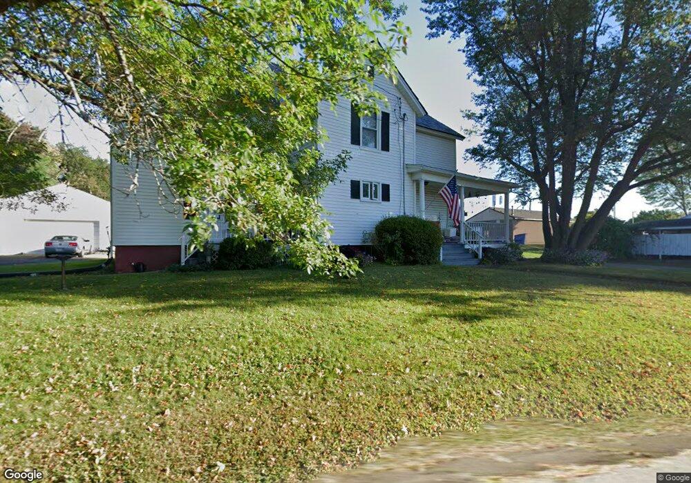
25 Barrett St Northampton, MA 01060
Estimated Value: $493,102 - $602,000
4
Beds
1
Bath
1,508
Sq Ft
$365/Sq Ft
Est. Value
About This Home
This home is located at 25 Barrett St, Northampton, MA 01060 and is currently estimated at $550,526, approximately $365 per square foot. 25 Barrett St is a home located in Hampshire County with nearby schools including Northampton High School, Hilltown Cooperative Charter Public School, and The Montessori School of Northampton.
Ownership History
Date
Name
Owned For
Owner Type
Purchase Details
Closed on
Jul 9, 2024
Sold by
Squires Joseph D and Squires Michaelle L
Bought by
Mcqueary Carol R and Gouin Laura M
Current Estimated Value
Purchase Details
Closed on
Sep 10, 2003
Sold by
Prevent Inc
Bought by
Squires Joseph L and Squires Michelle L
Home Financials for this Owner
Home Financials are based on the most recent Mortgage that was taken out on this home.
Original Mortgage
$192,000
Interest Rate
6.22%
Mortgage Type
Purchase Money Mortgage
Create a Home Valuation Report for This Property
The Home Valuation Report is an in-depth analysis detailing your home's value as well as a comparison with similar homes in the area
Home Values in the Area
Average Home Value in this Area
Purchase History
| Date | Buyer | Sale Price | Title Company |
|---|---|---|---|
| Mcqueary Carol R | -- | None Available | |
| Mcqueary Carol R | -- | None Available | |
| Squires Joseph L | $240,000 | -- | |
| Squires Joseph L | $240,000 | -- |
Source: Public Records
Mortgage History
| Date | Status | Borrower | Loan Amount |
|---|---|---|---|
| Previous Owner | Squires Joseph L | $159,000 | |
| Previous Owner | Squires Joseph L | $192,000 |
Source: Public Records
Tax History
| Year | Tax Paid | Tax Assessment Tax Assessment Total Assessment is a certain percentage of the fair market value that is determined by local assessors to be the total taxable value of land and additions on the property. | Land | Improvement |
|---|---|---|---|---|
| 2025 | $6,398 | $459,300 | $138,300 | $321,000 |
| 2024 | $5,421 | $356,900 | $138,300 | $218,600 |
| 2023 | $5,317 | $335,700 | $125,600 | $210,100 |
| 2022 | $4,759 | $266,000 | $117,500 | $148,500 |
| 2021 | $4,772 | $274,700 | $111,900 | $162,800 |
| 2020 | $4,615 | $274,700 | $111,900 | $162,800 |
| 2019 | $4,480 | $257,900 | $103,700 | $154,200 |
| 2018 | $4,400 | $258,200 | $103,700 | $154,500 |
| 2017 | $4,309 | $258,200 | $103,700 | $154,500 |
| 2016 | $4,173 | $258,200 | $103,700 | $154,500 |
| 2015 | $4,223 | $267,300 | $108,300 | $159,000 |
| 2014 | -- | $267,300 | $108,300 | $159,000 |
Source: Public Records
Map
Nearby Homes
- 22 Woodbine Ave
- 13A Finn St
- 20 View Ave Unit A
- 30 View Ave
- 37 Finn St
- 80 Damon Rd Unit 5104
- 80 Damon Rd Unit 4302
- 61 Crescent St Unit 8
- 61 Crescent St Unit 7
- 289 Hatfield St
- 61 Woodlawn Ave
- 35 Hubbard Ave
- 0 Terrace Ln
- 50 Union St Unit 18
- 25 Union St
- 25 Union St Unit 2
- 218 Elm St
- 30 Graves Ave Unit B
- 88 Pines Edge Dr Unit 88
- 43 Center St Unit K
Your Personal Tour Guide
Ask me questions while you tour the home.