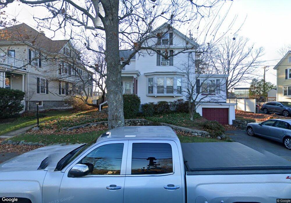
25 Bartlet St Andover, MA 01810
East Andover NeighborhoodEstimated Value: $1,386,000 - $1,605,000
3
Beds
2
Baths
4,639
Sq Ft
$326/Sq Ft
Est. Value
About This Home
This home is located at 25 Bartlet St, Andover, MA 01810 and is currently estimated at $1,514,395, approximately $326 per square foot. 25 Bartlet St is a home located in Essex County with nearby schools including Bancroft Elementary School, Doherty Middle School, and Andover High School.
Ownership History
Date
Name
Owned For
Owner Type
Purchase Details
Closed on
Jul 9, 2009
Sold by
Fortin Thomas J
Bought by
Fortin Terese E
Current Estimated Value
Home Financials for this Owner
Home Financials are based on the most recent Mortgage that was taken out on this home.
Original Mortgage
$491,250
Outstanding Balance
$313,048
Interest Rate
4.93%
Mortgage Type
Commercial
Estimated Equity
$1,201,347
Purchase Details
Closed on
Mar 24, 1995
Sold by
Fleming Charles E
Bought by
Fortin Thomas J
Create a Home Valuation Report for This Property
The Home Valuation Report is an in-depth analysis detailing your home's value as well as a comparison with similar homes in the area
Home Values in the Area
Average Home Value in this Area
Purchase History
| Date | Buyer | Sale Price | Title Company |
|---|---|---|---|
| Fortin Terese E | -- | -- | |
| Fortin Terese E | -- | -- | |
| Fortin Terese E | -- | -- | |
| Fortin Thomas J | $277,940 | -- | |
| Fortin Thomas J | $277,940 | -- |
Source: Public Records
Mortgage History
| Date | Status | Borrower | Loan Amount |
|---|---|---|---|
| Open | Fortin Terese E | $491,250 | |
| Closed | Fortin Thomas J | $491,250 |
Source: Public Records
Tax History
| Year | Tax Paid | Tax Assessment Tax Assessment Total Assessment is a certain percentage of the fair market value that is determined by local assessors to be the total taxable value of land and additions on the property. | Land | Improvement |
|---|---|---|---|---|
| 2024 | $17,348 | $1,346,900 | $509,500 | $837,400 |
| 2023 | $0 | $1,101,000 | $458,900 | $642,100 |
| 2022 | $0 | $910,300 | $406,100 | $504,200 |
| 2021 | $0 | $830,700 | $369,200 | $461,500 |
| 2020 | $0 | $791,400 | $360,200 | $431,200 |
| 2019 | $0 | $733,700 | $346,200 | $387,500 |
| 2018 | $0 | $681,500 | $326,500 | $355,000 |
| 2017 | $0 | $627,900 | $320,000 | $307,900 |
| 2016 | -- | $587,800 | $320,000 | $267,800 |
| 2015 | -- | $575,600 | $307,800 | $267,800 |
Source: Public Records
Map
Nearby Homes
- 33 Chestnut St Unit 2
- 96 N Main St Unit 3
- 100.5 Main St Unit Q
- Lot 7 Weeping Willow Dr
- 5 Lewis St
- 1 Sweeney Ct
- 67 High St
- 3 Torr St
- 2 Powder Mill Square Unit 2B
- 105 Central St
- 52 Salem St
- 53 Salem St
- 50C Washington Park Dr Unit 10
- 31 Porter Rd
- 4 Hammond Way
- 15 Alcott Way
- 104 Salem St
- 1 Longwood Dr Unit 105
- 16 Balmoral St Unit 214
- 354 N Main St Unit 214
- 27 Bartlet St
- 29 Bartlet St
- 33 Chestnut St
- 8 Punchard Ave
- 78 Main St Unit 6, 2nd fl
- 32 Chestnut St Unit Suite A
- 68 Main St Unit Suite 7
- 68 Main St Unit 7
- 68 Main St Unit 3
- 68 Main St Unit 3&5
- 4 Punchard Ave
- 4 Punchard Ave Unit 2B
- 14 Bartlet St
- 28 Chestnut St Unit 2nd Floor
- 28 Chestnut St Unit 2
- 28 Chestnut St Unit 1st Flr Rt
- 28 Chestnut St Unit 4
- 28 Chestnut St
- 28 Chestnut St Unit 6
- 28 Chestnut St Unit 3
Your Personal Tour Guide
Ask me questions while you tour the home.