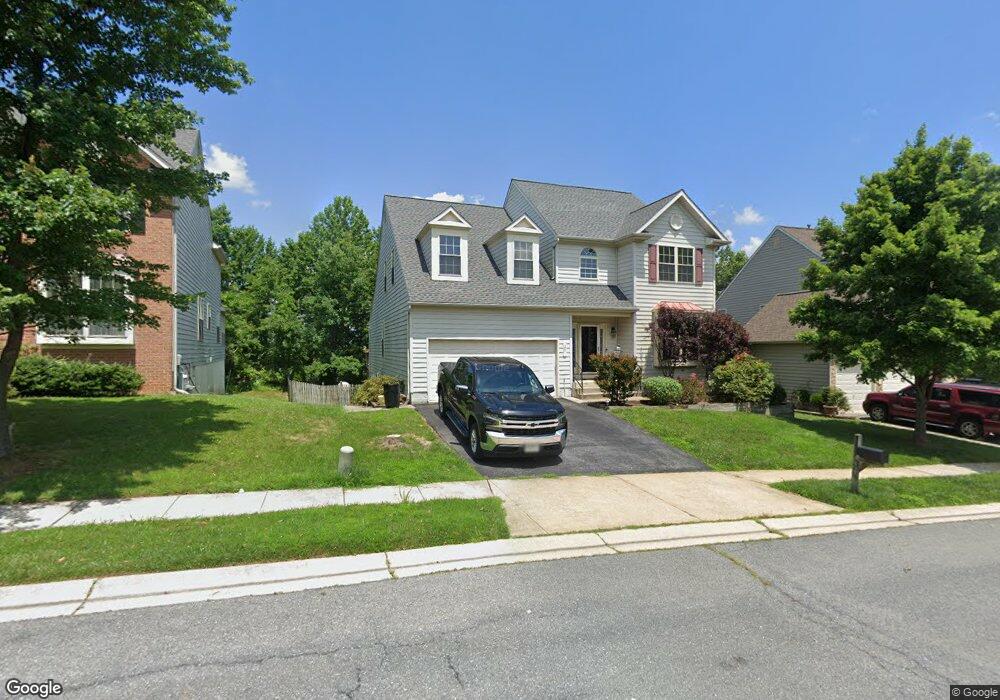
25 Broadbridge Rd Rosedale, MD 21237
Estimated Value: $633,081 - $741,000
5
Beds
5
Baths
3,490
Sq Ft
$195/Sq Ft
Est. Value
About This Home
This home is located at 25 Broadbridge Rd, Rosedale, MD 21237 and is currently estimated at $682,020, approximately $195 per square foot. 25 Broadbridge Rd is a home located in Baltimore County with nearby schools including Parkville Middle & Center of Technology, Overlea High School, and St. Joseph School-Fullerton.
Ownership History
Date
Name
Owned For
Owner Type
Purchase Details
Closed on
Nov 24, 2010
Sold by
Quinn Edward B
Bought by
Sipes Karen L and Sipes Brandon E
Current Estimated Value
Home Financials for this Owner
Home Financials are based on the most recent Mortgage that was taken out on this home.
Original Mortgage
$312,000
Outstanding Balance
$205,643
Interest Rate
4.25%
Mortgage Type
Purchase Money Mortgage
Estimated Equity
$476,377
Purchase Details
Closed on
Jun 25, 2002
Sold by
Marsh Mark White
Bought by
Quinn Edward B and Quinn Penny J
Create a Home Valuation Report for This Property
The Home Valuation Report is an in-depth analysis detailing your home's value as well as a comparison with similar homes in the area
Home Values in the Area
Average Home Value in this Area
Purchase History
| Date | Buyer | Sale Price | Title Company |
|---|---|---|---|
| Sipes Karen L | $390,000 | -- | |
| Quinn Edward B | $349,015 | -- |
Source: Public Records
Mortgage History
| Date | Status | Borrower | Loan Amount |
|---|---|---|---|
| Open | Sipes Karen L | $312,000 |
Source: Public Records
Tax History
| Year | Tax Paid | Tax Assessment Tax Assessment Total Assessment is a certain percentage of the fair market value that is determined by local assessors to be the total taxable value of land and additions on the property. | Land | Improvement |
|---|---|---|---|---|
| 2025 | $6,777 | $599,667 | -- | -- |
| 2024 | $6,777 | $553,533 | $0 | $0 |
| 2023 | $3,400 | $507,400 | $128,000 | $379,400 |
| 2022 | $6,515 | $503,767 | $0 | $0 |
| 2021 | $5,759 | $500,133 | $0 | $0 |
| 2020 | $5,759 | $496,500 | $128,000 | $368,500 |
| 2019 | $5,578 | $489,233 | $0 | $0 |
| 2018 | $5,308 | $481,967 | $0 | $0 |
| 2017 | $5,205 | $474,700 | $0 | $0 |
| 2016 | $6,282 | $424,433 | $0 | $0 |
| 2015 | $6,282 | $374,167 | $0 | $0 |
| 2014 | $6,282 | $323,900 | $0 | $0 |
Source: Public Records
Map
Nearby Homes
- 22 Merion Ave
- 24 Merion Ave
- 8 Comes Ridge Ct
- 8 Comes Ridge Ct
- 6 Comes Ridge Ct
- 5 Comes Ridge Ct
- 1 Comes Ridge Ct
- 5011 Silver Oak Dr
- 5013 Silver Oak Dr
- 5015 Silver Oak Dr
- 5019 Silver Oak Dr
- 5021 Silver Oak Dr
- 8103 Cypress Point Dr
- 8113 Alan Tree Rd
- 5085 Silver Oak Dr
- 8500 Dolina Ct
- 58 Hardwood Dr
- 8382 Cypress Mill Rd
- 34 Hardwood Dr
- 8276 Berryfield Dr
- 23 Broadbridge Rd
- 27 Broadbridge Rd
- 21 Broadbridge Rd
- 29 Broadbridge Rd
- 100 Queensberry Rd
- 32 Broadbridge Rd
- 19 Broadbridge Rd
- 34 Broadbridge Rd
- 8216 Selwin Ct
- 31 Broadbridge Rd
- 8218 Selwin Ct
- 34 Broadbridge Rd
- 102 Queensberry Rd
- 8212 Selwin Ct
- 101 Queensberry Rd
- 17 Broadbridge Rd
- 8220 Selwin Ct
- 33 Broadbridge Rd
- 36 Broadbridge Rd
- 104 Queensberry Rd
Your Personal Tour Guide
Ask me questions while you tour the home.