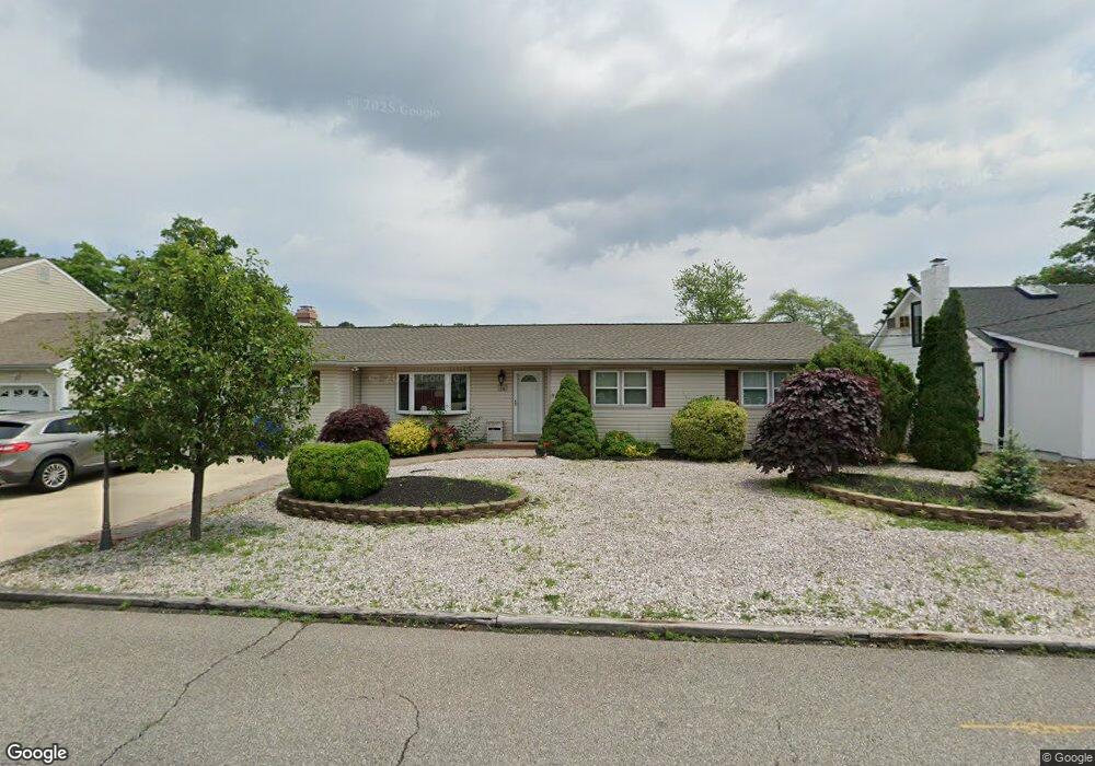
25 Cedar Tree Ln Toms River, NJ 08753
Estimated Value: $542,638 - $575,000
4
Beds
2
Baths
1,792
Sq Ft
$312/Sq Ft
Est. Value
About This Home
This home is located at 25 Cedar Tree Ln, Toms River, NJ 08753 and is currently estimated at $558,910, approximately $311 per square foot. 25 Cedar Tree Ln is a home located in Ocean County.
Ownership History
Date
Name
Owned For
Owner Type
Purchase Details
Closed on
Sep 8, 2008
Sold by
Day Patrick M and Day Donna J
Bought by
Scialpi Domenico and Scialpi Anna
Current Estimated Value
Purchase Details
Closed on
Aug 31, 2004
Sold by
Peters Daryl P and Peters Jessica L
Bought by
Day Patrick M and Day Donna J
Home Financials for this Owner
Home Financials are based on the most recent Mortgage that was taken out on this home.
Original Mortgage
$229,900
Interest Rate
6.01%
Mortgage Type
Fannie Mae Freddie Mac
Purchase Details
Closed on
May 22, 2003
Sold by
Peters Daryl P
Bought by
Peters Daryl P and Peters Jessica L
Home Financials for this Owner
Home Financials are based on the most recent Mortgage that was taken out on this home.
Original Mortgage
$188,678
Interest Rate
5.45%
Purchase Details
Closed on
May 30, 2002
Sold by
Farrell William
Bought by
Peters Patricia and Peters Daryl
Home Financials for this Owner
Home Financials are based on the most recent Mortgage that was taken out on this home.
Original Mortgage
$171,281
Interest Rate
6.92%
Mortgage Type
FHA
Create a Home Valuation Report for This Property
The Home Valuation Report is an in-depth analysis detailing your home's value as well as a comparison with similar homes in the area
Home Values in the Area
Average Home Value in this Area
Purchase History
| Date | Buyer | Sale Price | Title Company |
|---|---|---|---|
| Scialpi Domenico | $325,000 | Transnation Title Ins Co | |
| Day Patrick M | $289,900 | None Available | |
| Peters Daryl P | -- | -- | |
| Peters Patricia | $174,000 | -- |
Source: Public Records
Mortgage History
| Date | Status | Borrower | Loan Amount |
|---|---|---|---|
| Previous Owner | Day Patrick M | $229,900 | |
| Previous Owner | Peters Daryl P | $188,678 | |
| Previous Owner | Peters Patricia | $171,281 |
Source: Public Records
Tax History Compared to Growth
Tax History
| Year | Tax Paid | Tax Assessment Tax Assessment Total Assessment is a certain percentage of the fair market value that is determined by local assessors to be the total taxable value of land and additions on the property. | Land | Improvement |
|---|---|---|---|---|
| 2025 | $6,135 | $336,700 | $102,000 | $234,700 |
| 2024 | $5,828 | $336,700 | $102,000 | $234,700 |
| 2023 | $5,616 | $336,700 | $102,000 | $234,700 |
| 2022 | $5,616 | $336,700 | $102,000 | $234,700 |
| 2021 | $5,873 | $235,100 | $78,800 | $156,300 |
| 2020 | $5,847 | $235,100 | $78,800 | $156,300 |
| 2019 | $5,593 | $235,100 | $78,800 | $156,300 |
| 2018 | $5,537 | $235,100 | $78,800 | $156,300 |
| 2017 | $5,499 | $235,100 | $78,800 | $156,300 |
| 2016 | $5,370 | $235,100 | $78,800 | $156,300 |
| 2015 | $5,177 | $235,100 | $78,800 | $156,300 |
| 2014 | $4,921 | $235,100 | $78,800 | $156,300 |
Source: Public Records
Map
Nearby Homes
- 6 Cedar Tree Ln
- 2 Cedar Tree Ln
- 99 Silver Bay Rd
- 133 Mello Ln
- 139 Mello Ln
- 230 Christoffer Terrace
- 190 Bay Stream Dr
- 200 Silver Bay Rd
- 193 Bay Stream Dr
- 46 Clarkson Dr
- 1201 Lighthouse Ln Unit 1fm
- 72 Shasta Ln
- 98 Maine St
- 35 Heather Rd
- 88 Circle Dr
- 231 Bay Stream Dr
- 92 Blossom Dr
- 59 11th St
- 36 Lagoon Dr E
- 101 Reflection Rd
- 23 Cedar Tree Ln
- 29 Cedar Tree Ln
- 21 Cedar Tree Ln
- 31 Cedar Tree Ln
- 134 Walnut Creek Ln
- 131 Silver Bay Rd
- 116 Holly Tree Ln
- 133 Walnut Creek Ln
- 22 Cedar Tree Ln
- 17 Cedar Tree Ln
- 133 Silver Bay Rd
- 33 Cedar Tree Ln
- 136 Walnut Creek Ln
- 16 Cedar Tree Ln
- 137 Walnut Creek Ln
- 30 Cedar Tree Ln
- 114 Holly Tree Ln
- 135 Silver Bay Rd
- 9 Evergreen Dr
- 4 Bay Creek Ln