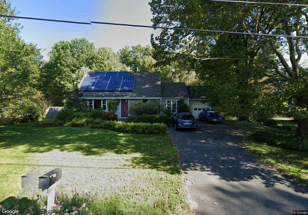
25 Columbia Dr Amherst, MA 01002
Estimated Value: $479,000 - $533,000
3
Beds
2
Baths
1,553
Sq Ft
$324/Sq Ft
Est. Value
About This Home
This home is located at 25 Columbia Dr, Amherst, MA 01002 and is currently estimated at $503,609, approximately $324 per square foot. 25 Columbia Dr is a home located in Hampshire County with nearby schools including Crocker Farm Elementary School, Amherst Regional Middle School, and Amherst Regional High School.
Ownership History
Date
Name
Owned For
Owner Type
Purchase Details
Closed on
Oct 9, 2003
Sold by
Goodwin Frances P
Bought by
Goodwin Frances P and Bryant Jerry W
Current Estimated Value
Home Financials for this Owner
Home Financials are based on the most recent Mortgage that was taken out on this home.
Original Mortgage
$96,000
Outstanding Balance
$45,229
Interest Rate
6.35%
Mortgage Type
Purchase Money Mortgage
Estimated Equity
$458,380
Purchase Details
Closed on
Nov 9, 1998
Sold by
Norton Christiane G and Norton David A
Bought by
Goodwin Frances P
Home Financials for this Owner
Home Financials are based on the most recent Mortgage that was taken out on this home.
Original Mortgage
$105,000
Interest Rate
6.64%
Mortgage Type
Purchase Money Mortgage
Purchase Details
Closed on
Aug 1, 1988
Sold by
Gisick Alice Kerr
Bought by
Norton David A
Create a Home Valuation Report for This Property
The Home Valuation Report is an in-depth analysis detailing your home's value as well as a comparison with similar homes in the area
Home Values in the Area
Average Home Value in this Area
Purchase History
| Date | Buyer | Sale Price | Title Company |
|---|---|---|---|
| Goodwin Frances P | -- | -- | |
| Goodwin Frances P | $159,300 | -- | |
| Norton David A | $143,000 | -- |
Source: Public Records
Mortgage History
| Date | Status | Borrower | Loan Amount |
|---|---|---|---|
| Open | Norton David A | $96,000 | |
| Previous Owner | Norton David A | $105,000 | |
| Previous Owner | Norton David A | $18,000 |
Source: Public Records
Tax History
| Year | Tax Paid | Tax Assessment Tax Assessment Total Assessment is a certain percentage of the fair market value that is determined by local assessors to be the total taxable value of land and additions on the property. | Land | Improvement |
|---|---|---|---|---|
| 2025 | $82 | $454,900 | $188,200 | $266,700 |
| 2024 | $7,867 | $425,000 | $177,600 | $247,400 |
| 2023 | $7,538 | $375,000 | $161,600 | $213,400 |
| 2022 | $7,330 | $344,600 | $146,900 | $197,700 |
| 2021 | $6,967 | $319,300 | $136,100 | $183,200 |
| 2020 | $6,807 | $319,300 | $136,100 | $183,200 |
| 2019 | $6,605 | $303,000 | $136,100 | $166,900 |
| 2018 | $6,405 | $303,000 | $136,100 | $166,900 |
| 2017 | $6,117 | $280,200 | $129,700 | $150,500 |
| 2016 | $5,946 | $280,200 | $129,700 | $150,500 |
| 2015 | $5,755 | $280,200 | $129,700 | $150,500 |
Source: Public Records
Map
Nearby Homes
- 170 E Hadley Rd Unit 87
- 170 E Hadley Rd Unit 46
- 24 Greenleaves Dr Unit 418
- 27 Greenleaves Dr Unit 726
- 30 Greenleaves Dr
- 18 N Prospect St
- 75 Amity Place Unit 75
- 89 Potwine Ln
- 48 Gray St
- 53 Pine Grove Unit 53
- 310 Belchertown Rd
- 365 Middle St
- 0 Red Gate Ln Unit 73348273
- 100 Larkspur Dr
- 60 Red Gate Ln
- 23 Alyssum Dr
- 270 N East St
- 0 Heatherstone Rd
- 130 Linden Ridge Rd
- 13 Vista Terrace
- 17 Columbia Dr
- 33 Columbia Dr
- 20 Columbia Dr
- 30 Columbia Dr
- 52 E Hadley Rd Unit 52
- 41 Columbia Dr
- 41 E Hadley Rd
- 61 E Hadley Rd
- 6 Justice Dr
- 73 E Hadley Rd
- 51 Columbia Dr
- 14 Justice Dr
- 81 E Hadley Rd
- 21 E Hadley Rd
- 61 Columbia Dr
- 22 Justice Dr
- 657 S Pleasant St
- 19 Justice Dr
- 91 E Hadley Rd
- 65 West St