Estimated Value: $670,817 - $729,000
3
Beds
2
Baths
1,360
Sq Ft
$511/Sq Ft
Est. Value
About This Home
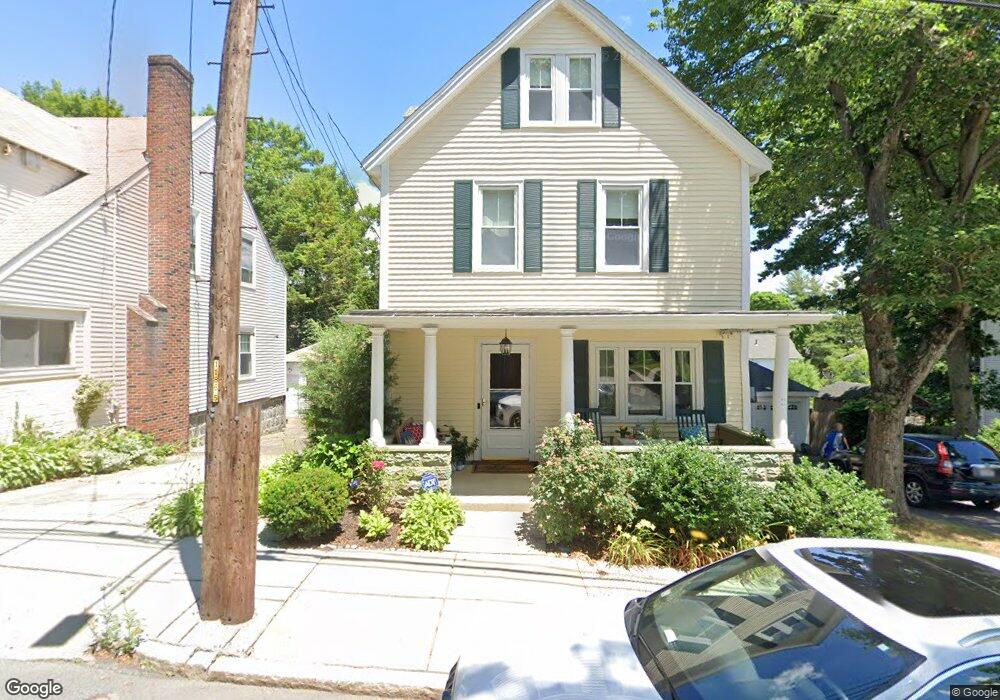
This home is located at 25 Cowing St, West Roxbury, MA 02132 and is currently estimated at $695,454, approximately $511 per square foot. 25 Cowing St is a home located in Suffolk County with nearby schools including St Theresa School, The Roxbury Latin School, and Catholic Memorial School.
Ownership History
Date
Name
Owned For
Owner Type
Purchase Details
Closed on
Apr 1, 2021
Sold by
Kfoury Richard and Kfoury Tara M
Bought by
Kfoury Ft
Current Estimated Value
Purchase Details
Closed on
Mar 11, 2005
Sold by
Hailey Hans R
Bought by
Kfoury Richard and Kfoury Tara M
Home Financials for this Owner
Home Financials are based on the most recent Mortgage that was taken out on this home.
Original Mortgage
$200,000
Interest Rate
5.64%
Mortgage Type
Purchase Money Mortgage
Create a Home Valuation Report for This Property
The Home Valuation Report is an in-depth analysis detailing your home's value as well as a comparison with similar homes in the area
Home Values in the Area
Average Home Value in this Area
Purchase History
| Date | Buyer | Sale Price | Title Company |
|---|---|---|---|
| Kfoury Ft | -- | None Available | |
| Kfoury Richard | $250,000 | -- |
Source: Public Records
Mortgage History
| Date | Status | Borrower | Loan Amount |
|---|---|---|---|
| Previous Owner | Kfoury Richard | $200,000 |
Source: Public Records
Tax History Compared to Growth
Tax History
| Year | Tax Paid | Tax Assessment Tax Assessment Total Assessment is a certain percentage of the fair market value that is determined by local assessors to be the total taxable value of land and additions on the property. | Land | Improvement |
|---|---|---|---|---|
| 2025 | $6,632 | $572,700 | $156,900 | $415,800 |
| 2024 | $5,986 | $549,200 | $165,700 | $383,500 |
| 2023 | $5,564 | $518,100 | $156,400 | $361,700 |
| 2022 | $5,124 | $471,000 | $142,100 | $328,900 |
| 2021 | $4,879 | $457,300 | $138,000 | $319,300 |
| 2020 | $4,317 | $408,800 | $126,400 | $282,400 |
| 2019 | $4,026 | $382,000 | $105,000 | $277,000 |
| 2018 | $3,811 | $363,600 | $105,000 | $258,600 |
| 2017 | $3,811 | $359,900 | $105,000 | $254,900 |
| 2016 | $3,735 | $339,500 | $105,000 | $234,500 |
| 2015 | $4,232 | $349,500 | $123,100 | $226,400 |
| 2014 | $4,105 | $326,300 | $123,100 | $203,200 |
Source: Public Records
Map
Nearby Homes
- 2 Lagrange St Unit 4
- 4873 Washington St Unit 1
- 12 Loyola Cir
- 35 Heron St
- 145 Lagrange St
- 50 Heron St
- 12 Eagle St
- 275 Bellevue St
- 14 Starling St
- 4959 Washington St
- 10 Starling St
- 4975 Washington St Unit 306
- 4975 Washington St Unit 311
- 4975 Washington St Unit 305
- 73 Woodard Rd
- 45 Weymouth Ave
- 152 Stratford St
- 67 Hautevale St
- 124 Glendower Rd Unit 2
- 276 Cornell St
- 29 Cowing St
- 29 & 0 Cowing St
- 19 Cowing St
- 37 Pheasant St
- 37 Cowing St
- 41 Pheasant St
- 29 Pheasant St
- 30 Cowing St
- 18 Cowing St
- 41 Cowing St
- 45 Pheasant St
- 25 Pheasant St Unit 27
- 25 Pheasant St Unit 1
- 9 Cowing St
- 25-27 Pheasant St
- 10 Cowing St
- 38 Cowing St
- 21 Pheasant St Unit 23
- 21 Pheasant St Unit 23
- 21 Pheasant St Unit 2