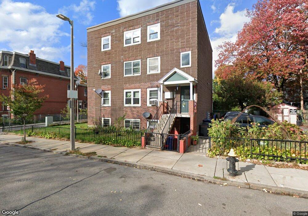
25 Dale St Unit 2 Roxbury, MA 02119
Washington Park NeighborhoodEstimated Value: $348,000 - $521,000
3
Beds
2
Baths
1,184
Sq Ft
$364/Sq Ft
Est. Value
About This Home
This home is located at 25 Dale St Unit 2, Roxbury, MA 02119 and is currently estimated at $430,989, approximately $364 per square foot. 25 Dale St Unit 2 is a home located in Suffolk County with nearby schools including Bridge Boston Charter School and City on a Hill Charter Public School.
Ownership History
Date
Name
Owned For
Owner Type
Purchase Details
Closed on
Dec 29, 1994
Sold by
Habitat For Hmnty Bost
Bought by
Mendez Segismundo and Mendez Maria
Current Estimated Value
Home Financials for this Owner
Home Financials are based on the most recent Mortgage that was taken out on this home.
Original Mortgage
$62,986
Interest Rate
9.2%
Mortgage Type
Purchase Money Mortgage
Create a Home Valuation Report for This Property
The Home Valuation Report is an in-depth analysis detailing your home's value as well as a comparison with similar homes in the area
Home Values in the Area
Average Home Value in this Area
Purchase History
| Date | Buyer | Sale Price | Title Company |
|---|---|---|---|
| Mendez Segismundo | $64,000 | -- |
Source: Public Records
Mortgage History
| Date | Status | Borrower | Loan Amount |
|---|---|---|---|
| Closed | Mendez Segismundo | $62,986 |
Source: Public Records
Tax History Compared to Growth
Tax History
| Year | Tax Paid | Tax Assessment Tax Assessment Total Assessment is a certain percentage of the fair market value that is determined by local assessors to be the total taxable value of land and additions on the property. | Land | Improvement |
|---|---|---|---|---|
| 2025 | $2,621 | $226,300 | $0 | $226,300 |
| 2024 | $2,349 | $215,500 | $0 | $215,500 |
| 2023 | $2,204 | $205,200 | $0 | $205,200 |
| 2022 | $2,126 | $195,400 | $0 | $195,400 |
| 2021 | $1,986 | $186,100 | $0 | $186,100 |
| 2020 | $1,871 | $177,200 | $0 | $177,200 |
| 2019 | $1,779 | $168,800 | $0 | $168,800 |
| 2018 | $1,685 | $160,800 | $0 | $160,800 |
| 2017 | $1,621 | $153,100 | $0 | $153,100 |
| 2016 | $1,604 | $145,800 | $0 | $145,800 |
| 2015 | $1,682 | $138,900 | $0 | $138,900 |
| 2014 | $1,664 | $132,300 | $0 | $132,300 |
Source: Public Records
Map
Nearby Homes
- 10 Rockland St Unit 4
- 94 Walnut Ave
- 30 Copeland St Unit 1
- 7 Langford Park Unit 3
- 59 Perrin St
- 59 Perrin St Unit 1
- 33 Copeland Park Unit C
- 22 Alaska St
- 31 Alaska St
- 22 Rockville Park
- 62 Clifford St Unit A
- 133 Blue Hill Ave
- 20 Rockville Park
- 119 Blue Hill Ave
- Lot 84 Blue Hill Ave
- 37 Regent St Unit 2
- 45 Woodville St
- 80 Blue Hill Ave Unit 5
- 90 Munroe St
- 79 W Cottage St