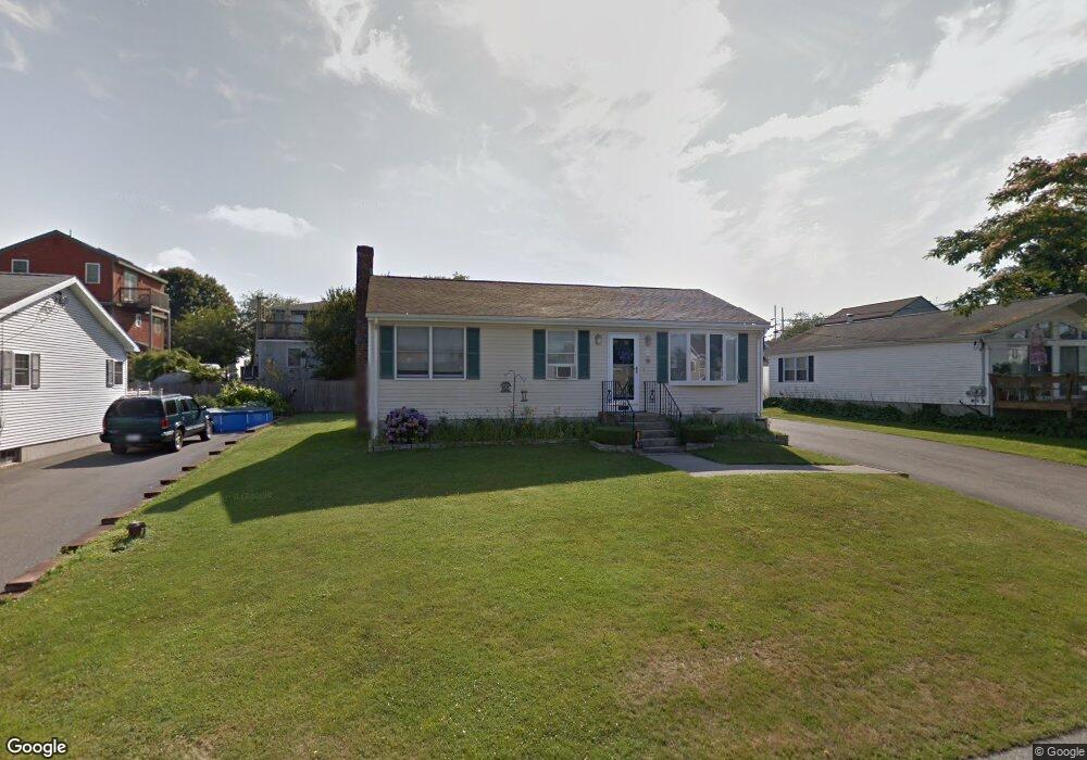
25 Draper Ave Middletown, RI 02842
Estimated Value: $639,582 - $778,000
3
Beds
1
Bath
960
Sq Ft
$704/Sq Ft
Est. Value
About This Home
This home is located at 25 Draper Ave, Middletown, RI 02842 and is currently estimated at $675,396, approximately $703 per square foot. 25 Draper Ave is a home located in Newport County with nearby schools including Middletown High School, St Michael's Country Day School, and St George's School.
Ownership History
Date
Name
Owned For
Owner Type
Purchase Details
Closed on
Jul 14, 1989
Sold by
Pine Joseph
Bought by
Sisson Fletcher
Current Estimated Value
Create a Home Valuation Report for This Property
The Home Valuation Report is an in-depth analysis detailing your home's value as well as a comparison with similar homes in the area
Home Values in the Area
Average Home Value in this Area
Purchase History
| Date | Buyer | Sale Price | Title Company |
|---|---|---|---|
| Sisson Fletcher | $75,800 | -- |
Source: Public Records
Mortgage History
| Date | Status | Borrower | Loan Amount |
|---|---|---|---|
| Open | Sisson Fletcher | $25,000 | |
| Open | Sisson Fletcher | $77,000 | |
| Closed | Sisson Fletcher | $13,906 | |
| Closed | Sisson Fletcher | $83,250 |
Source: Public Records
Tax History
| Year | Tax Paid | Tax Assessment Tax Assessment Total Assessment is a certain percentage of the fair market value that is determined by local assessors to be the total taxable value of land and additions on the property. | Land | Improvement |
|---|---|---|---|---|
| 2025 | $5,191 | $440,300 | $298,500 | $141,800 |
| 2024 | $4,958 | $440,300 | $298,500 | $141,800 |
| 2023 | $4,305 | $341,900 | $217,700 | $124,200 |
| 2022 | $4,110 | $341,900 | $217,700 | $124,200 |
| 2021 | $4,110 | $341,900 | $217,700 | $124,200 |
| 2020 | $4,055 | $294,700 | $167,500 | $127,200 |
| 2018 | $4,052 | $294,700 | $167,500 | $127,200 |
| 2016 | $4,029 | $261,300 | $150,200 | $111,100 |
| 2015 | $3,930 | $261,300 | $150,200 | $111,100 |
| 2014 | $4,082 | $254,000 | $136,500 | $117,500 |
| 2013 | $3,990 | $254,000 | $136,500 | $117,500 |
Source: Public Records
Map
Nearby Homes
- 206 Reservoir Rd
- 118 Wolcott Ave
- 181 Center Ave
- 10 Oceanview Dr
- 84 Allston Ave
- 0 Allston Ave
- 55 John Clarke Rd Unit 8
- 55 John Clarke Rd Unit 3
- 141 Gray Craig Rd
- 11 Odonnell Rd
- 476 Green End Ave
- 4 James St
- 129 Bliss Mine Rd
- 310 Corey Ln
- 78 Ellery Rd
- 14 Kay Blvd
- 138 Green End Ave
- 223 Corey Ln
- 81 Beagle Dr
- 1 Shangri-La Ln
Your Personal Tour Guide
Ask me questions while you tour the home.