Estimated Value: $263,000 - $393,000
2
Beds
1
Bath
1,175
Sq Ft
$265/Sq Ft
Est. Value
About This Home
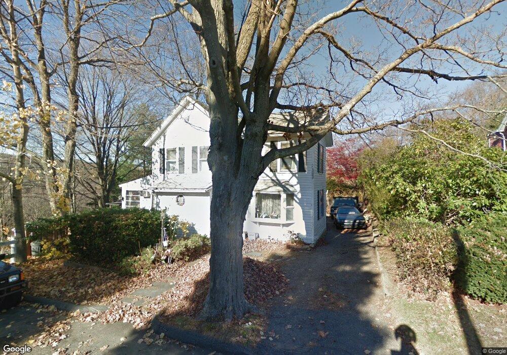
This home is located at 25 Elm St, Derby, CT 06418 and is currently estimated at $311,823, approximately $265 per square foot. 25 Elm St is a home located in New Haven County with nearby schools including Derby Middle School, Derby High School, and St Mary & St Michael School.
Ownership History
Date
Name
Owned For
Owner Type
Purchase Details
Closed on
Apr 29, 2025
Sold by
Duhaime Peter T and Duhaime Carolyn M
Bought by
Duhaime Peter T and Duhaime Carolyn M
Current Estimated Value
Purchase Details
Closed on
Jan 24, 1997
Sold by
Est Jensen Harold M and Jensen Harold
Bought by
Duhaime Peter T and Duhaime Carolyn M
Purchase Details
Closed on
Jun 29, 1988
Sold by
Jensen Harold
Bought by
Duhaime Peter
Create a Home Valuation Report for This Property
The Home Valuation Report is an in-depth analysis detailing your home's value as well as a comparison with similar homes in the area
Home Values in the Area
Average Home Value in this Area
Purchase History
| Date | Buyer | Sale Price | Title Company |
|---|---|---|---|
| Duhaime Peter T | -- | None Available | |
| Duhaime Peter T | $18,000 | -- | |
| Duhaime Peter T | $18,000 | -- | |
| Duhaime Peter | $140,000 | -- |
Source: Public Records
Mortgage History
| Date | Status | Borrower | Loan Amount |
|---|---|---|---|
| Previous Owner | Duhaime Peter | $80,000 | |
| Previous Owner | Duhaime Peter | $97,700 | |
| Previous Owner | Duhaime Peter | $115,200 |
Source: Public Records
Tax History
| Year | Tax Paid | Tax Assessment Tax Assessment Total Assessment is a certain percentage of the fair market value that is determined by local assessors to be the total taxable value of land and additions on the property. | Land | Improvement |
|---|---|---|---|---|
| 2025 | $4,143 | $95,900 | $34,000 | $61,900 |
| 2024 | $4,143 | $95,900 | $34,020 | $61,880 |
| 2023 | $3,702 | $95,900 | $34,020 | $61,880 |
| 2022 | $3,702 | $95,900 | $34,020 | $61,880 |
| 2021 | $3,702 | $95,900 | $34,020 | $61,880 |
| 2020 | $3,621 | $82,530 | $34,020 | $48,510 |
| 2019 | $3,456 | $82,530 | $34,020 | $48,510 |
| 2018 | $3,249 | $82,530 | $34,020 | $48,510 |
| 2017 | $3,249 | $82,530 | $34,020 | $48,510 |
| 2016 | $3,183 | $80,850 | $32,340 | $48,510 |
| 2015 | $3,257 | $91,140 | $32,340 | $58,800 |
| 2014 | $3,257 | $91,140 | $32,340 | $58,800 |
Source: Public Records
Map
Nearby Homes
- 112 River Rd
- 1 Windward Way Unit 1
- 22 Jenyfer Ct
- 71 Sentinel Hill Rd
- 0 Harvard Ave
- 126 Wells View Rd
- 83 Myrtle St Unit 83
- 223 River Rd
- 11 Westminster Ave
- 27-29 Mclaughlin Terrace
- 28 Mclaughlin Terrace
- 1 Hull St
- 0 Wells Ave
- 1 Bank St
- 29 Toas St
- 26 King St
- 63 Derby Ave
- 30 Commodore Hull Dr
- 1025 Willard Rd
- 39 Westminster Ave
Your Personal Tour Guide
Ask me questions while you tour the home.