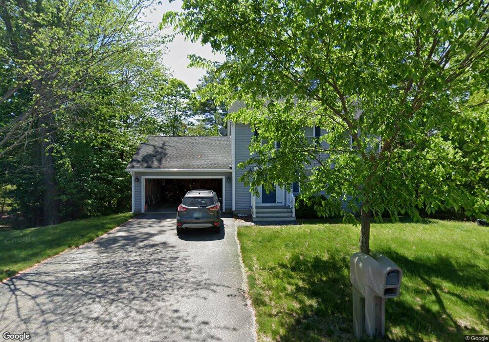
25 Hawthorne Cir Somersworth, NH 03878
Estimated Value: $447,000 - $540,000
3
Beds
3
Baths
1,560
Sq Ft
$322/Sq Ft
Est. Value
About This Home
This home is located at 25 Hawthorne Cir, Somersworth, NH 03878 and is currently estimated at $501,947, approximately $321 per square foot. 25 Hawthorne Cir is a home located in Strafford County with nearby schools including Maple Wood Elementary School, Somersworth High School, and Tri-City Christian Academy.
Ownership History
Date
Name
Owned For
Owner Type
Purchase Details
Closed on
Nov 24, 2009
Sold by
Gerrish Park Llc
Bought by
Riggio Kyle C and Riggio Jennifer D
Current Estimated Value
Home Financials for this Owner
Home Financials are based on the most recent Mortgage that was taken out on this home.
Original Mortgage
$213,098
Outstanding Balance
$138,709
Interest Rate
4.86%
Estimated Equity
$363,238
Create a Home Valuation Report for This Property
The Home Valuation Report is an in-depth analysis detailing your home's value as well as a comparison with similar homes in the area
Home Values in the Area
Average Home Value in this Area
Purchase History
| Date | Buyer | Sale Price | Title Company |
|---|---|---|---|
| Riggio Kyle C | $224,500 | -- | |
| Riggio Kyle C | $224,500 | -- |
Source: Public Records
Mortgage History
| Date | Status | Borrower | Loan Amount |
|---|---|---|---|
| Open | Riggio Kyle C | $213,098 | |
| Closed | Riggio Kyle C | $213,098 |
Source: Public Records
Tax History Compared to Growth
Tax History
| Year | Tax Paid | Tax Assessment Tax Assessment Total Assessment is a certain percentage of the fair market value that is determined by local assessors to be the total taxable value of land and additions on the property. | Land | Improvement |
|---|---|---|---|---|
| 2024 | $8,471 | $453,000 | $100,900 | $352,100 |
| 2023 | $7,741 | $264,200 | $37,700 | $226,500 |
| 2022 | $7,421 | $264,200 | $37,700 | $226,500 |
| 2021 | $7,273 | $264,200 | $37,700 | $226,500 |
| 2020 | $7,358 | $264,200 | $37,700 | $226,500 |
| 2019 | $7,207 | $264,200 | $37,700 | $226,500 |
| 2018 | $7,143 | $213,800 | $47,300 | $166,500 |
| 2017 | $7,075 | $213,800 | $47,300 | $166,500 |
| 2016 | $6,867 | $213,800 | $47,300 | $166,500 |
| 2015 | $6,895 | $213,800 | $47,300 | $166,500 |
| 2014 | $6,658 | $213,800 | $47,300 | $166,500 |
Source: Public Records
Map
Nearby Homes
- 159 W High St
- 395 Route 108
- 43 Otis Rd
- 203 New Hampshire 108
- 45 Crystal Springs Way
- 38 Laurel Ln
- 18 Lenox Dr Unit C
- 29 Chadwick Ln
- 301 Sherwood Glen
- 200 Sherwood Glen
- 229 Sherwood Glen
- 206 Sherwood Glen
- 163 Rochester St
- 13 Guy St
- 187 Old Rochester Rd
- 19B Birch Hill Ln Unit 19B
- 23A Birch Hill Ln Unit 23A
- 23B Birch Hill Ln Unit 23B
- 19A Birch Hill Ln Unit 19A
- 27B Birch Hill Ln Unit 27B
- 29 Hawthorne Cir
- 29 Hawthorne Cir
- 24 Hawthorne Cir
- 28 Hawthorne Cir
- 33 Hawthorne Cir
- 70 Hawthorne Cir
- 15 Hawthorne Cir
- 16 Hawthorne Cir
- 32 Hawthorne Cir
- 77 Hawthorne Cir
- 79 Hawthorne Cir
- 73 Hawthorne Cir
- 35 Hawthorne Cir
- 64 Hawthorne Cir
- 10 Hawthorne Cir
- 11 Hawthorne Cir
- 67 Hawthorne Cir
- 9 Hawthorne Cir
- 9 Hawthorne Cir
- 38 Hawthorne Cir