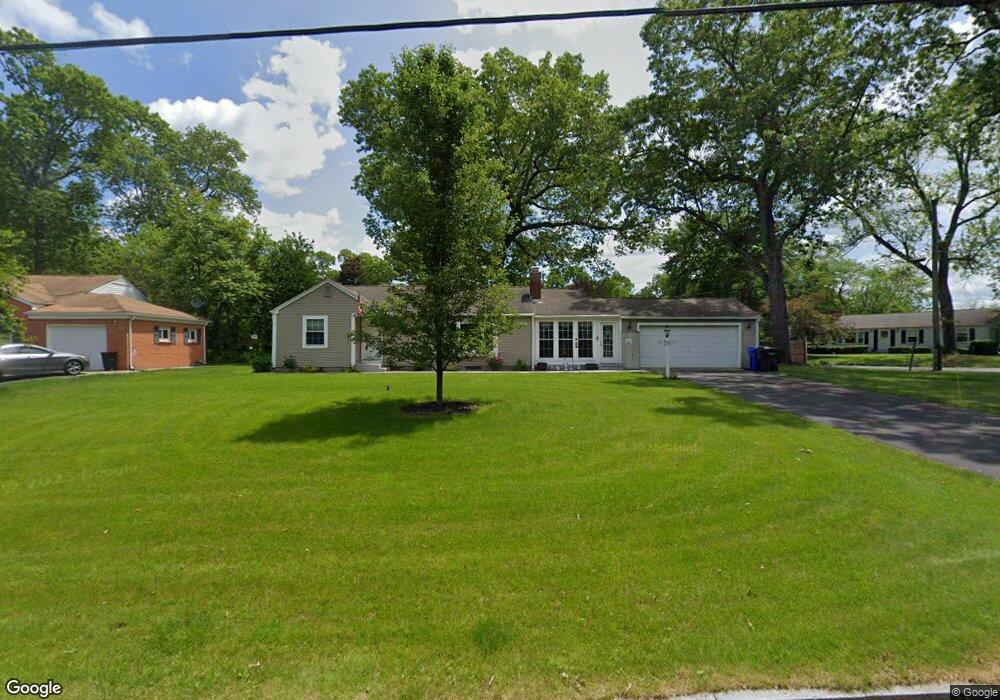
25 Intervale Rd Springfield, MA 01118
East Forest Park NeighborhoodEstimated Value: $343,000 - $373,000
3
Beds
1
Bath
1,420
Sq Ft
$253/Sq Ft
Est. Value
About This Home
This home is located at 25 Intervale Rd, Springfield, MA 01118 and is currently estimated at $358,590, approximately $252 per square foot. 25 Intervale Rd is a home located in Hampden County with nearby schools including Frederick Harris Elementary School, M Marcus Kiley Middle, and Springfield High School of Science and Technology.
Ownership History
Date
Name
Owned For
Owner Type
Purchase Details
Closed on
Jul 21, 2011
Sold by
Halon Paul T and Halon Keith
Bought by
Stromberg Irene M and Stromberg Wayne F
Current Estimated Value
Purchase Details
Closed on
Jan 31, 2007
Sold by
Antinori Deborah D and Davison Wellen G
Bought by
Halon Keith and Halon Paul T
Home Financials for this Owner
Home Financials are based on the most recent Mortgage that was taken out on this home.
Original Mortgage
$143,724
Interest Rate
6.16%
Mortgage Type
Purchase Money Mortgage
Purchase Details
Closed on
Aug 28, 2003
Sold by
Davison Wellen G
Bought by
Antinori Deborah D and Davison Wellen G
Create a Home Valuation Report for This Property
The Home Valuation Report is an in-depth analysis detailing your home's value as well as a comparison with similar homes in the area
Home Values in the Area
Average Home Value in this Area
Purchase History
| Date | Buyer | Sale Price | Title Company |
|---|---|---|---|
| Stromberg Irene M | $173,500 | -- | |
| Halon Keith | $146,000 | -- | |
| Antinori Deborah D | -- | -- |
Source: Public Records
Mortgage History
| Date | Status | Borrower | Loan Amount |
|---|---|---|---|
| Previous Owner | Halon Keith | $143,724 |
Source: Public Records
Tax History
| Year | Tax Paid | Tax Assessment Tax Assessment Total Assessment is a certain percentage of the fair market value that is determined by local assessors to be the total taxable value of land and additions on the property. | Land | Improvement |
|---|---|---|---|---|
| 2025 | $5,261 | $335,500 | $41,400 | $294,100 |
| 2024 | $5,093 | $317,100 | $41,400 | $275,700 |
| 2023 | $5,473 | $321,000 | $43,100 | $277,900 |
| 2022 | $5,328 | $283,100 | $43,100 | $240,000 |
| 2021 | $4,466 | $236,300 | $39,100 | $197,200 |
| 2020 | $4,318 | $221,100 | $39,100 | $182,000 |
| 2019 | $4,316 | $219,300 | $39,100 | $180,200 |
| 2018 | $4,280 | $217,500 | $39,100 | $178,400 |
| 2017 | $3,851 | $195,900 | $39,100 | $156,800 |
| 2016 | $3,564 | $181,300 | $39,100 | $142,200 |
| 2015 | $3,826 | $194,500 | $39,100 | $155,400 |
Source: Public Records
Map
Nearby Homes
- 27 Regal St
- 101 Regal St
- 120 Bridle Path Rd
- 231 Dayton St
- 37 Chesterfield Ave
- 55 Allen St
- 19 Manor Ct Unit 19
- 81 W Crystal Brook Dr
- 86 Talmadge Dr
- 24 Wands St
- 100 Abbott St
- 85 Talmadge Dr
- 17 Pebble Mill Rd
- 384 Abbott St
- 86 Wildwood Ave
- 125 Manor Ct Unit 125
- 82 Louis Rd
- 7 Ashbrook St
- 54 S Shore Dr
- 79 Arvilla St
- 11 Intervale Rd
- 229 Newton Rd
- 28 Intervale Rd
- 240 Newton Rd
- 3 Intervale Rd
- 250 Newton Rd
- 33 Newton Rd
- 217 Newton Rd
- 226 Newton Rd
- 271 Newton Rd
- 271 Newton Rd Unit 1
- 271 Newton Rd Unit *
- 23 Newton Rd
- 47 Newton Rd
- 268 Newton Rd
- 100 Westbank Ct
- 59 Intervale Rd
- 100 Westbanks Ct
- 218 Newton Rd
- 193 Newton Rd
Your Personal Tour Guide
Ask me questions while you tour the home.