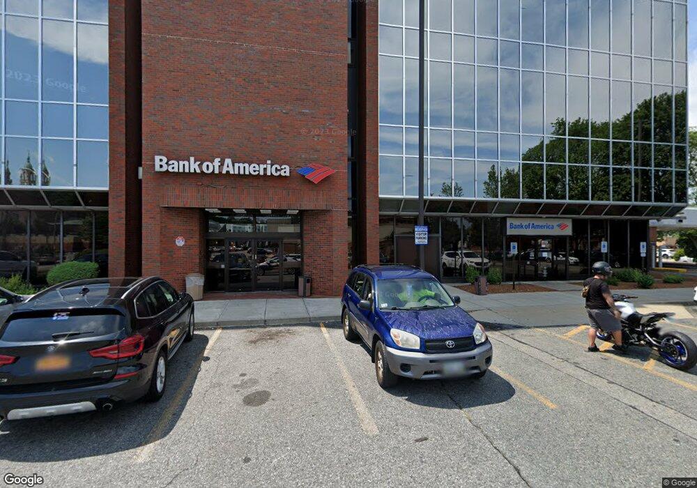
25 John A Cummings Way Woonsocket, RI 02895
Social District NeighborhoodEstimated Value: $6,556,281
Studio
--
Bath
52,380
Sq Ft
$125/Sq Ft
Est. Value
About This Home
This home is located at 25 John A Cummings Way, Woonsocket, RI 02895 and is currently estimated at $6,556,281, approximately $125 per square foot. 25 John A Cummings Way is a home located in Providence County with nearby schools including Woonsocket High School, Rise Prep Mayoral Academy Middle School, and Rise Prep Mayoral Academy.
Ownership History
Date
Name
Owned For
Owner Type
Purchase Details
Closed on
Jul 9, 2019
Sold by
Clinton St Partners Llc
Bought by
Thundermist Health Ctr
Current Estimated Value
Home Financials for this Owner
Home Financials are based on the most recent Mortgage that was taken out on this home.
Original Mortgage
$2,840,000
Outstanding Balance
$2,477,386
Interest Rate
3.82%
Mortgage Type
New Conventional
Estimated Equity
$4,078,895
Purchase Details
Closed on
Jul 23, 2014
Sold by
Way 25 John A Cummings
Bought by
Bank Of New York Mello
Purchase Details
Closed on
Jan 12, 2007
Sold by
Clinton Street Rlty
Bought by
25 John Cummings Way L
Home Financials for this Owner
Home Financials are based on the most recent Mortgage that was taken out on this home.
Original Mortgage
$3,360,000
Interest Rate
6.18%
Mortgage Type
Commercial
Create a Home Valuation Report for This Property
The Home Valuation Report is an in-depth analysis detailing your home's value as well as a comparison with similar homes in the area
Home Values in the Area
Average Home Value in this Area
Purchase History
| Date | Buyer | Sale Price | Title Company |
|---|---|---|---|
| Thundermist Health Ctr | $3,550,000 | -- | |
| Bank Of New York Mello | $2,000,000 | -- | |
| Bank Of New York Mello | $2,000,000 | -- | |
| 25 John Cummings Way L | $4,790,000 | -- | |
| 25 John Cummings Way L | $4,790,000 | -- |
Source: Public Records
Mortgage History
| Date | Status | Borrower | Loan Amount |
|---|---|---|---|
| Open | Thundermist Health Ctr | $2,840,000 | |
| Previous Owner | 25 John Cummings Way L | $3,360,000 |
Source: Public Records
Tax History
| Year | Tax Paid | Tax Assessment Tax Assessment Total Assessment is a certain percentage of the fair market value that is determined by local assessors to be the total taxable value of land and additions on the property. | Land | Improvement |
|---|---|---|---|---|
| 2025 | $77,038 | $3,616,800 | $275,900 | $3,340,900 |
| 2024 | $95,126 | $3,525,800 | $229,900 | $3,295,900 |
| 2023 | $91,459 | $3,525,800 | $229,900 | $3,295,900 |
| 2022 | $91,459 | $3,525,800 | $229,900 | $3,295,900 |
| 2021 | $122,205 | $3,516,700 | $312,000 | $3,204,700 |
| 2020 | $123,929 | $3,516,700 | $312,000 | $3,204,700 |
| 2018 | $106,073 | $2,931,000 | $312,000 | $2,619,000 |
| 2017 | $110,295 | $2,986,600 | $300,400 | $2,686,200 |
| 2016 | $114,506 | $2,986,600 | $300,400 | $2,686,200 |
| 2015 | $139,267 | $3,421,800 | $300,400 | $3,121,400 |
| 2014 | $137,558 | $3,439,800 | $333,000 | $3,106,800 |
Source: Public Records
Map
Nearby Homes
- 42 Elbow St
- 142 Brook St
- 685 Social St Unit 211
- 685 Social St Unit 115
- 263 Elm St
- 271 Elm St
- 70 W Park Place
- 311 Elm St
- 84 Chester St
- 71 Hamlet Ave
- 65 Mill St
- 130 E School St
- 56 Mailloux St
- 0 N Main St Unit 1401765
- 203 Dulude Ave
- 222 Carrington Ave
- 96 E Mill St
- 35 Greene St
- 187 Boyden St
- 410 Carrington Ave
- 481 Clinton St
- 512 Social St
- 520 Social St
- 450 Social St (Rt 126)
- 450 Social St
- 515 Social St
- 625 Clinton St
- 627 Clinton St
- 235 Social St
- 397 Clinton St
- 514 Social St
- 63 Cumberland St
- 0 Rathbun St
- 401 Clinton St
- 395 Clinton St
- 395 Clinton St
- 32 Rathbun St
- 30 Cumberland St Unit 3
- 30 Cumberland St
- 1 Cumberland St
